contact us

Use the form on the right to contact us.

You can edit the text in this area, and change where the contact form on the right submits to, by entering edit mode using the modes on the bottom right.

6 Mayfred Avenue
Hope Valley, SA, 5090
Australia

The official website of adventurer and author of It Takes Two To Tandem, Louise George. Louise currently resides in Adelaide, South Australia with her husband. The two regularly travel and undertake many adventures together, including riding travelling 880 miles through the United Kingdom, from John O’Groats to Lands End.

MY BLOG

Philippines: Boracay Island and two of the Romblon Island group (Tablas Island and Romblon Island)

Louise George

r10DSC03765.jpg

Boracay Island

We had been told we might need a permit to take bicycles to Boracay as there are vehicle restrictions but we didn’t find that the case.

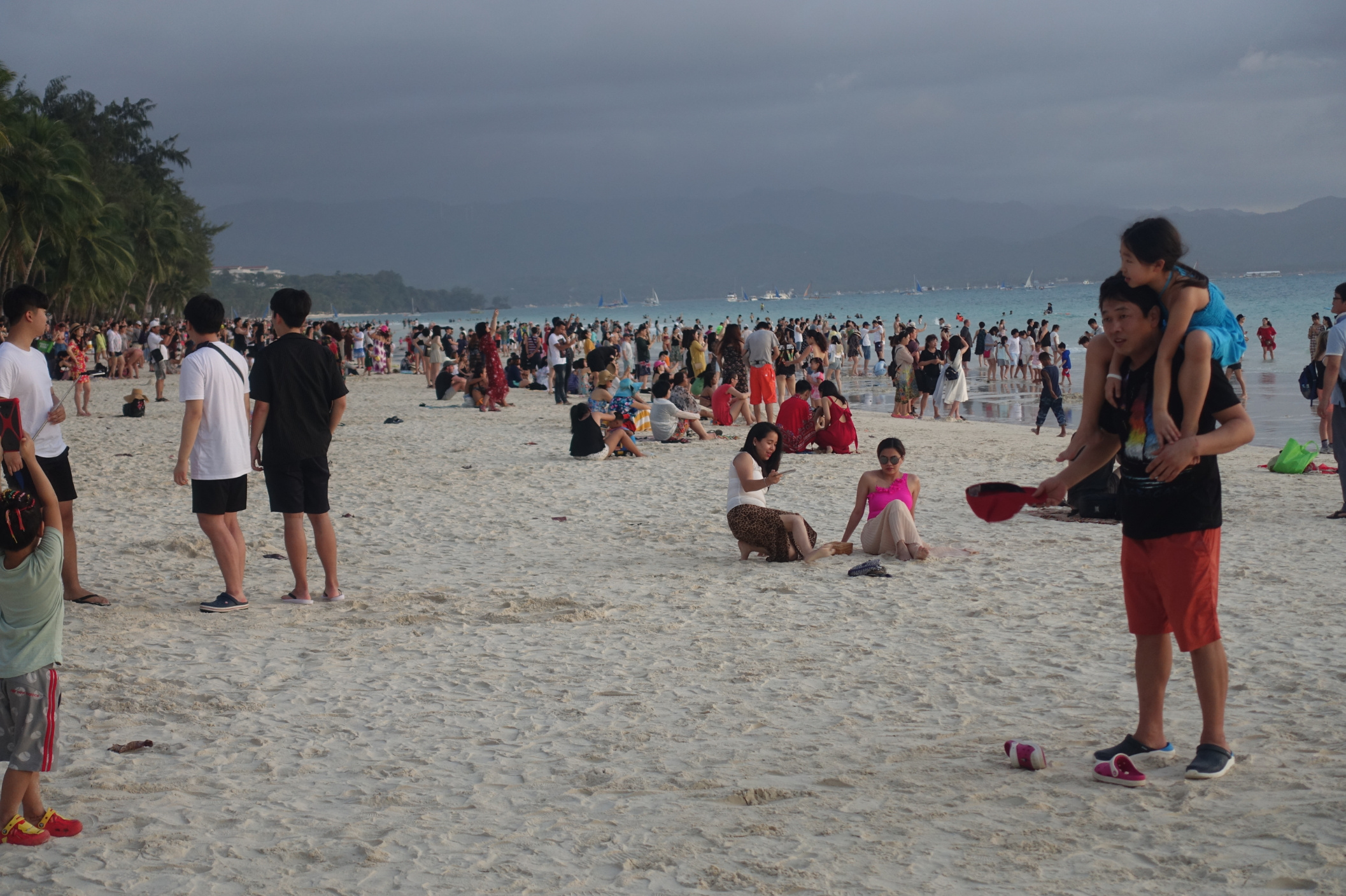
Our initial reaction to Boracay was shock! Apart from that it was a popular tourist destination, we knew little about it. The road was rough, dug up in places and congested with motor tricycles and electric passenger vehicles vying for customers. We found our accommodation after dodging open drains and a huge stagnant pond. Later, when we walked out looking for food, we first checked out Bulabong Beach nearest to our accommodation, only to be blasted by on-shore winds that were obviously favoured by kite surfers, because there were many, speeding from one end of the lagoon to the other. We were at the narrowest width of the island, so one kilometre later we had crossed to White Sand Beach, along with thousands of mostly Asian tourists, who like us, were out to marvel at the sunset.

Boracay had been spoiled by tourism. As a paradise discovered in the 60’s, Boracay had in recent years became wall to wall resorts, dive shops and restaurants all wanting beach frontage, visited by tourists wanting to participate in water sports during the day and beach parties at night. Two million tourists visited Boracay in 2017 and the island could no longer cope. Environmental issues such as algae bloom on the beaches and poor sewerage conditions forced the government to completely shut down the island to tourism for six months from April 2018. Now, January 2019, the island had only recently been reopened and we were witness to the continuing redevelopment program. Tourist numbers were now being limited to 6000 incoming people per day and proof of accommodation needed to be provided. Many accommodations had not reopened as they were not yet compliant with new sewage regulations. Roads, kerbs and pavements continued to be built around the tourist throng.

A local catch!

A local catch!

Boracay 15km, 202m ascent

With three days to relax before we rode again, we treated this tropical destination as a holiday. Days were filled with walks to the beach and seeking out restaurants with food flavours we enjoy.

Our favourite treat; fresh jel-like coconut flesh, scrapped off the shell, topped with mango, coconut ice-cream and black sesame seeds. We queued for one hour to get one on our last day!

Our favourite treat; fresh jel-like coconut flesh, scrapped off the shell, topped with mango, coconut ice-cream and black sesame seeds. We queued for one hour to get one on our last day!

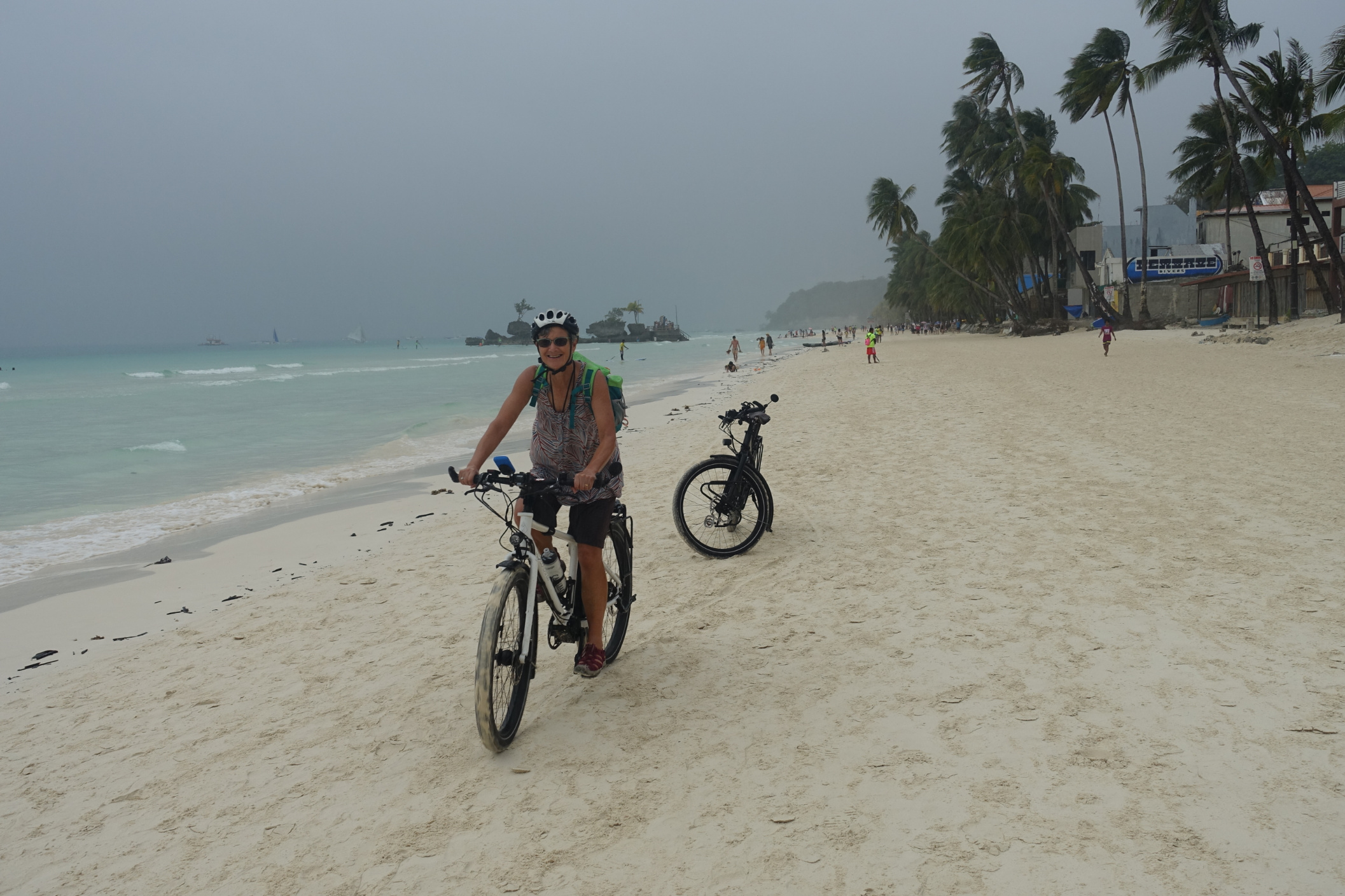
The island is 7 kilometres long and offers every type of water activity imaginable: jet ski, sailing, paddle boarding, diving, mermaid lessons, helmet dive and parasailing to name a few so there was always people watching for our entertainment. On the second day we ventured out on the bikes to Diniwid Beach that we could access by ocean path from White Beach, and then rode to Puka Beach in the north. Many buildings in the north were uninhabited, and from signage we got the impression that some ancestral lands were now handed back to be in the possession of the Ati local tribes. Returning to our accommodation was disrupted by a traffic jam as the concrete kerb on one side of the road was being poured. We ducked down to the beach to ride our own highway!

Having watched the Kite surfers with envy and marveling at the strength they must need to rein the wind, we decided to ‘give it a go’. Our lesson was about controlling the kite, at first with a small kite on the sand and later knee deep in water with a full kite. We learned that a relaxed technique, rather than strength got the kite into the desired position and in a couple of hours got enough of a buzz to think about a future time back here to master the sport. I can’t believe that on our last evening at Boracay we were prepared to queue for an hour for a dessert treat that we had already had a serving of two days ago and I didn’t want to leave without satisfying the cravings for another one. Half a green coconut with the jelly flesh scrapped away from the husk, that now served as the bowl, topped with coconut Icecream, fresh mango and a sprinkling of nuts. Devine!

Boracay Island to near Alicantara (Tablas Island) 39km, 403m ascent

We were on the bikes before daybreak as we needed to be at Caticlan by 6 a.m. to change our ferry booking from 27th to today, 26th. We found that the Pump Boat would take bicycles so they were duly loaded on the roof of the boat cabin, and we sat inside with our panniers for the ten minute ride.

Tablas Island

Day 1:
For a small fee our tickets to Tablas Island were reissued. The ferry wasn’t in port yet, and it didn’t sail until 8 a.m. so we had plenty of time for breakfast. I had rice, egg and bangas (small portion of fish, deep fried to a crisp), Nev ate pork pieces basted with a sweet sauce, egg and rice.

Wheeling our bikes, we were ushered to be first to board the ferry. The vehicle deck gaped open, and I said to Nev “thank goodness this will be easy” but no! Rather than push our bikes to the vehicle desk we had to enter the vessel through the side passenger door, wheeling the bikes, and then carried them, in relays, up two flights of stairs so they could stand in a corner of the ‘bunk room’. This was deck class. We found a spare bunk each, as centre of the ship as possible amongst rows of bunks, bottom and top, separated by aisles, in an area as large as a basketball court. Along the outside edge of the ship, most tarpaulins were down and taut, blocking out both view and wind. It was nice to walk to the edge railing occasionally, where some tarpaulins were raised, to see islands as we passed. We copied other passengers, making a pillow of the life jacket and settled back for hours of relaxation, to read and snooze. Disembarking was again in relay, but going down stairs was a little easier.

Our first stop was for lunch at Odiongan, a few kilometres from the port of the same name. Odiongan is a small town similar to the many we have ridden through on other islands that offered little in the way of food choices for our tastes. Eventually we found a cafe that sold us a burger as small as a dinner bun and a milkshake, that we hoped would sustain us the 23 kilometres to Aglicay Beach Resort. Because Nev was still suffering from a headcold, and the day was hot with the air temperature in the 30s, we elected to take a shorter route that went across the island rather than travel 42 kilometres along the coast. There were a couple of hills but generally pleasant riding beside former rice fields that were now meadows where cows grazed. From where we left the main road we had an interesting 5.8 kilometre track that alternated between concrete and dirt, with a couple of steep climbs, and then a lovely descent to the white sand beach at the resort, that for tonight we had to ourselves. We were the only guests. Evidently due to prevailing winds, the west coast is not so popular at this time of the year.

Day 2: Aglicay Resort - no riding

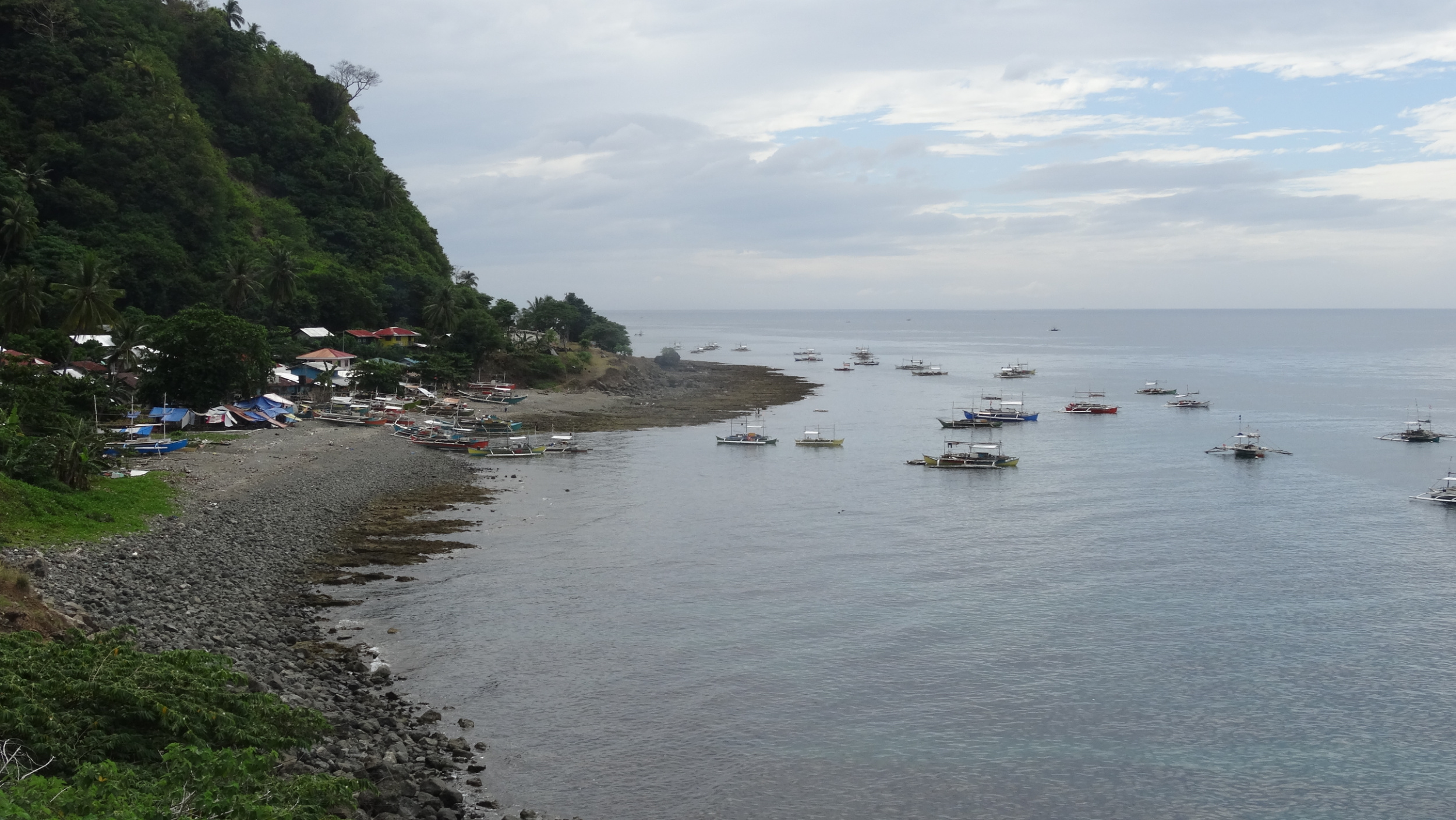
The three islands in the Romblon group are small but we had chosen to spend the next five days in the area because we can catch a ferry from Odiongan to Batangas, near Manila, from which we fly to New Zealand on 5th February. It felt a bit like ‘killing time’ as today was another ‘rest’ day. Apart from eating, reading and relaxing, we took a short walk to the next bay. The first photo below is of Aglicay Beach, our own little piece of paradise, and the 2nd is of the Tablas Island coast.

Around midday van loads of tourists arrived for a buffet lunch, and some locals arrived on motorbikes to swim, but by late afternoon we were alone again. We had been amazed at the amount of work that is done here on a daily basis as each high tide recedes, leaving a tide mark of rubbish, mostly small plastics that are swept into piles and then dumped behind the resort. We resolve to try to eliminate our own household waste, especially plastic, when we return home.

Day 3: Ride Aglicay Resort to San Agustin (ferry to Romblon Island) Ride Romblon Town to Talipasak Beach

59.1km, 621m ascent

Our day needed to start early as the last ferry left at 1 p.m. but we didn’t want to put our hosts to too much trouble with a super early start, so ordered breakfast for 7:30 a.m. We’d packed already so it was good to receive breakfast on time and have the bikes rolling out the gate at 8. We were feeling rested and the couple of climbs back to the main road weren’t too difficult. Then began a slog into a headwind, up and over a headland, then repeat. We kept moving, apart from a short stop at 24 km, that happened to be our halfway mark, to get our butts out of the saddle and stand in the shade for a while.

Another long coast road; this one on Tablas Island

Another long coast road; this one on Tablas Island

We pulled into San Agustin Port and our bikes were whisked out from under us by enthusiastic porters. We purchased a ferry terminal ticket and will pay for the boat when on board. Even though we had enough time for lunch we couldn’t find anything to whet our appetite. This was often the case for us as a result of combined heat and weariness. Two boys had ordered a slice of chocolate cake coated in coconut. It looked tasty and we followed their lead, adding a normal plain bun each for a healthy option. The boat was a narrow wooden vessel that looked like it had been in service for many years. We each don a life jacket as the Coast Guard will not allow departure until this requirement is checked. As soon as we began moving, all life jackets were removed and hung again on the backs of the bench seats for cushioning comfort. The boat cut through the gentle swell and the one hour crossing was pleasant enough. As soon as we’d docked, a number of Porters stormed the boat trying to be the first to help with a suitcase or in this case, one motorcycle and two bicycles. There was no point taking ownership until both bikes were on land and just one person had their hand out for the carrying fee.

Unloading, and we are trying to keep an eye on who should be paid for the work!

Unloading, and we are trying to keep an eye on who should be paid for the work!

Romblon Island

Romblon Town looked interesting but we’d be back tomorrow, so we headed south, with the ocean on our right, riding passed some pretty beaches to arrive at the end of a narrow peninsula, at the very private white-sand Talipasak Beach, and a Nipa Hut overlooking the sea at San Pedro’s Beach Resort. The sun set over Tablas Island in the distance and the long coastline that we rode this morning was soon swallowed between the dark ocean and sky.

Day 3: Circuit of Romblon Island 43.3km, 587m ascent

My estimate of 42km turned out to be pretty close to the mark. First we had a steep climb from sea level to the high point of the headland, and then down to the main road. Riding south I found the sharp climbs along the east coast quite challenging. At least Romblon was a small island so I could focus on this not being a long day of riding.

Romblon Island; picture perfect!

Romblon Island; picture perfect!

The coast was very pretty with a number of white sand beaches and turquoise waters along which an occasional fishing boat, long and narrow, with noisy motor and the fisherman standing as if riding a stand-up paddle-board, wizzed by. We saw small quantities of little fish displayed in full sun, on narrow tables at the roadside, and wondered how long such a perishable food would sit out like that, and if the entire catch would be sold.

The main road back north cut through the centre of Romblon and took us up the edge of a broad valley cloaked in coconut trees and jungle.

Large piles of coconut meat were being tipped from bags and laid out to dry at the side of the road. We passed a marble quarry and the zinging of circular saws, and tapping of chisels as craftsman cut and shaped the stone, filled the valley. Many nipa huts were covered in white dust as if it had snowed.

There was very little traffic on the island, mostly motor tricycles that stopped often to pick up and drop off passengers. There were sections of road works, with roads being widened, or restored, where a lane had become narrow because the outside edge had broken, or where a landslide had blocked part of the inside lane. We climbed long and steady until eventually we dropped passed another marble quarry, down into Romblon Town. A cruise ship had anchored offshore but we didn’t notice any increase in the numbers of people in town. It was 2:00 p.m. by the time we sought out some lunch and the restaurants were quiet. Maybe the cruise passengers had already returned to the ship.

Day 4: Talipasak Beach loop, 24km

The purpose of our ride was to explore Romblon Town, that was a trading post during the Spanish period but first we stop at picturesque Bonbon Beach, riding out as far as we could in the soft sand to where two white-sand beaches met, forming a sandbar.

Romblon is one of the most intack old Filipino-Spanish towns in the country. There are many tradional houses and a coral-bricked cathedral. The restored Spanish Fort San Andres, looks over the town and harbour. We climbed the many stairs and were just in time to be met by a man who who proudly opens the gates to tourists. He took part in the renovation and was happy for us to climb over the balastrades for a view of the town.

Romblon Town from the 17th Century San Andres Fort

Romblon Town from the 17th Century San Andres Fort

Romblon is a quiet quaint town with few tourists even though it offers scuba diving at marine sanctuaries and access to other pristine islands nearby. The short time we had on Romblon Island was our favourite time in the Philippines.

Day 5: Talipasak Beach (Romblon Island) to Calunacon (Tablas Island)

We rode into town early as we wanted to catch the 8 o’clock ferry. The large boat was already docked. We paid for the ferry and then found that it leaves at 12:30, not the time we’d expected. We were told that If we wanted to leave at 8 we need to go to the local terminal and catch the Bangka, so we apologised, collected our money and went there. As soon as we pulled into the kerb a porter offered his service and we happily passed over the bikes. At the time of boarding we walked a narrow plank, with an unsteady handrail. I noticed the bamboo rail was not even fixed, it was just held by one man at each end! The bikes were tied to a pole on the roof. We were seated and don the life jackets, just to copy everyone else and remove them when the vessel was underway.

Many different boat styles make travel interesting. The man in the yellow T-shirt is one end of the hand-rail!

Many different boat styles make travel interesting. The man in the yellow T-shirt is one end of the hand-rail!

Tablas Island

It was drizzling as we docked at San Agustin and the sky was dark, threatening more rain. By the time our bikes were rolling and heading in a northerly direction we had dodged a drenching from rain, and instead slick-wet with sweat as we climbed for seven kilometres and then dropped, to cross Tablas to the west coast.

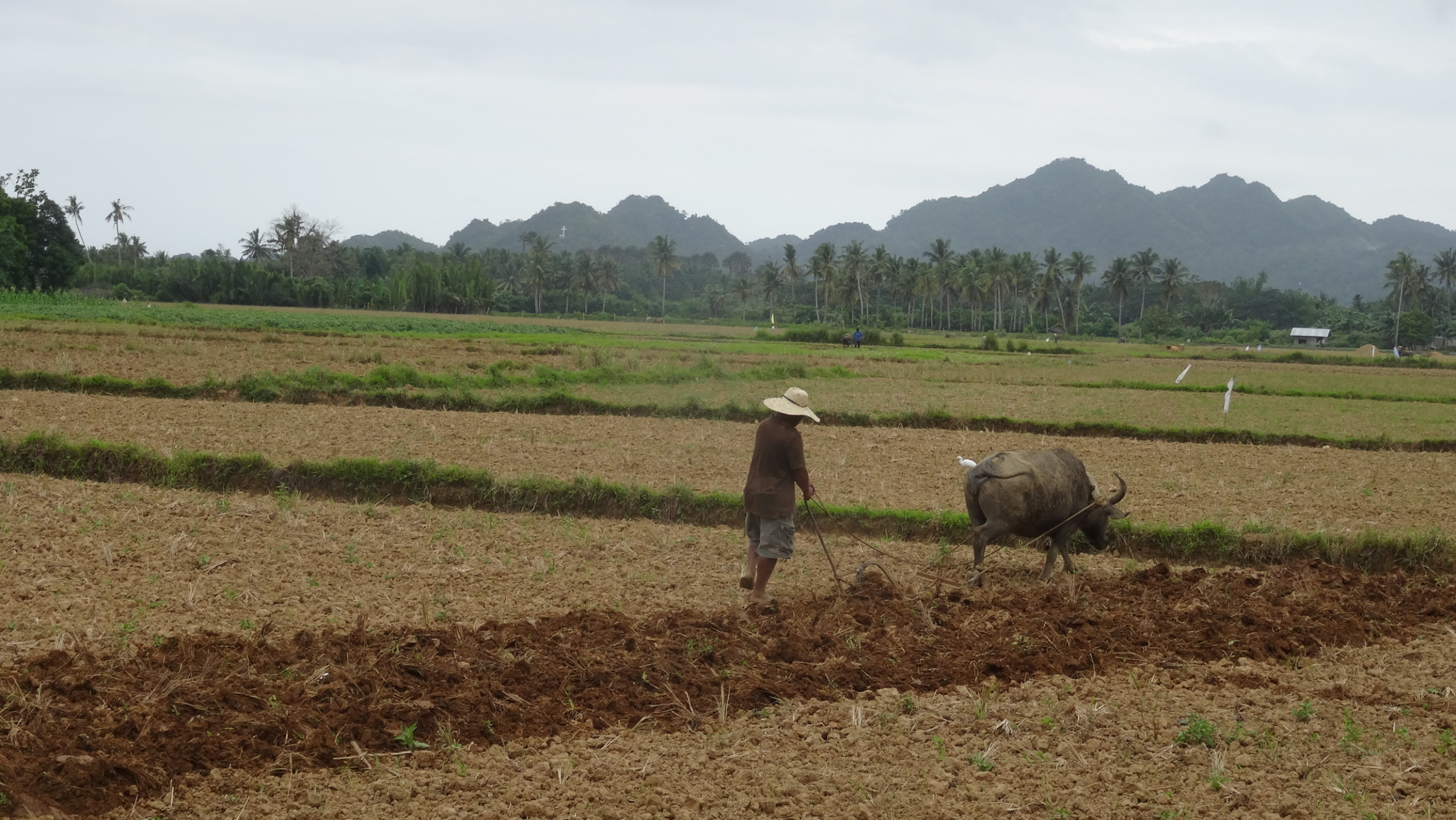
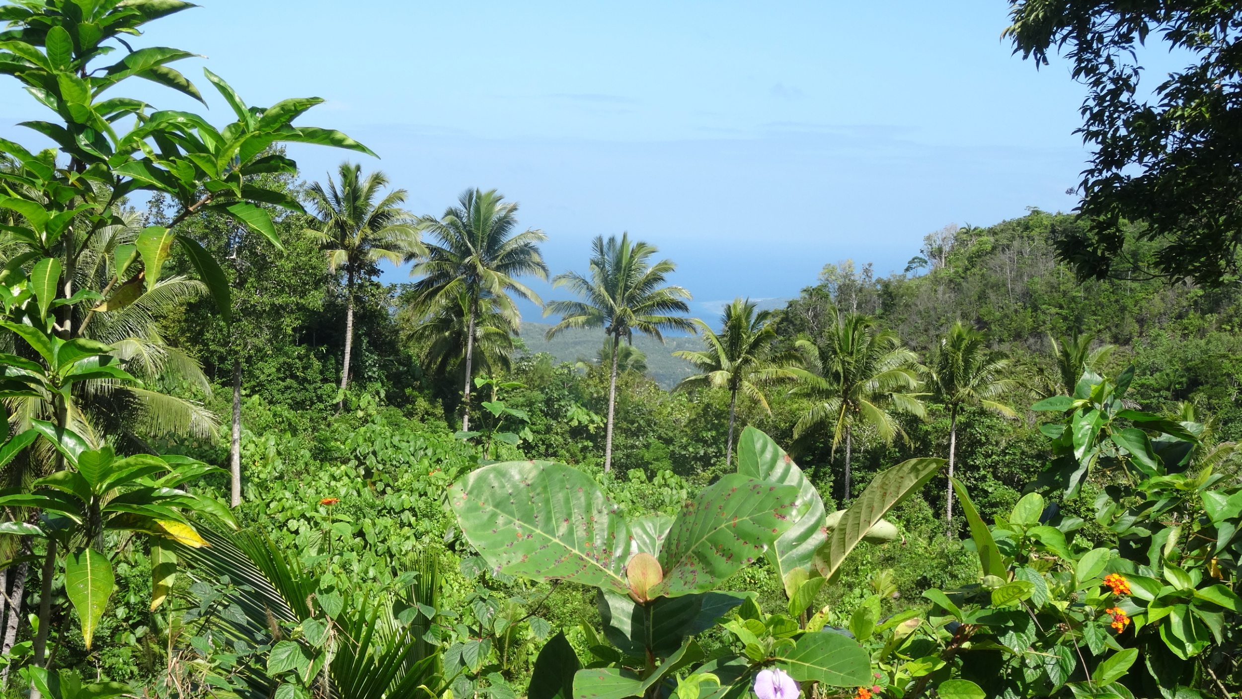
A typical Filipino Island scene; rice and jungle

A typical Filipino Island scene; rice and jungle

Once at the coast the road leveled and we cruised along at a good pace, enjoying the flat terrain and windless day. It hadn’t been easy finding accommodation only a couple of hours from Odiongan but eventually, using Agoda, we found Footprints Beach Resort, at Calunacon, a few kilometres before San Andres. We had an afternoon of swimming and relaxing, and our last night on Tablas Island was delightful as we chatted with our hosts and another guest and settled into our comfortable room at the three year old resort.

Day 6: Calunacon to Odiongan, 27.4km 85m Ascent

“Be at the port four hours before the departure time” was the last detail we were given as the lady handed us the tickets, days ago in Caticlan. The fine print on the second page also mentioned this. Hmmm! Locals assured us the early requirement wasn’t necessary so we relaxed over breakfast, had some photos taken with our friendly hosts and left Footprints, expecting to have one hour to wait when we reached the port.

This was our last day cycling in the Philippines and our last day in a rural area. The route was mostly flat on a smooth surface. I relaxed and let my senses obsorb the vibrancy of the rice paddies and green bunches of bananas bending from the centre of the trees. Coconut palms stood like sentinels dividing the fields from the jungle clad hills. My gaze constantly flicked back to the roadside, always looking out for dogs, chickens, children, motorcyclists, that may at any time, appear as obstacles on the road.

We arrived at the port at 9:30 a.m. to be told the ferry would depart at 1200, and yes, there was plenty of time to go the two kilometres to Odiongan, get some lunch, and return. Later, back at the passenger terminal, we waited until 1300 for the 2GO ferry. This time porters lugged our bikes up to the deck bunk room. We however, had tourist class for this journey, on a lower level. Tourist Class was an enclosed room, so no views. Like deck class there was no seating. Travel comfort was achieved by lying on the bunk identified by the number that matched our tickets. Even though the rows of bunks were close together, in this more superior class, rigid panels between bunks gave privacy and blankets were provided. We set sail while information was being broadcast over the communication system; details about evacuation procedures, the knots per hour that we would travel that should still deliver us to Batangas at our initial expected time of arrival, and then a prayer asking for the voyage to be blessed. Then followed a very long afternoon!

A 2Go ferry, that we used on a couple of longer distance transfers between islands.

A 2Go ferry, that we used on a couple of longer distance transfers between islands.

Now on the island of Luzon, our next section of travel was by bus from Batangas to Manila. In Manilla we were dumped unceremoniously at the side of the road on a bridge that crossed a river that was black with pollution. The footpath that our bags sat upon was slushy with grey filth. We packed up and decided not to contend with the traffic for the short distance to our accommodation. Nev later noticed the photo below, snapped by someone out of their vehicle window, on a Philippines Cycling Facebook page.

FB_IMG_1563608358618.jpg

We left the Philippines, the day following the death of a 20 people and injury to 102 by an attack at a Roman Catholic Cathedral on Mindinao Island. Mindinao has a long history of conflict as muslim insurgents want to re-establish the Islamic state on that island. Even though Mindinao is a long way from Manila it was a sad note on which to finish our travels.

We were subject to delays at the airport as security had been increased and every bag, both check in and carry on, had to be opened and swabbed with a bomb detecting wand. We had taken ages to back the bikes in boxes only to have the boxes opened for swabbing. Both the gladwrap and duck tape we carried was consficated at the airport at check-in as we might have used it to hold an abducted person securely while in flight.





Philippines: Panay Island

Louise George

Iloilo contrasts: Jaro Metropolitan Cathedral and Jeepney transport vehicles

Iloilo contrasts: Jaro Metropolitan Cathedral and Jeepney transport vehicles

Iloilo was in darkness when we arrived after the two hour ferry ride from Bacolod (Negros Island), and we made our way to Injap Tower Hotel. What a contrast to everything we had experienced so far! The hotel was a modern high-rise, directly opposite the SM Mall with cinemas, cafes and shops of every franchise that can be found at any mall in the world.

Day 1: Iloilo: No riding

When we booked our flights into, and out of the Philippines, we chose a six week stay, but we hadn’t realised that at our point of entry we would only be given a 30 day Visitors Visa. In Iloilo we chose to rectify the days of shortfall by applying for a Philippines Department of Immigration Visa Extension. The process took a few hours, most of which was waiting our turn to be seen, waiting to lodge the completed application form, waiting for approval, waiting to pay the fee, waiting for our passports to be returned. The office had run out of stickers to update the passports so we left with an accompanying letter to be produced when we exited the Philippines, if it was asked for. It wasn´t!

Day 2: Exploring Iloilo. 19km

Iloilo is a large city with a modern appearance but as soon as we left the main road, the surface became dirt, punctuated with potholes. Traffic moved at walking pace and there were a couple of traffic jams. With defensive riding we mostly managed to keep moving. Jeepneys constantly pulled in to pick up passengers, but usually a metre was left between the vehicle and the kerb, and with passengers alighting the Jeepney from the rear, we found cautiously undertaking them was a safe manoeuvre. At times we noticed we were the fastest moving vehicles on the road! In this manner we made our way from one area of interest to another, following a tourist brochure and saw what one of the Philippines major cities had to offer tourists. Iloilo was colonised by the Spanish in 1569 and had been an important port and religious base.

Our ride took us to Jaro Metropolitan Cathedral and then through a tight traffic jam towards Lizares Mansion. We had difficulty locating that building, and ended up at a dead end in an area that was clearly a poorer part of town. The rather run down La Paz market was our next stop and then to Molo Church. We sat for a while in the shade at a park and watched young people practicing their dance moves. Unfortunately our timing to visit Iloilo meant that we would miss the city’s most significant event that would be held next weekend. The Dinagyang Festival is held on the fourth weekend in January. It is a religious and cultural celebration with vibrantly colourful costumes, street dancing and accompanying loud drumming music. Mind you, we would not have been able to find accommodation here then.

Day 3: Iloilo to Sari-an Hot Springs Resort near Anin-y 86.8km, 452m ascent

Although we know what direction we intend to travel, we’re not sure where we’ll stay tonight. There are only a couple of options that we are aware of, but we’re not sure how far we’ll ride, so haven’t booked anything.

Once we’d negotiated the early morning traffic in Iloilo we rode the National Highway, fortunately with a shoulder most of the time. It appears that most towns on Panay Island have a 7/11 so we habitually made a mid-morning stop at these convenience stores for coffee and doughnuts. The 7/11 toilets were often signed ‘out of order’ but when I asked to use them, they were unlocked for me. The Philippines is a country I have found it very hard to ‘go bush’ in. Men are often seen with their backs to the road, nose facing a tree, but for a female there is limited privacy because there are always people about, or houses in sight. Mid morning we noticed a car wash, and pulled in to get the salt spray cleaned from our bikes. A man and his young son worked diligently and 100p later we left on two shiny bikes and we’d had a nice chat with the owner while we waited. Later we were passed by a motorcycle with a stainless steel container on the back, we passed it, it passed us. The next time we saw the motorcycle at the side of the road and the chap was selling ice-cream. We caught up again later and purchased ice-cream for us and for the young children who were staring at us curiously.

Not far south of San Joaquin the main road headed west to cross the island. We continued south through many small villages that were having festivals on different days in this week. Banners displaying religious icons and with family names printed on them, fluttered outside every home. At Cata-an we came across many high school students, outside their school, only clad in dried banana leaves folded to form the appearance of scales. These youths were going to a dance competition, as baby crocodiles, as part of their festival. We chatted with the teacher supervising the loading of a papier-mâché lizard that was as long as the truck tray, then the many excited bodies climbed on board, and we called “good luck” as we waved goodbye to the students and their supporters.

Now that we had left the main road, as we headed towards the far south-west point of Panay, we felt like we were more in the backwaters. The road was narrow and there was not much traffic. We had coastal views and rice paddies that were now terraced meadows, where the occasional cow or goats grazed.

Youngsters on bikes joined us for a couple of kilometres, five of them, aged 13 and 14. They had no trouble keeping up without gears, even on the hills, and showed off riding no-hands.

It was late afternoon by the time we arrived at Sira-an Hot Spring Resort where we got a room. The resort had seen better days as the waterslide was not functioning and the pool at the base was empty. There were a couple of cool larger pools set up for swimming. Groups of small pools, just big enough for couples to soak in, looked inviting however the temperatures varied from cool to tepid. The pools were situated on a rocky outcrop with ocean views across to Nogas Island, popular for snorkeling and scuba diving, and we watched the closing day deliver a beautiful sunset while soaking in a sulphurous pool.

The resort had a restaurant, that had mixed Internet reviews. Our meal was okay but the dining experience was spoiled by an uncomfortably loud videoke and three Filipino guests with tuneless voices enthusiastically following the lyrics on the screen. The tide was out next morning and the beachside did not look at all appealing for swimming.

Day 4: Anin-y to San Jose (aka Antique) 49.3km, 193m ascent

It´s mid January and to avoid riding in the heat later in the day we were on the bikes before the resort staff rose to serve breakfast. At Anin-y we stopped at a local restaurant, but the soupy stew being served to locals didn’t appeal. We asked for, and were served breakfast of rice and eggs; still we were given some of the liquid from the soup, in a separate bowl, as a ‘tea’.

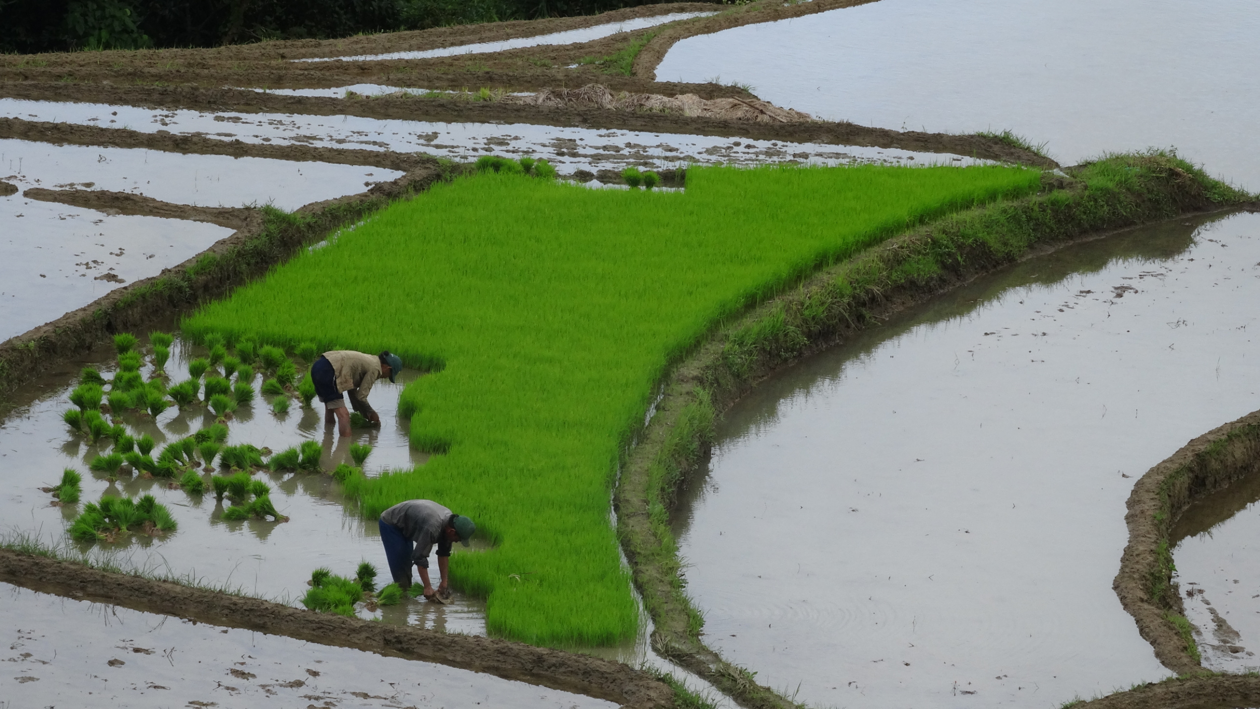
Rice production is the main industry here and the following set of photos shows how much labour is put into the production of small holdings of rice. We were surprised to see that rice comes in many different grades with price relating to the type of grain and the quality.

n10DSC06189.jpg
t3DSC03466.jpg

Flat terrain got us quickly to San Jose and the Robinson Mall, that with a number of franchise type restaurants was an attractive place to stop for lunch. Temperatures were in the mid 30C, with no cloud cover, and we were both hot and dehydrated. Acommodation is sparse along the west coast; especially when we don’t want to pay premium prices. We got the shabbiest room we have had to date. The building was made of concrete blocks, the room was small, with a separate bucket washroom. With the bonus of aircon, we managed to cool the hot room and rest for the afternoon. Later we rode along what we thought was the coast road, but it was actually a very narrow lane-type road, bordered by shabby houses in what appeared to be a very poor suburb. There were people about, we could see children playing at the beach when there was a gap between dwellings, but we had the feeling that people were looking at us with a ´what are you doing here´ expression.

Day 5: San Jose to Tibiao 91.6km, 443m ascent

Our room certainly hadn´t been attractive enough to hang about in, so we made another early start. McDonalds offered breakfast: garlic rice, fried chicken, hash browns and eggs.

By now we were very familiar with island countryside but never tired of passing through rice paddies, passed grazing cattle and through ‘dots’ of villages. We loved the coastline and at an elevated point near Bugasong stopped to take a photo.

From a garden over the road, ¨hello¨, was called. We were invited indoors by Rose, who had lived in San Francisco for 55 years. A former Registered Nurse, Rose was now retired to the village of her youth. Tomorrow Rose will be celebrating 76 years of age. She was fit from gardening for long hours on a daily basis. We enjoyed her warm hospitality and left loaded with fruit and chocolate treats. Further along we stopped for our usual lunch of bread, bananas, and peanut butter. We were sitting in the best shade we could find; at a bus stop, beside an enormous bill-board promoting the current controversial leader, President Rodrigo Duterte, to be reelected in May this year. A man, curious about why we were sitting there, came over for a chat. He used to work on coal ships out from Newcastle in Australia.

Roads in the Philippines on each of the islands we visited were undergoing significant rebuilding. Concrete surfaces were being replaced, dirt roads were being turned into concrete. Stone drains were being laid and stone retaining walls being built against cliffsides. This work, apart from the pouring of concrete was always done manually. We were grateful to usually have a good surface to ride on, and often a very wide shoulder to ourselves.

Had I been sucked in by the Eco in the Tibiao Ecoadventure Park? I booked accommodation within the park as it offered kayaking, and white-water kayaking was a sport Nev participated in when he was younger, and this week Nev celebrates his birthday. To get there we had a 4km ride from the main road. There were two significant climbs; short but steep at gradients reaching 18% and 16%. I was proud to ride both, but it was an effort at the end of an 87km day. Fortunately the temperature hadn’t exceeded 30C, but we still arrived at the accommodation in a lather of sweat.

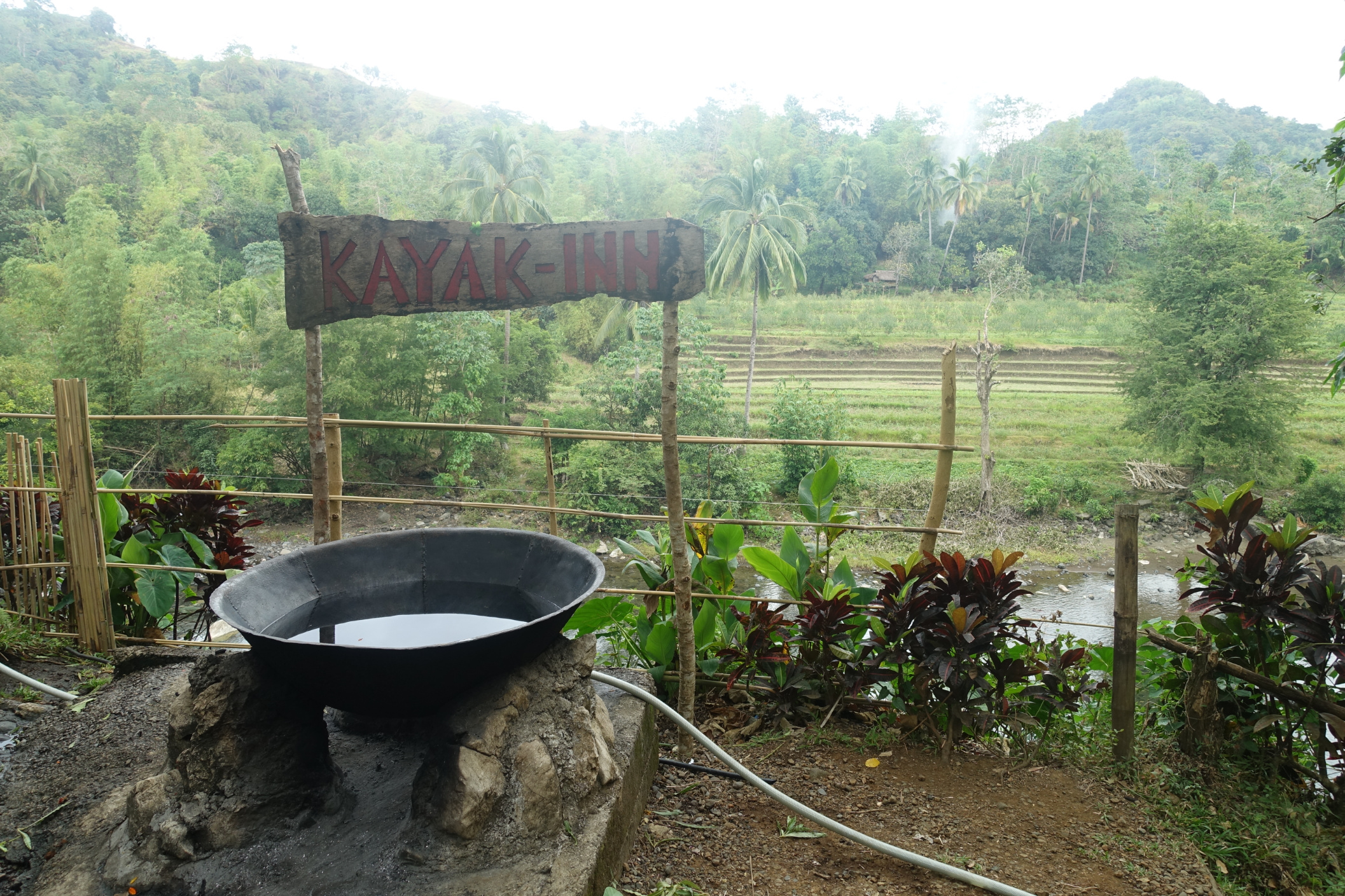
We were shown to our room that was simply a large replica of a local nipa hut. Here the Nipa Huts hang out from the high riverbank giving a view beyond a curtain of huge trees, to the beautiful river. I wind the clock back to when we traveled in Asia in our mid twenties and try to feel a little excited about the mattress on the springy, split-bamboo, slat floor, with gaps between big enough for any number of creatures to crawl through. At least there was electricity. There was an open sided veranda between the bedroom and the stone walls of the bathroom facilities. A separate toilet (no seat) with water tap and bucket for flushing, and a separate washroom where a tap, placed quite low, filled a scoop with water for washing. We sat on the veranda, admired the river and the mountain beyond until we felt recovered enough to walk down to the river for a cool swim. Back at our room we had a bucket wash and dressed quickly to avoid being eaten alive by mosquitoes. We were told mosquitoes would be active between 6 and 7 p.m., and compliant insects that they are, that was exactly the period of time we found them after our blood. At other times they were not a problem. After dinner we took a Kawa hot bath, a famous tourism draw-card to this area. A large steel bowl is filled with water and local herbs, seeped to a rather hot, but bearable bathing temperature tea, by fire lit under the bowl.

Day 6: Tibiao to Pandan, 63.6km, 251m ascent

The two of us squeezed on the back of a motorbike and were driven a short distance up the hill to the end of the road. We hiked to the seven tiered Bugtong Falls with our guide Christa. We chatted as we walked. Christa lived at the mountain village and was rostered to guide four times a week. She had a one month old daughter. Villager´s income was from farming and tourism. It was a beautiful walk to the falls and then a bit challenging to negotiate two of the climbs to look into pools at the base of the falling water. We were interested to see that locals lived in the same type of building as we had stayed in last night. It was Sunday and some people were worshipping at a small church. Young children appeared to be amusing themselves, without adult supervision. We stopped and bought a green coconut for the refreshing water, before walking back to collect our bicycles from our accommodation, feeling like we had a very fortunate life.

Our ride began with a ´no-pedalling´ drop, down to the main road. The way north to Pandan, was then into head-on wind. To our right, mountains were shrouded in moisture loaded cloud, that dropped only a smattering of rain, enough to keep us cool riding in a temperature of about 27C; but with humidity high. The dark sky illuminated the young rice to luminous green. Then the wind intensified and I took my mind off the riding by focusing on the scenery, watching the grain stalks move as if hands waving at a joyous music concert. Our expected 52km ride extended to 62km when we identified our accommodation was north of Pandan. The map showed one squiggle in the road, that always meant a hill. Fortunately the final 10km was rather pleasant and the hill, definitely a zig-zag but not too difficult. Settled into our room, we looked out to see the wind whip the surrounding trees into a fury. We were happy to be enjoying a little luxury. It seems our preference, after months of cycle touring, that in itself can be challenging, is to end the day with a nice room, hot shower and comfortable bed such as we had at H&P Inn www.hpinn.net . We also had a comfortable lounge suite to sit on in the shared lounge, and access to Wifi!

Day 7: Pandan - No cycling today

Itś Nev’s birthday and a non riding day for us. We handed over our laundry and will collect it this evening. We have an admin morning, a swim in the pool, pack up and change our accommodation to Phaidon Beach Resort, over the road that we had booked in advance, a few days ago. We had initially planned an afternoon at Malupati Spring but figured we’d be riding that direction tomorrow and may as well see that area on route. Phaidon is a lovely white sand beach. We swim, eat lunch then catch a motor tricycle to Pandan to buy a birthday cake. The picture of Nev beside the Jeepney was taken the day before his birthday. Jeepneys always have a name blazoned across the windscreen and often have quirky sayings or biblical text adorning the panels.

It pours with rain while we are in town so Nev gets a haircut to pass away some time. On the return motor tricycle we got a warning that the ride was coming to an interesting point, when those passengers that had something to hold on to, grabbed it! It was an understatement to say it was a little hairy on the hill. Gears were chopped down, throttle expanded and the vehicle loaded with six adults and two children, screamed up, taking over the on-coming lane on the blind corner and with a jerk to the lowest gear, breaths held, the apex of the climb was achieved. I felt like clapping! The lady opposite said he was a good and strong driver. Sometimes other drivers stall on the hill and the passengers have to climb out and push!

Day 8: Pandan to Boracay 54km, 386m ascent

We left the comfort of Phaidon Resort and rode the climb up to Malupati Springs, where the river had been broadened and edged by stone walls to create a swimming pool area, complete with diving boards. Groups of Asian tourists floated around on inner tubes or in life jackets. There were a number of tourist vans in the car park, that appeared to be the road end. Our map showed that the road continued and linked back onto the main road. We asked a van driver for information, and while we expanded our map on the phone screen, to show him, we saw that the road stopped and was broken at the river. Although there was a bridge, he explained we could reach the other road with a bit of a walk and some bike carrying; but he wouldn’t recommend it. We’re not into epic adventures at the moment and happy to back-track, downhill to the main road. Head winds blew at us as we travelled across to the north-east coast, and then the wind was more helpful but we had a number of climbs up, and over headlands. Until now our coastal views had been pretty and serene, of calm waters with sandy shores bordered by waving coconut palms. This coast had furious waves driving into a rocky shoreline.

At Caticlan we headed straight to the port. It was 1:30 p.m. and we were hungry but had already started the process, that someone described as ´being as crazy as trying to get into Disneyland´; queue to show that we had accommodation booked, then queue for a boat ticket. We chose an ‘oyster boat’ rather than a ‘pump boat’ because we thought a boat that took cargo, rather than only passengers would be easier with the bikes. Oyster boats departed on the hour, so we chose 1500 to give us time for lunch. Filipino fast food is predominately fried chicken and rice. We had eaten this for many breakfasts, lunches and sometimes evening meals. I was at the point where I could happily never eat chicken again, but today it won again as the easiest option.

Back at the port we pushed our bikes across a narrow ramp to the boat. Within ten minutes we disembarked at Boracay. You can read our blog of Boracay and Romblon Island here.

Philippines: Negros Island including Apo Island

Louise George

Transport to Apo Island Beach. Negros Island in the background

Transport to Apo Island Beach. Negros Island in the background

Day 1: Siquijor (Siquijor Island) by ferry to Dumaguete (Negros Oriental Island) cycle to Malatapay then boat to Apo Island 28.4 km 105m Ascent

Dumaguette was a surprise for us as we had expected a small town similar to those we had traveled through to date, but it was a bustling city with many cafes and western style restaurants. We settled at a cafe and our medium size Latte came in a mug as big as a bucket! Next stop was an Italian restaurant for pasta and salad. There was a lot of traffic heading in the same direction as us, but for the 28 kilometres we had a flat road and a shoulder as wide as a lane, that no other vehicle was using, so we had a comfortable ride. At Malatapay we left our panniers at the booking office for the crossing to Apo Island and then sought out a place to leave the bikes. When we asked the residents of a house nearby, they were happy for us to leave the bikes with them. We returned to the beach where three other tourists had arrived for the crossing, so we were able to share the cost. There was no jetty at either departure or landing points so we waded out to the vessel, helped by the crew of two who carried and stowed our bags. Thus began a roller coaster of wave riding. Sometimes white caps broke over the five of us. We arrived drenched. Having paid our island access fee, that goes towards protection of the landscape and seascape, and dodging a couple of women selling T-shirts we climbed up to Marios Diving and Homestay. They only had a family room vacant, so bigger than we needed, but comfortable, with a balcony, cold water shower, and fan cooling, however electricity is only available from 6 to 10 p.m.

Apo Island was a thriving community, with both an elementary school and high school educating around 300 children. A concrete pathway wove through the populated area, with wooden pushing trolleys being used for carting drinking water, and other goods from the beach to the homes. Wells at each end of the village, provided water for washing. At the end of the footpath street up to Marios there was a square of bench tops and bright lights that formed the internet hub used by island residents.

There were a couple of short walking tracks on the island so as soon as we had dumped our gear, and put our names on the whiteboard to indicate our preference of one of three choices for the evening meal, we walked to the view point to watch the sunset.

Day 2: Apo Island

The waters surrounding Apo Island are a marine sanctuary known for a huge variety of corals and the sea meadows are a feeding ground for Green Turtles. We paid for snorkeling gear and a guide, and walked from the shore into a marine paradise where we spent a couple of hours snorkeling amongst some enormous turtles, colourful fishes and beautiful corals. In the afternoon we walked up to the lighthouse and were surprised to see an area of pasture with goats and cattle grazing. There were also solar panels that we thought might supply the island with the daily few hours of electricity.

The tide´s out on Apo foreshore

The tide´s out on Apo foreshore

Day 3: Apo Island to Bayawan 77.5km 420m Ascent

Our early departure with locals, also heading for Negros Island, was calm, so we remained dry. When we had arrived at Malatapay the other day, there were many seemingly abandoned wooden structures like store fronts and wooden benches, but no people about. Now these were laden with goods as a market at Malatapay was in full swing, and to retrieve our bikes we dodged people and motorcycles with side-frames carrying pigs.

Market purchase going home

Market purchase going home

People here don’t give the impression that they have great wealth so we were humbled when the family that stored our bikes securely, wouldn’t take any payment. Back on the bikes we had the ocean on our left, making navigation easy! There was a range of jungle covered mountains splitting Negros into two regions, on our right. This was a day of fast flat cycling, with a gentle push by a tail wind. Being overtaken by vehicles carrying people and animals as they moved to and from the market, added interest.

Day 4: Bayawan To Sugar Beach 87.6km 409m Ascent

Another mostly flat ride until we pulled over to take a photo of the view of Calipapa from the top of a headland. A cyclist was coming towards us so we waved and he pulled in for a chat. Sonny had just completed a 20km ride and his final burst was to ride up to the view point. He lived back down below the view point, in Calipapa and invited us to his house for a cold drink. We spent about an hour with Sonny, and over glasses of iced water took the opportunity to ask him all of the questions we had about the Philippines, and to learn of his life as a Bosun on a ship, away from home for weeks at a time, and of his wife who was a head teacher at a school in the mountains, who lived at the village where she taught and only returned home for weekends.

A few kilometres before Sipalay we had two climbs; the first a bit of a teaser and the final climb twice as high, twice as long and twice as steep. There is always a reward for energy expended, and the downhill to Sipalay was awesome. Sipalay Beach was a long broad stretch of sand, popular with Filipinos as a holiday destination. We had chosen Sugar Beach as our destination so after a cheesy-fries snack, left Sipalay and headed north a few kilometres. We turned left at Gil Montilla and continued to the road end where we asked for Mondo, as we had been told we could leave our bikes with him. The bikes were locked together in an open shed.

Access to Sugar Beach was by a long narrow wooden boat with outriggers, that are typically used for transportation or fishing. The boat squeezed through the sandbar at the river mouth and then motored through the ocean, running parallel with the stretch of white sand along the shoreline. We wanted a rest of three nights staying in one place, however Sugar Beach was popular and we couldn’t get consecutive nights all at one place. We stayed at one resort for the first night, moved next door for the second night and returned to our first room for the third night. So we did stay in one place, only because we didn´t leave Sugar Beach but packed and moved each day. Just as well we had little in the way of items that needed to be unpacked, and had pannier packing down to a fine art!

Day 5: Sugar Beach Day Off

A day of being as lazy as we possibly could be. Energy was only expended to eat food, swim in the turquoise ocean, and soak up the sunset with a walk along the beach.

Paradise for a few days

Paradise for a few days

Day 6: Sugar Beach Day Off

We’d organised a ‘Snorkeling Turtle Island’ trip with One Ocean Diving. It had been my intention to go to Danjugan Island as I had read there were canoes available to use to paddle around the island and there was a nice beach and a walk in the interior; but to get there would be an hour by boat (not Nev’s favourite means of transport). The alternative of snorkeling at a wreck, only 20 minutes by boat was also attractive, so after breakfast a boat pulled onto the sand for us to board. Snorkeling over a wreck was a new experience for us. The water was deep except for the deteriorating bulk of steel directly below. Fish flittered about and it was tempting, but too scary for us, to follow them into the open cavities that led into tunnels. Later we snorkelled in another area, floating over beautiful coral, marveling at the array of tiny fish swimming in schools around us.

Day 7: Sugar Beach to Kabankalan 77.4km, 436m ascent

Our boat arrived just after breakfast and we left Sugar Beach with lovely memories of interesting conversations with fellow travelers, homemade sourdough bread, mango jam, and other delicious meals. The boat was briefly caught on a sandbar, but was quickly nudged free by the second boatman. Fortunately the bikes were where we left them, locked but in an open shed. When we told Mondo we were heading for Bacolod and it would take two days, he found this quite amusing.

We chose a different route back to the main road that wasn’t flat and concrete, as was the road we had ridden to Sugar Beach on. Before long we were on rocky gravel and then climbing; well pushing up the 18% in my case, and then struggling to dig deep and ride up a few other hills. 4.5 km later we were at the main road and I was feeling like I’d completely undone two days of relaxation. Some areas we ride through we are something of an oddity and this last few kilometres was such a time. Faces lit up as we passed and there was no option but to offer a return grin at least equally as broad as the one given, and call back with a greeting. Groups of women squatted beside wells, around large bowls of sudsy washing water. The smell of detergent wafted from clothes hanging to dry and two young women walking by, heading to church, wore the detergent perfume.

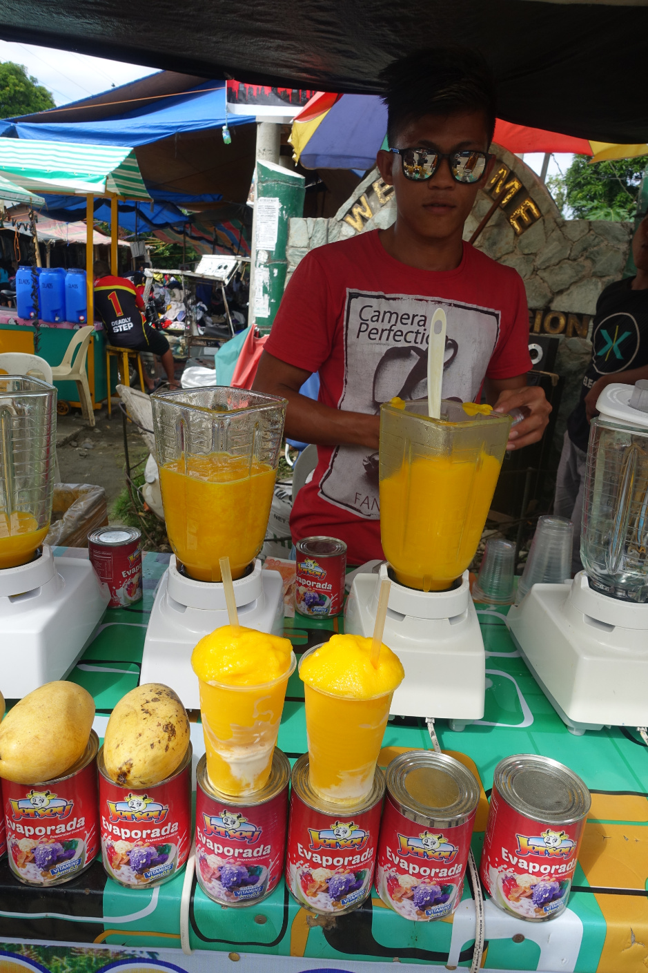
Our first 30 kilometres was; climb a headland, take in the view if there was one, drop down to a flat area where the road was bordered by rice paddies; then repeat. As we headed east, the pleasure of finally having kilometres of flat riding was negated by a headwind. We stopped for our ‘go to’ lunch of bread, bananas and peanut butter at a village stage; the only place we could find shade that wasn´t private property. A few villages later we arrived at Caliling where there were no shops but there were a number of market stalls. Many were selling second hand clothing. We purchased Mango slushy with evaporated milk added.

Today’s final 20 kilometres was quite heavy with traffic, the road cutting a swathe through acres of sugar cane. Very old trucks, overloaded with cane, overtook at a pace barely faster than us. Our destination was the bustling city of Kabankalan. Kabankalan had many new buildings including a City Mall, McDonalds, coffee shop and restaurants; quite a contrast to only secondhand goods and clothing available at Caliling.

Day 8: Kabankalan to Bacolod (Negros Island), 89.3km, 143m Ascent then ferry to Iloilo (Panay Island) Ride to accommodation 4.56km

We had a ferry to catch later in the day so made an early start. Breakfast was at Jollibees, the Filipino equivalent of McDonalds. Breakfast for me was garlic rice, a battered chicken leg and fried egg. Nev had pancake sandwich with filling of bacon and egg.

Fast food breakfast Filopino style

Fast food breakfast Filopino style

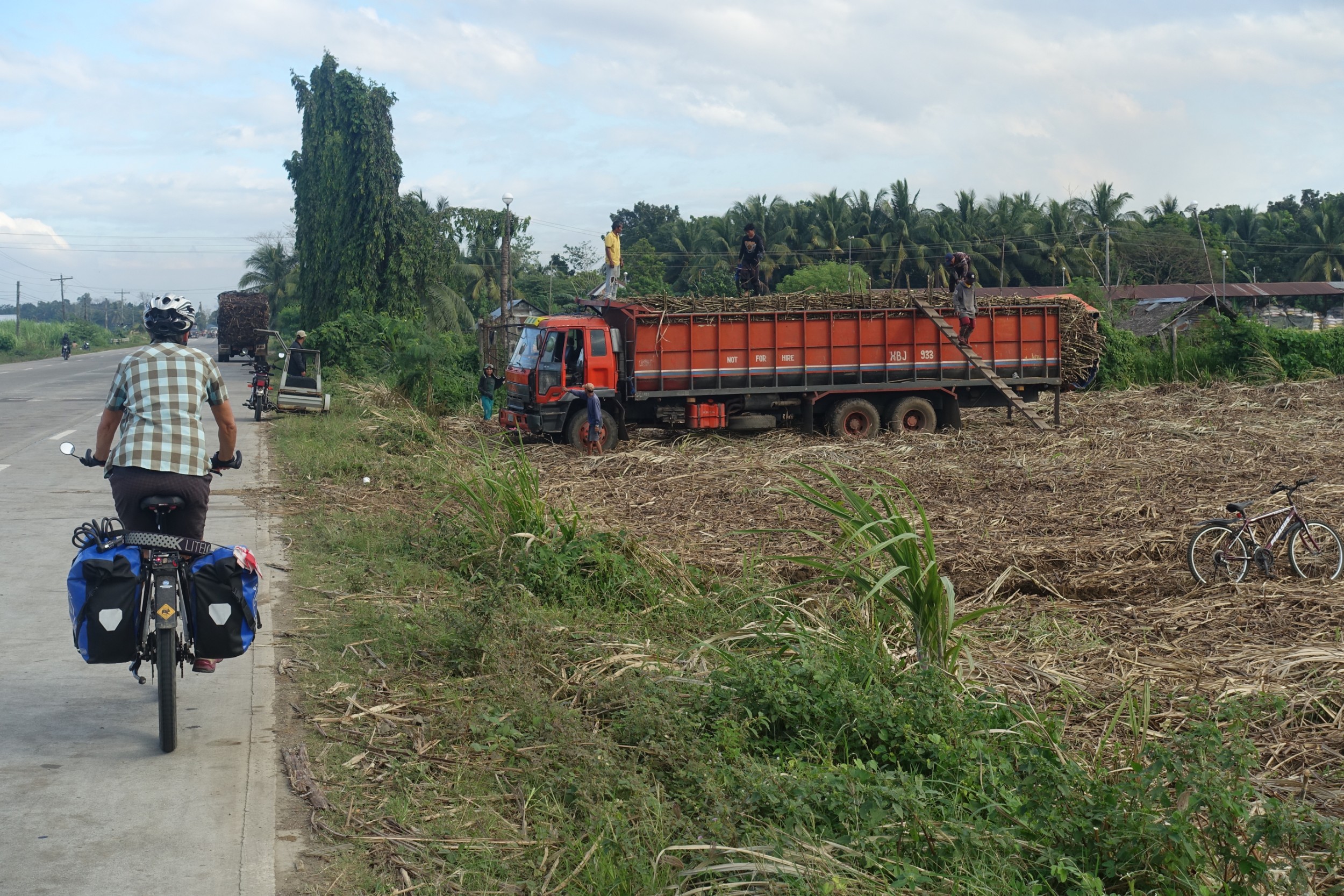
We had a flat ride on the National Highway that started with two lanes each side and as usual no vehicles using the lane closest to the road edge. Maybe that was because at one area the concrete had been poured around a crooked row of power poles leaving them dangerously smack in the middle of our lane. We noticed someone riding a mountainbike behind us and manoeuvred to let him alongside. For a few kilometres we chatted to the young man who worked for the army and was returning to barracks after a 15km trail ride.The rice paddies we had been riding through up to now had been replaced with sugar cane fields extending infinitum and at varying stages of the production cycle. Some fields bare and recently ploughed, others with young growth, and some had recently been burned off and now the remaining stubble was being manually slashed by men with sharp machetes. Many areas were being harvested, with canes being loaded into trucks, some of very old vintage. All work was done manually with large loads carried up to the tray of the truck by men walking a steep plank.

We were passed by many cane trucks and other overloaded vehicles. The most common vehicle on the road was the motor-tricycle usually with too many passengers, or sometimes carrying lengths of bamboo that extended many metres for and aft, with the rear scraping the road. At the 7/11 at Binalbagan we had coffee and from a ‘donut kiosk’ cabinet we chose the most delicious jam doughnuts. There were only a few tables and chairs available, so we moved across our seats to let a man who was standing, share our table. We then had an enjoyable chat with Glenn who was a dive instructor and resort owner, who was traveling to Romblon Island on his motorcycle.

n19DSC03436.jpg

On leaving Hinigaran the two lanes each side of the road were now in full use, as traffic volumes had increased. There was no sign of rain today and the days heat had gotten uncomfortable. By mid-day a severe head-wind added to our discomfort.

We finally arrived at Bacolod and rode directly to the port. The bikes were manhandled by crew to stand at the front of a very old boat that looked more like a floating aircraft carrier than a ferry. Next stop Panay Island.

Can you see the bikes tucked in the front? An ideal position to be sprayed in salt water!

Can you see the bikes tucked in the front? An ideal position to be sprayed in salt water!

Philippines: Siquijor Island

Louise George

s3DSC03298.jpg

Day 1: Tagbilaran (Bohol Island) to Siquijor (Siquijor Island) 15km 123m Ascent

So far we had not found good coffee in the Philippines so went back to Bohol Bees Cafe for morning tea, before heading down to the Tagbilaran port. Tagbilaran to Siquijor Island by ferry was straightforward. It was a ‘roll-on, roll-off’ ferry that we pushed our bikes onto, and left them tucked in a corner of the vehicle deck. You can read about our riding in Bohol Island and Panglao Island here.

We docked at Larena, and were 9 km into the ride to Siquijor town when the drizzle that had been hanging about all morning, turned to rain, forcing us to duck for cover. The downpour was short and we were soon at the town of Siquijor tucking into lunch of burgers and chips before riding a few more kilometres to our accommodation at EM’S Seaside Resort.

Day 2: 54.6km, 509m Ascent

One cycle blog we read indicated that a circuit of Siquijor Island was achievable in one day. Our attempt failed! We reckon it could be achieved if you did nothing but sit on your bike seat, but Siquijor had more to offer than a concrete road circumnavigating the island. We had made a late start and the morning heat was already fierce enough for us to consider a swim at our first detour to the pretty palm-fringed white-sand Paliton Beach, but this early into the ride we didn’t want to cause irritation for the rest of the day, of the prickly sensation of salt water drying on our skin.

s2DSC03295.jpg

We skirted back to the Siquijor Circumferential Road and rejoined it at the turn off by the little church at Paliton village. Next stop was for a mid morning caffeine fix at the small town of San Juan, that attracts most visitors to the island because of its proximity to beautiful beaches and dive spots. Late morning in January the beaches were very quiet.

At Tubod we turned inland for the sheer pleasure (said sarcastically) of undertaking a 4km climb so we could visit Lugnason Falls. A few young local men met us at the parking area and indicated they were keen to be our guide, but we knew already that a guide wasn’t really necessary, unless you wanted some instruction for jumping, or for someone to take photos of you performing jumps, with your own camera. The walk down was steep and slippery at the edge of the natural pool, but worth the effort to watch those brave enough to jump from the top of the waterfall, or swing out holding a rope from a higher place amongst the trees.

Lugnason Falls

Lugnason Falls

We swam in the pool along with some little fish that, disconcertingly, kept nibbling at our skin. There was an alternative track looping back to the car park, that featured views to many river pools that were named after signs of the Zodiac. We took that longer route but the trail was a bit overgrown in places and we arrived back at the bikes hot and sweat-sticky from clambering the jungle route.

Having ridden up from the coast, it was great to now have a downhill. We had seen signs, with paint still bright, guiding to ´Jungle Jacks´, so assuming by the freshness of their sign, that they might take care of their facility, we stopped for lunch. The patio restaurant gave great views over the jungle and out to sea, and the food was fresh. With full bellies we continued on down a steep descent to the main road, turned left, where a gradual ascending gradient took us to the Balete Tree at Campalanas. We sat, along with some other tourists, in the shade of the enormous 400 year old Banyan tree, with our feet dangling in the spring at its base, for a fish nibbling foot spa.

Back on the bikes we kept on climbing for a number of kilometres. The heat was wearing us down. We pulled to the side of the road at the top of the hill, and checked our map. We still had 6 km to Lazi, and from this point that was obviously going to be descending. It was also clear to us there was insufficient time for us to complete a circuit of the island today. We figured we would be best to turn at Lazi and double-back to our accommodation. When we thought more carefully about that decision, we realised this meant when we came back this way, the ride would start with a long climb back to this hilltop. Instead we ‘gave up,’ turned at the apex of the climb and enjoyed a five kilometres descent. A short stop back at Campalanas was to enjoy the coconut water and flesh of a green coconut; and then keeping to the coast this time, we had virtually a flat ride back to Siquijor town.

Day 3: ´Cheating´ Siquijor by motorcycle

What a good decision it was to hire a motorcycle. We headed through the centre of the island towards Lazi. Part of the journey was on a narrow road through jungle, with steep and constant climbing, until our first stop at Cantabon Cave. When we passed Canatabon village hall, someone poked their head out and asked if we were going to the caves. We had said ‘no’ because at that point we hadn´t intended going there. Later when we saw the sign to the cave we got curious so walked down to it, only to find we couldn’t enter because a locked gate prevented entry without a guide. Oh well, missed out on that experience! Next stop was climbing 148 steps, cut into the mountain path, followed by more steps up a metal tower at the top of Mt Bandila-an (557m) to get a view out to the coast.

Further along, the Bandila-an Mountain View Park gardens were a bit unkempt, but we dragged our weary legs to the top of the path and back down. Our central island route took us passed Cambugahay Falls and we stopped there to swim and to watch people swinging and dropping into each of the three pools.

Cambugahay Falls, this is the top fall of three

Cambugahay Falls, this is the top fall of three

At Lazi we picked up the coastal circuit route we had abandoned yesterday, Further along, Salagdoong Beach in the Salagdoong National Park, situated on a peninsula from the right of Provincial Road, was a relaxing place for an afternoon swim. It was a popular spot with the locals and as usual there was the opportunity, for those who loved to leap, to jump from the rocky escarpment that divided the beach into two sections.

Salagdoong Beach

Salagdoong Beach

We filled the tank with petrol; from coke bottles and then headed to a restaurant for our evening meal. Halo Halo, a Filipino dessert that translates as ´mix-mix´ was a tasty conclusion to a lovely day. Halo Halo is layers of boiled sweet beans, tapioca, jelly and fruits on top of a base of shaved ice and evaporated milk. If it melts it looks like a mixed up mess of sweet deliciousness.

Tomorrow we catch a ferry to Negros Island and Apo Island you can read that blog here.

Philippines: Bohol Island and Panglao Island

Louise George

a5DSC03361.jpg

The cocka doodal oodal call and response of crowing roosters was a constant cocaphony, trilling throughout day and night, drowning any sweet birdsong. “Hey Joe” was called from Nipa huts, school playgrounds, palm groves and jungle; reminding us that we were never alone.

Getting Started: 23.81 km

We flew into Cebu, in the Philippines, two days before Christmas, and then needed to decide which of the 7107 islands (count differs if the tide is out) we would ride to reach Manila by early February. We had chosen Panglao, a small island south-west of Bohol, for a short break and to be our cycle touring starting point. First we needed to get there. We had three hours until the holiday office closure to get ferry tickets so after dumping our gear we rode to the shopping centre nearby, through sound waves of Christmas Carols broadcast from every small store, at a volume suitable for a night club. We secured the last seats on the 2GO ferry from Cebu to Tagbilaran. Because it was Holidays, all other ferry sailings for the next day were fully booked.

We intended to come back to Cebu Island, but this never eventuated, so our only time on Cebu was riding to the ferry 8 kilometres from our accommodation. For our travel we had to be at the port on Christmas Eve by 7 a.m. Cycling to the ferry at dawn was very pleasant, as the air was cool and the traffic was light. The port terminal was chocker with waiting passengers. We’d been told to arrive 2 hours before departure and duly complied, but with tickets already in hand the early arrival was hardly necessary. The bikes were booked as luggage and handed over to 2GO staff, for loading. We’d left the panniers on the bikes, so it was lovely to just settle ourselves.

Bohol Island: Briefly

Tagbilaran, Bohol Island, the port of arrival, was crazy with people and traffic but I was keen to get some Christmas treats. What a stupid idea! First surprise was going through security and being frisked before I could enter the supermarket, and this level of security was enforced throughout the country at other shopping centres. Finding familiar items was hopeless so I came away with little more than a packet of cracker biscuits and a locally made nut-paste sweet treat. I returned to Nev who had been waiting outside with the bikes and we set off. Fortunately the town streets that were clogged with motor tricycles and pedestrians thinned out, to only the occasional vehicle, as we rode across a bridge to Panglao Island, then into the countryside for a peaceful and flat few kilometres to our accommodation and a relaxing, no cycle touring, Christmas and Boxing Day.

Panglao Island: Just a taste: 17.81 km

Yesterday was Christmas Day that we spent relaxing beside the pool, with our only excursion being taken by courtesy van to Alona Beach for an evening meal at clothed tables set in the sand on the edge of the ocean, where we were served delicious seafood and entertained by a karaoke duo and fire twirling dancers. Today is Boxing Day and having sat around long enough, we stretch our legs on a short ride to nearby beaches on Panglao.

Alona Beach at dusk

Alona Beach at dusk

Cycle Touring: Bohol Island

Day 1: Panglao Island to Loboc 38.5km 178m Ascent

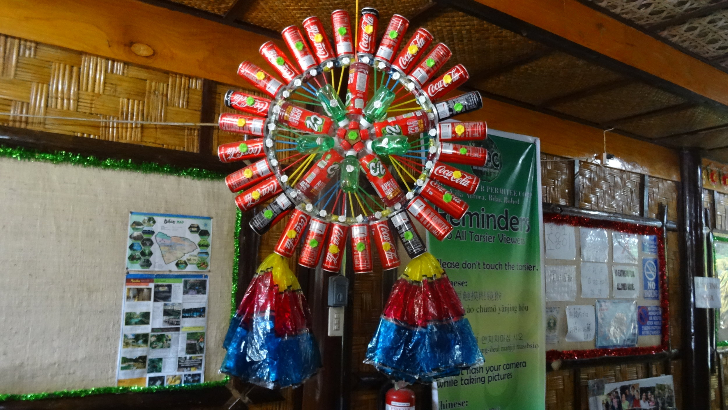
We left Panglao Island taking the same route as we rode in, but after crossing the bridge onto Bohol Island, turned right to follow the coast in an anticlockwise direction until Loay and then turned inland to Loboc. Loboc, a popular holiday destination for locals, is situated on the Loboc River where river cruises, floating restaurants, and evening viewings of fireflies along the river banks are promoted as ‘must do’ activities. We did none of these things. I was feeling very unwell and my focus was on getting out of the heat and to our accommodation for a rest. Late afternoon we walked into the small town, passing Christmas Decorations, most of which are made from recycled materials, and a group of people ‘caroling’ near the ruins of San Pedro Church, brought down by earthquake in 2013.

Day 2: Loboc to Batuan (bottom of Chocolate Hills Lookout) 32.7km, 606m Ascent

Attracted by the opportunity to fly on a Zip-Line, our first stop was at the Loboc Ecotourism Adventure Park. We were at the park the moment it opened, and committed to the ride as soon as we’d seen another couple cross and return safely.

DSC06010.JPG

The ride was high above, and across the Loboc River and for a very reasonable price we enjoyed the thrill of flying across the river with great views into the river valley. There is also a ‘Ride-a-bike’ zip line at another adventure park that seemed more conducive to our cycle touring lifestyle but it was a few kilometres out of our way. With bodies full of adrenaline we headed for the more sedate butterfly park, that included me having Macaw birds sitting on my head while Nev was being wrapped around the neck by a blonde Python. The things we do for photo opportunities!

Next stop was the Tarsier Sanctuary, where we spotted a few of the wide eyed marsupials staring back at us from behind a curtain of leaves. This is certainly a tourist route and there was a lot of traffic on a road that climbed and wound through a man-made Mahogany Forest to the Chocolate Hills.

We had not been able to find an ATM and were told there was one at the lookout. What a serious climb to get some money. The road wound around one of the Chocolate Hills, so named because the geology of limestone domes is covered in grass that browns in the summer heat, and the hills look like Chocolate Bon-Bons. From the car park there were extensive views across mounds of these hills. Later we had a great view of this view-point hill from our accommodation.

Chocolate Hills

Chocolate Hills

Day 3: Batuan to Jagna 62.6km, 897m Ascent 1185m descent

The road to Sierra Bullones undulated and even though the effort wasn’t too intense, the heat and humidity sucked out our energy and hydration levels. We stopped for a cool refreshing drink but were tempted by a shop selling slushy. A bright green Pandan Slushy for me and a deep purple Ube one for Nev, hit the spot. From the bakery, Bread rolls and banana cake that we would eat later, were purchased for lunch. We knew we should expect a significant climb after Sierra Bullones but had been riding for about five kilometres without coming across one. In fact we were having a lovely gentle descent. When we reached the Malinao Reservoir we realised we’d made a navigational error. I hate having to backtrack but that’s how it had to be! Now with a gentle climb before us, we returned and rode back through Sierra Bullones, to our route just on the outer edge of town, and yes, after turning left, we were straight into a significant climb. At a small village we stopped in the shade of a hedge that separated someone’s home from the road, and sat on a wooden bench to eat lunch. A couple of children sat beside us and asked ‘Give me money?’ We were a bit shocked when they repeated the request a number of times, so we gave them a slice of banana cake to share. Later, in contrast to this, a man walking by said that if we needed water, we could go to the filtered water station in the village. He had noticed us earlier and kindly told them to give us what water we needed. The local ‘mayor’ also stopped and spoke to us about our journey and the state of the roads on the island. Most roads, he said, were now concrete, making it easier for locals to travel in the wet season. With food in our bellies we continued to climb. I was able to be distracted from the riding task by admiring mass plantings of potted tropical plants that bordered the road on each side.

Soon the road twisted with gradients getting so steep, that my energy levels lagged and I didn’t have the strength in my legs to ride so had to walk and push up two of them. The Peak was at 756 metres and from there we had an awesome downhill to the coast.

Sometimes cycle touring is like being stuck in mud. Parts of this day felt like that!

Sometimes cycle touring is like being stuck in mud. Parts of this day felt like that!

Our accommodation was on the seaside edge of the Bohol Circumferential Road, our room was almost hanging over the ocean. We got a bit of a buzz when we chatted to some other guests at the restaurant who were in awe that we had ridden that road on bicycles. They said that their vehicles struggle on those climbs in first gear!

DSC06050.JPG

Day 4: Jagna to Anda 33.7km, 159m Ascent

Having been up all night with diarrhoea my body felt heavy and sluggish. Fortunately the medication I had been taking kicked in, and I finally dragged myself out of bed at 10:15 and was able to eat omelette and toast for breakfast. We set off around 11 am. After what had seemed to me to be an epic climb yesterday, my illness, and a 35C air temperature with humidity that we are not used to, at an average speed of 13 kph, this day was the slowest flat distance we’d ever ridden. The road followed the coast and the sea breeze was refreshing. We stopped briefly after 10km and purchased water and then stopped again at 20km for Nev to have some lunch. Our accommodation at Andanott Garden was one of two adjoining holiday rooms for rent and the second was vacant. At the far end of the garden there was a small thatched roof nipa hut, where the manager lived. We were disappointed to find the room had neither air conditioning nor wifi, two mandatory items we look for when booking accommodation. I napped all afternoon and then we took a walk to the white-sand beach, 400 metres away, arriving just in time for Nev to have a sunset swim. By the time we returned to our room I was needing to rest again so Nev went into Anda town to the food centre, for his dinner and to purchase fruit.

Day 5: Anda Rest day

With the fan oscillating at our feet, we did manage to have a restful night after the rather loud Karaoke singers over the road went to bed around 10pm. This was our second rest period in the Philippines when I had plenty of time, but couldn’t upload photos to blogs I’d completed. Although I had data on my phone, the Globe network signal was pitifully weak. I needed a new focus to quell my feelings of agitation, so applied the ‘be in the moment’ approach and reconsidered this interlude to be a luxury retreat. The garden was shaded by tall trees but enough dappled sunlight allowed plush grass to grow in patches making the perfect natural yoga mat. To one side there was a deep rocky sink hole with beautiful rockery planting showcasing the feature, and the peaceful tropical garden setting (so long as the karaoke over the road didn’t rev up), an ideal spot in which to read and write. A beautiful white-sand beach and calm turquoise ocean was a short walk away. We started the day with nutritious muesli, coconut milk and banana that we had brought along with us. Later we ate sweet, fresh Mango. Apart from wishing that the coffee powder with sugar and crema included, could adequately substitute for our preferred sugar-free flat-white, what more could we ask for?

We cycled the short distance into Anda village and ate a healthy lunch at Coco Loco: coconut water and jellied flesh fresh from the green shell, entree of hummus with carrot and cucumber sticks, and for me a main of chicken and couscous (my eyes were bigger than my belly, so Nev ate half), and Nev also enjoyed a Coco burger of which the vegetarian pattie was made of grated coconut. We returned to our accommodation and relaxed, listening to the pleasant music amplified from the house at the rear, that was intermittently drowned by the cheers and commentary from the cock fighting at ‘The Cockers Association’ over the road.

It was New Years Eve and we expected to eat at a restaurant near the beach, but didn’t book and hadn’t considered they would be full. Oh dear! J&R Resort further along the road was recommended. Although J&R were having a private party for guests and staff they made us welcome to join their buffet meal and entertainment of a talented duo, who passed the mic to staff to sing their own karaoke favourite during the breaks. Fireworks at midnight closed the evening and moments later the heavens opened with torrential rain as if to draw the final curtain. Our hosts kindly offered us their van and driver to transport us back to Andanott Gardens.

Day 6: Poblacion region 25 km

As with New Years morning anywhere, most shop and restaurant owners were having a sleep in, but mid morning we found a restaurant serving breakfast to sustain our cycle ride eight kilometres along the coast to Lamanok Island. The island is small, separated from the peninsula by little more than a chasm in the rock, but being clad in dense bush, it is only accessible from the ocean, first by a long, rickety board-walk through mangroves to a restaurant, and then by paddle boat. We hired a paddle boat and the rower who was also our guide. We travelled across an area of marine sanctuary that was marked by poles in the water. There was also a hut perched on stilts that we were told is where the warden spends the night, keeping a watchful eye so that local fishermen do not enter the sanctuary. We then spent an interesting couple of hours being shown Red Hermatite Rock Paintings, an ancient wooden coffin in a prehistoric burial site, and a Shaman’s Cave. We also saw that some of the natural geographic formations had been destroyed. This had occurred after the war, as some treasure hunters thought that the natural layers of rock having the appearance of concrete slabs, were treasure stores where Japanese had hidden gold.

The Poblacion area is a popular tourist destination and there are many places to stay with resorts dotted along the coast and access to half a dozen beaches. The water is clear and snorkeling and diving are popular activities. We rode back to Anda town and went searching for cave springs. There are a few in the area, popular swimming pools for the locals but it was the end of the day and most people were leaving so we didn’t venture in for a swim ourselves. While it looked amazing to be swimming in these deep caverns, some looked difficult to access with locals either leaping in, or negotiating rope ladders.

Locals enjoying a cave spring

Locals enjoying a cave spring

Day 7: Anda to Beunos Aires (Chocolate Mountains) epic 65.84km, 1030m ascent

We had already planned a long route and discussed back-up options such as taking a vehicle if necessary but I’d been awake since 5 am and read a blog about Bohol highlights from another traveler’s (not cycling) perspective. There was a little diversion we could take that would go directly past three of the attractions mentioned. With me not wanting to ‘miss out’ Nev adjusted the course, and we reckoned the new length and additional gradient would be manageable.

We were on the bikes at 6:20, each with half a mango and small satchet of red bean porridge in our bellies. The road was mostly flat, through rice paddies, and there was little traffic. At 8:30 we rode through Candijay. Nev called back to me that he was looking for somewhere for breakfast. A man beside the road heard and called out “it’s here; park at the kerb so you can see your bikes.” There was an open shop front with three lidded stainless steel dishes on a bench; one with green beans, one with mung bean sprouts and another with egg and bitter melon. None of these appealed as breakfast foods so we asked for a fried egg and rice. We each received one fried egg atop a mountain of rice, on a dinner sized plate. Later from the bakery nearby we purchased buns for lunch.

A few kilometres from Candijay we turned off the flat Bohol Circumferential Road and straight into a climb. We should have taken the steep introduction to the hinterland as an omen of difficult riding to come, and it should have also been obvious to us that terraced rice paddies we were heading to, would be on hillsides. At this point we had just completed one steep climb up one hill; however that meant now we were committed to continue; no turning back allowed!

The ride took us through many little villages. We were surprised by the number of small schools we passed, signs outside schools indicated that they had four teachers. There were a number of people about who called to Nev, as he was ahead, so there was an almost continuous cry of ‘Hey Joe!’ After a number of hills we came across a roadside tourist ticket office with three people working to collect the small fee of P20, required to visit the Can-Umantad waterfall, at 18 metres it’s the highest in Bohol. Nev joked that after that hilly road they should be paying us to be here! It was explained to us that before the falls we could turn off to Cadapdapan farm and pay another P20 to see the rice terraces.

We did this, and the view of the terraces was very pretty. As we left the farm we noticed a sign to the falls and steps down from the parking area. This was confusing as we’d recently paid to access the Can-Umantad Falls and believed they were further along the road. As you can see from the photo below, we continued our ride for quite a distance from the falls before turning into a side road that would lead to the falls. We rode downhill and at the point where we had just descended a -23% hill, and knew we were going to have to bike back out this way, we decided to pull to the side of the road and lock the bikes together, proceeding on foot. In retrospect it may have been easier to take the steps from the farm. A couple who had arrived at the farm by car at the same time as us, were emerging from the bush near the falls at the same time as we arrived, having walked down the steps, and probably didn’t need to pay a fee to see the falls. We however had continued to walk downhill from where we’d left the bikes, and subsequently arrived at a parking area where we were met by a group of locals who wanted to be guides. We followed a young lad down steps slick with mud, then took photos of the waterfall and watched people enjoy a swim in the natural pool.

We then climbed back out, walked up to the bikes and made our way back to the top road. Nev heroically rode a section that short 23% incline, while I followed, slowly pushing my bike.

Our third stop was at Canawan Cold Spring. The water source is a mystery and no-one has reached the bottom. There was another small fee of P20 to swim there, but a crazy P200 to hire a table. When this was pointed out to us we quickly removed our clothing and towels from the table top. No tables were in use! The spring water certainly was cold. Refreshed from our swim we hit the road again. We had a problem in that the road we were on was not on our map and we became worried when it deteriorated into a rocky track.

Maybe this isn´t the right way!

Maybe this isn´t the right way!

We double-backed a short distance to where we had last seen a person, and were pointed in the correct direction. Finally we got to Alicia and hoped to pay for a ride to Sierra Bullones but there didn’t seem to be any vehicles available. We continued to Pilar, getting more concerned about riding into the evening.

Is there room in there for me!

Is there room in there for me!

Fortunately a motorcycle-van driver was happy for us to hire him to take us 26 kilometres to Carmen. It was a squeeze but Nev and the driver managed to get one bike tied on the roof, and Nev and I squashed around the second bike inside. We were dropped at Carmen just on dark and rode the final few kilometres to our accommodation at Beunos Aires.

Day 8: Beunos Aires to Tagbilaran 64.5km, 394m ascent

It would have been helpful to have a good topographical map of the Philippines but we had not looked for one and had to ‘make do’ with Maps.me, sometimes Google Maps, or the Komoot App, that incidentally I thought unhelpful as it didn’t have points of interest on it, that we would want to include when creating a course. Nev had set the day’s course to take us left at Bilar and head for Dimiao on the coast, via a couple of waterfalls. We weren’t sure how far off the course the Dam-agan or Ingkumhan waterfalls were, or how steep the access would be to each of them. After yesterday’s effort we decided that we would make a decision when we got to the turnoffs. If we had to go down to a waterfall, only to climb back up, we would likely give them a miss.

“Where are you going? Oh you’ll have a good surface,” was laughed heartily at me as we rode by a local man. I relayed this to Nev but he was pretty confident we would have a straight forward ride because he had based the course on a route he figured (after reading Internet notes) a cycle tour used, and he reckoned they would be on road bikes. Sure enough, the concrete road we had been riding on that went passed the local high school was a pleasure to ride, but oh dear it soon deteriorated into a rough surface, hill-climb track. At least the views were spectacular!

What goes up, must come down. The long steep descent dropped onto the main coastal road. We found that we had ridden parallel to the road where the waterfalls were, and certainly missed them, but through navigational error rather than being hampered by the terrain. Food and hydration was our priority so we purchased water, Sprite, and buns that we ate in the shade of an unfinished building. Fortunately there are many bakeries throughout the Philippines. If nothing else at least we can find bread and buns. While they look like they are all different flavours we found that they all taste exactly the same.

Tasty!

Tasty!

The concrete road took us the final 29km on Bohol Circumferential Road back to the port town of Tagbilaran, where we celebrated the completion of our ride on Bohol Island, with two Lattes each at Bohol Bees Cafe.

Next stop is Siquijor Island

Taiwan: Cycling South from Taroko Gorge to Kenting via the East Rift Valley

Louise George

cover photoDSC03128.jpg

Although there is a signed ‘Cycle Route 1’, a circuit of Taiwan that can be completed in 5 to 12 days, and we have more time than that, the entire route doesn’t really appeal to us as we’ve read that the western side of the island is very industrial, and the north will likely receive monsoonal rains at this time. We are riding in December. We’ve decided to have a good look at the East and Southern areas, and take advantage of public transport to link sections if we need to.

We’ve decided to give up on camping for now. We’ve come from South Korean autumn, where we found it too cold for camping, and continuing to lug camping gear seems superfluous to requirements now in Taiwan and later in the Philippines, that will be the next country we travel in. Neither Taiwan nor the Philippines seem too expensive for accommodation so we chose to take a more comfortable option and posted the small front panniers and all of the camping equipment to New Zealand where we figured it might next come in handy.

We´d had an enjoyable couple of days exploring Taipei; but keen to get out of the metropolis

We´d had an enjoyable couple of days exploring Taipei; but keen to get out of the metropolis

Our first section by train is from Taipei to Hualien. Bikes are allowed to be taken on trains, in a specific carriage, however no bikes are allowed on a station platform. Anyone cycle touring would know that the easiest way to get a loaded bike to within cooee of a train carriage, would be to wheel the bike, right up to where the carriage would stop, and then package the bike to meet the travel requirements. We were sure that officials would understand this, so arrived at the lift used for transferring luggage to the platform, armed with tools, bags and tape that would eventually conjure our bicycles into a form such that they would no longer be recognised as such offending items. We rang the bell, as the lift had a ‘lock’, that summoned the official, who made it clear she would not let the bikes on to the platform. We soon had a group of curious passersby keen to interpret our request and concerns, but to no avail. Rules are rules! We set about dismantling and packaging the bikes, beside the lift with our audience taking an active interest in the proceedings, us, and our travels to date. The inquisitiveness slowed us a bit, and by the time we completed the job and got approval to use the lift, we were getting uncomfortably close to departure time, and trains wait for no-one! Finally we arrived at the platform, but outside where carriage 8 would stop. We then had to run relays of heavy, awkward bikes, and then panniers and handlebar bags, what seemed like 500 metres down to where carriage one was identified on the platform concrete. By the time we, and the bikes boarded, we were exhausted.

Hualien to Xiulin near Taroko Gorge 30km

Hualien was a small station and we easily alighted and got the bikes ready to ride. Before setting off, for what we expected would be about 16 kilometres to our guesthouse, we enjoyed a Railway Box lunch and Bubble Tea near the station. We knew we would be following the coast and that there was a cycle route to follow, so we headed for the ocean, stopping briefly at the roadside to glimpse Hualien Railway Culture Park and Tungching Temple. Finally beyond the city, the coastline reminded us of the West Coast of New Zealand as the shore was of dark weathered stones and huge waves pounded the coast. On dusk we arrived at an area where many tourists were milling about and watching the ocean. There were also a couple of food stalls so we stopped to eat baked sweet potato. We couldn’t figure out what people were waiting for, but noticed fishnets on the ocean and wondered if they were about to be hauled in. By this point we had ridden well beyond 16 kilometres and couldn’t understand why we still had such a long way to go. We checked the cycle brochure and found we had headed south out of the city and hit the coast lower than we needed to, then by hugging the coast had skirted around a headland, clearly quite a few extra kilometres! Darkness followed us into the guesthouse. We were shown our room and the kitchen where we could prepare our dinner.

We had been told what time breakfast would be ready and duly arrived outside the kitchen on time. Nothing appeared to be ready but our host ushered us into his truck and drove us out the gate, across the stone beach to the ocean shore where a long table and chairs were set up. We were left to enjoy the unique beach setting and then he returned with a huge array of food, with other guests following on foot behind his vehicle.

Taroko Gorge, from Xiulin and return 50.53 km, 635 m ascent

DSC03069.JPG

Taroko Gorge was an 18 kilometre gradual incline on a narrow winding road with spectacular marble canyon walls hemming in the Liwu River. Cut by the Japanese (using Taroko labour) the Zhongbu Cross Country Highway was to extract natural resources and access to control the mountain tribes. Just as well traffic was light, because the width of the occasional tour bus, took up all of the road. We took our time, stopping for many photos, to climb up to shrines and temples and just take in the spectacle of the road.

We ate lunch at the only village, Tien-hsiang, and then onward and upwards continued our cycling, but not for too long. We parked the bikes and walked in to the Baiyang Trail that surprisingly started with an entrance tunnel of 380 metres.

The walk was a 4km round trip that took in the scenic view of Baiyang Falls and finished with us wading through a dark tunnel to the Water Curtain that was sheets of water escaping through a rock fissure. The crack occurred when digging of the cave accidentally pierced the stream bed above the cave. The tunnels were built with a view to creating a power source that would have blocked the ecosystem of the Taroko Gorge. Fortunately public pressure caused the power plant concept to be abandoned.

Xiulin To Guangfu 80 km, 450 m ascent

We rode through Banana plantations before joining the main road to Hualien, and yes the direct route was exactly 16km. We easily added another 6 kilometres looking for an ATM! The narrow roads, we took on the outskirts of Hualien took us through a farming area where a variety of produce was grown, such as Taro, sweet potato, and onions. We followed a canal, on a path that must have been a footpath as it was narrow and negotiating steps was involved.

d34DSC03105.jpg

Lake Liyu marked the entrance to the East Rift Valley where Coastal Mountains rose on our left, and Central Mountains to the right.

Rain fell heavily not long after we left the lake. There was an open garage close to the road so we ducked in. The man who’s garage we occupied pulled up a chair for each of us and we sat comfortably until the rain stopped. The man was drying very small chips of wood that I think was camphor.

It was getting dark and we couldn’t find our accommodation. We had ridden through Guangfu and had already passed through, turned around and come back to another small village. We showed a group of people sitting outside a house where we wanted to go. One lady indicated for us to follow her on her motorscooter. I was riding as fast as I could and felt anxious every time the motorscooter and Nev disappeared around a corner. Eventually we arrived at the Guesthouse (that incidentally was on the wrong road on Google Maps). We were quite a long way out of town and dinner here wasn’t an option. Thankfully our host spoke English. We took him up on his offer to drive us to town, and then he ordered our meal, left us to enjoy dinner and returned later to take us back to our room.

Guangfu to Yuli 77 km, including a detour up to the Walami Trail 747 m ascent

Our host told us his wife taught him how to cook when, following his retirement, he took on the guesthouse. She taught him well. There was an enormous breakfast laid before us. We ate as much as we could, and then on leaving we were given some bananas, a loaf of bread, a huge vegetable dumpling, and cumquats to take away. Our host also wanted to be sure we got to route 193 as he had recommended it to be the most scenic, so he rode with us. Ahead of us actually; and flat out. We had trouble keeping up. We were parting ways near a dragon fruit plantation that had been recently harvested. Next thing he was back with us, passing a couple of dragon fruit to stuff in our already full panniers.

Route 193 was rather hilly, but very picturesque, with plantations of coconut, pineapple, rice, dragon fruit, and a view across to the mountains on the opposite side of the East Rift Valley. We dropped into the town of Ruisui for coffee and then continued on Route 9 so we could see the Wuhe Tea Plantation (although we didn’t stop there) and the Tropic of Cancer Marker Park so we could get a photo to mark the milestone. Next stop was at Satokoay Stone Pillars that are a ruin of the late Stone Age of Beinan Culture; a holy place where ancestors spirits live.

Yuli was to be our home for the night and we arrived at midday, too early to check-in, so rather than dumping our gear as we would have liked as we knew we had a long climb ahead of us, we continued with loaded bikes. Our effort took us uphill, past Nan’an Waterfall to the start of the Walami Trail in Yushan National Park. There was a tour bus and a few vehicles in the car park at the top of the climb, and we were greeted by applause and a cheering squad of strangers as we arrived at the highest point; rather a delightful way for two very sweat-drenched cyclists to finish a challenging ride.

Welcoming committee!

Welcoming committee!

We didn't have the permit, nor the time needed to walk the trail, as we only had 30 minutes before we would need to start our ride back down. We walked the first kilometre to the swing bridge, passed warning signs about bears, snakes and wasps, through pretty forest. Back out to the road we walked with some people from the tour group, who shared their baked sweet potatoes with us, and then helped us by phoning the number to our accommodation and arranging a time for us to meet our host. The downhill ride was a ‘blast’ and a great way to finish another long day.

Yuli to Dulan 81.8 km, 681 m ascent

There are three ways to exit the East Rift Valley. Either continue on south and eventually arrive at the coast at Taitung or take either of two routes across the mountains in an easterly direction to the coast. We chose Highway 30, that would take us over the mountains and then give us a longer ride along the coast. We left Yuli crossing the river on a bridge for cyclists and then following the Yufi Cycle Trail. The recently harvested rice field on our right would soon be prepared for rapeseed that would paint the lowlands yellow in Spring. Papaya and Bananas would ripen on our left. The areas we have ridden in to date have had a high indigenous population. Their farming methods has changed over time from a scattered burn approach of farming millet to the production of fields of maize, and now of rice. Traditionally they sing in 8 part harmony, to make the gods happy and achieve the success of the crops.

For now we weren’t concentrating on our course and should have ducked out to the road a few kilometres back. An about turn, took us back to a turn off to Highway 30. We then passed Antong Hot Spring area and straight into the climb. It wasn’t as bad as I had anticipated; 4 kilometres of steady effort and then the road plateaued.

A 2660 metre long tunnel took the sting out of the mountain crossing. On exiting the tunnel we had cloud hanging low, cooling us with water droplets and obliterating the Liushishi mountain tops (In Spring the slops are covered in Day Lily blooms).

The Pacific Ocean spread before us. A wonderful downhill dropped us beside the coast, where a very strong wind had whipped the waves into a frenzy, but to our advantage that strength would blow favourably on our backs. We stopped at Sanxiantai Bridge and dragged our weary legs up and down the eight arches of the dragon structure, that to us seemed an incongruent link between the mainland and the ocean-eroded volcanic islands. The wind was so strong it was an effort to stay upright as we walked around the island.

Sanxiantai Bridge

Sanxiantai Bridge

We decided to take advantage of the wind and with only two hours of daylight remaining, smashed out the 36 kilometres to Dulan, a small town with a reputation for an arts scene and good food. It didnt take long to find the Sintung Sugar Factory Culture Park, and less time for us to take in the ´vibe´ there. It seemed more suitable as a venue for younger people to enjoy music, and buy food and crafts from ´pop-up´ stall.s

Dulan to Taitung 26.4 km, 118 m ascent

Because we have a short riding day to Taitung we spent the morning at Dulan with a walk to the beach, evidently a popular surf beach, and a stop for Bubble Tea that we have become addicted to. We stopped just out of town to join other tourists at the phenomena of ´Water Running Up´ but were more intrigued to sample some of the local custard apple grown with care, in local orchards.

Our arrival at Taitung was in time for lunch in the city then it was five kilometres to our accommodation near the railway station and close to the eastern exit from the East Rift Valley. We’ve had an amazing type of accommodation while in Taiwan. Lin Yuan Bicycle Homestay is one level of a private town-house, there is no restaurant nor cooking facilities, but breakfast is included, our room is large and we are given access to filtered water and to the laundry. After a rest and clothes washing, we set off on foot looking for a restaurant. Eventually we find a Railway Box restaurant that closes in 15 minutes. These ‘meals-in-a-box’ are created for passengers to take on their train journey and we have found them to be very adequate meals. They typically resemble a Japanese Bento Box and almost always include a combination of protein: pork, chicken, mackerel and other items such as tofu, pickles, a vegetable and an egg that is black edged because it has been marinated in soy, all served over a bed of rice.

Taitung 26 km

We had planned to have a day off the bikes but being out in the suburbs, cycling is the easiest way to get around. We started the day at the eastern head of the East Rift Valley to see the Badlands.

d74DSC03149.jpg

Next was a ride through the city centre in a south-easterly direction to the National Museum of Prehistory that gave interesting displays of the geographical formation of the island of Taiwan, the development of Homosapiens through the ages, including the human species in Taiwan, and the Taiwanese First Nation people´s rights.

Taitung to Dawu 62 km, 456 m ascent

We set out from Taitung not knowing where we would be staying for the night. I’d had a quick look on Maps.me and there appeared to be little accommodation available on the coast, however we didn’t know how far we would ride so took the chance of booking later. Probably not so wise as it was a Saturday and once we were riding the coast road south, became aware of how many tourists buses were on the road. The coast road was a four lane highway. We were riding on the right so, apart from snatches of distant sea views, didn’t get to see the coast. We did however see the built up highway ahead, as it climbed up and over headlands. Our road shoulder was very wide so we felt comfortable in the traffic, but later there were long sections of road works. A new high speed railway was being built on pillars above the road, and the work halted traffic for long periods, alternating between north and southbound.

d61DSC05940.jpg

One hundred tourists can’t be wrong so when we saw a number of vehicles, in what seemed like the middle of nowhere, we parked and walked up a switchback track to an area that looked like it had previously been a railway station. There were a couple of food stalls but apart from that we had no idea why we were there, amongst at least 100 other people milling around.

A little later at a 7/11 coffee stop Nev had access to 1-minute WiFi and established there was no accommodation available on our route. We wondered about what obstacles we might face if we found a secluded spot and slept ´bivvy-style´ in our bike bags tonight. Whenever we have been in difficult circumstances like this, something good has happened so I wasn’t too worried. Cycling routes are well signposted in Taiwan and there are designated cycling Stations, with distances between them signposted along the route. The cycling stations are usually at Railway or Police Stations. We haven’t used them yet but spoke to another cyclist who did spend the night at a Police Station, so that is always another option.

When we arrived in Dawu we noticed a sign with a snowflake on it, that we assumed meant air-conditioning, therefore a room. While crossing to that building entrance, we noticed another shop-front with pictures on the window indicating a Bike Hostel. Yes, they had a room so we settled in. A man at the seafood restaurant next door spoke good English so we were able to order prawn fried-rice, seafood omelette, cabbage, and Day-Lily Soup, in quantities that filled our hungry bellies.

Dawu to Kenting 74.5 km, 717 m ascent

We’re still carrying muesli, so that, with fruit and yoghurt was a solid start to the day. After eight kilometres our course took us inland into a twelve kilometre climb to cross the Central Mountains. Stunning views of forest clad mountains diverted our attention from the climbing task. We saw one monkey, but crashing branches indicated the presence of others leaving the roadside. Way below at the bottom of the valley an almost finished section of the high-speed railway snaked through the jungle.

We turned onto the 199 road in a south westerly direction and not long into our descent came across an Australian family of two adults and three children, riding up. We stopped for a very long chat. They’d had the bagging bikes (5) for trains issue and also experienced the northern monsoons and now rapidly escaping the industrial east. I could only admire their fortitude, and I expect infinite patience, to make their first experience of cycle touring as a family, a success.

Our descent took us through tribal villages that had buildings decorated with bright murals and statues that depicted the indigenous way of life.

Eventually, on the outskirts of Checheng, the course became flat, the landscape more densely populated and the Chinese influence more obvious.

d95DSC03162.jpg

With the wind light today, we were soon on the South-west coast at Kenting. What a difference a day makes! Our accommodation faced a golden sand beach (no swimming allowed because of the undertow) and in the evening the Kenting night market came to life, with food, cocktail and side-show stalls, and a constant stream of Asian tourists dawdling passed these on each side of the main road.

Kenting

Today was to be a day off. We’ve been travelling by bicycle for almost six months, just clicked over 7000 kilometres and to be honest I’m feeling physically weary and getting tired of the cycle touring routine. Maybe I’m feeling a bit melancholic because this is the time of the end-of-year wind up for Australia and the lead up to the Holiday Season. I know I have the luck of a perpetual holiday but it’s losing its glamour and I’d dearly love a hug with my children, the company of friends, and a touch of a normal life. So we decided this was to be a proper day off. No cycling! By 3 in the afternoon I was feeling jittery so we headed out on the bikes and rode uphill, 4 kilometres to Kenting Forest Park, just to take in the view and then enjoy a lovely downhill back to base.


Kenting to Taiwan’s southernmost point and return 22.5 km, 322 m ascent

We came to the south of Taiwan to cycle to the southernmost point and today we intended achieving that. We’d mapped a short 21 kilometre loop course from Kenting. With blue skies, and a late breakfast of too many calories providing energy to burn, we expected a couple of hours of pleasant riding. We passed a couple of pretty beaches but our view of the coast was usually hidden by shrubbery that thankfully offered some protection from the wind. By the time we got to the southernmost point we could barely stand to view the ocean.

The wind whipped at us so erratically, as we rode north on the high western cliff side of the peninsula, that I stopped a couple of times and walked, for fear of being blown into the path of a vehicle. Later there was no traffic on the narrow, sometimes gravel, minor road that we took back to the east, but the wind gusts continued to thrash us unpredictably, and it was with a feeling of ‘well that was a short but epic ride’ that we returned the bikes to the security of the foyer at our accommodation. Tomorrow we ride north with headwinds forecast.

Kenting to Kaohsiung 108.68 km 343 m ascent

d111DSC05961.jpg

We planned and achieved an early start as we wanted to get to Kaohsiung in one day. We knew it would be a flat ride but not sure how much of a handicap the wind would be. We started with the wind blustering sideways, but not too strong. At first we passed through the same flat route we had come south on, passing the paintball venues, and about six go-kart tracks; one even with miniature diggers and a mound of dirt suitably placed for removal. We followed a dual carriageway the entire route, with a breakfast break at McDonalds. Once we were in the lee of the mountains that stretched across the entire peninsula from west to east, we hugged the coast, sheltered from the wind. Later the route was signposted as a scenic area, and maybe it would have been if we had detoured to a beach, but we were riding in urban sprawl interspersed with orchards of mango, dragon fruit, and the wax apples that were currently in season, and the only fruits being sold at roadside stalls. Other stalls sold only onions so my guess was these were also in season. We crossed the very wide bridge over the shingle flats of the Kaoping River and arrived in an industrial zone of Kaohsiung. Many steel works and other industrial buildings lined the road and even though we had a designated cycle lane we were constantly stopping at traffic lights for trucks to turn across our path, into entrance ways of factories.

sign1DSC05943.jpg

Kaohsiung was our last cycle destination. From here the bikes were bagged and taken by train with us to Taipei where we had a final stint riding from the railway station to a suburb a few kilometres from the airport. Our evening was spent wrapping the bikes in Gladwrap, with cardboard protecting the frame, and finally bagged in the IDWorx cover bags that Nev had continued to carry. Duck tape secured the packages.

Next stop Philippines.


Jeju Island: Climbing Mt Hallasan

Louise George

Climb Mt Hallasan (1950m) highest mountain in Korea

Not the blog author! At Mt Hallasan summit. a member of another party, proud of his achievement

Not the blog author! At Mt Hallasan summit. a member of another party, proud of his achievement

The day dawned fine and clear and with a forecast 19C we’d already decided we were on Jeju, there was a mountain here, and we just had to do this climb. We were staying very near the Jeju City bus station and Bus No 510 leaves every 15 minutes in the early morning so we were ready for an 8:30 departure. Thirty minutes later we were at the Seongpanak Trail head, shrouded in fog that remained with us for most of the day.

Seongpanak is 9.6 kilometres of climb. I had in mind what it would take to undertake a hike of that distance and didn’t think it would be too difficult, having not really factored in the climbing element. At least I was thinking clearly about the walk being on a mountain and put hat, scarf and gloves in the daypack. In effect, even though we consider ourselves fit from five months of cycle touring, we found this a tough climb due to the distance and the never ending gradient. There is a cut-off time to be passed Jindallebat before 12:00 noon otherwise hikers would not have sufficient time to summit and descend before dark. A requirement that must be met by those people who want to climb. Signage, in English, made it clear what the distances were, and elevation at certain points, and also warned that the trip would likely take nine hours, water needed to be carried, and footwear should not be high-heeled shoes or slippers!

The start was an innocuous stroll on coir matting but soon turned into terrain that alternated between stepped rocks or wooden steps. All the time we were walking through forest enveloped in fog and we had no distant view the entire climb. At one point we heard a strange clattering noise and noticed to our right, a narrow furnicular railway, hidden in the trees. One person was sitting on a deck making their way up the mountain. For us, walking all the way, there were three points to aim for. The first was Sokbat Shelter where there was a toilet that at the time of our arrival had a queue outside the ‘ladies’ because it was temporarily closed for cleaning! I wondered if the person we had seen on the furnicular, was the cleaner going to work. I ducked into the men’s toilet and timed it perfectly as there were no men in there, and none came in. I quickly walked out passed the waiting ladies, without looking anyone in the eye.

We reached Saraoreum the second point, in good time. The third point was Jindallaebat Shelter (1500m) where we sat with many other people to eat the Gimbap we had carried for lunch. We had to pass this point before 12:00 noon, or we wouldn’t have time to summit.

The closer we got to the top, the colder it became, with a biting wind. The tree cover thinned and then parted for rocky terrain near the summit, Baengnokdam, and we were met by sharp winds and icy cold blasts of air. On a clear day there is a view directly into the crater of the extinct volcano, but not today. The queue to be photographed, in swirling cloud, beside the official stone marker was too long for our limited patience. We were cold and underdressed as we did not have the thermal jackets, as other climbers did, so we hurriedly took a photo and started on down the Gwaneusma Trail. 

The downward trail was a shorter 8.7 kilometres that, more steeply, wound down valleys and gullies with some stepped sections. Fortunately after a brief cold rain shower the air cleared giving views of the mountain cliffs on one side and Jeju City far away in the distance. This trail seemed to have more rocky steps and I found myself begging for each 500 metre marker to come into view, sooner than it did. With still two kilometres to go, my legs were quivering and my toes tender but there was no sympathy here, just a determined effort to finish. 

p11DSC05816.JPG

This morning, before leaving we thought we would get a bus back to Jeju City. This would have meant waiting for a bus, and transferring to a second bus at some point. There were taxis in the car park and neither of us hesitated to get a ride back to our accommodation. It had been an epic day, and now bliss to sit down!

p10DSC05812.JPG

Jeju Island: Fantasy Bicycle Trail

Louise George

Certificate Registration Kiosks made good distances to aim for

Certificate Registration Kiosks made good distances to aim for

Jeju Island is a South Korean Autonomous Province off the south coast. It is visited by more than 13 million tourists each year, of which 80% are Chinese and the remainder mostly South Korean locals, although there has recently been an increase in the number of Middle Easterners visiting. The island is promoted as the Hawaii of South Korea, so we were hoping for a warmer climate. In reality, although we have never been to Hawaii, the only resemblance is likely to be that Jeju is also a volcanic island with black basalt rocks dominating the landscape and a stark contrast to white-sand beaches with turquoise ocean waters.

The following is how we rode an anticlockwise circumnavigation of Jeju Island following the Fantasy Bicycle Trail. It is recommended to take this direction because the coast is on the right, the same side as traffic drives.

If rewards are appealing to you then you can get the Korea’s Cross Country Cycling Road Tour Passport (sorry I don’t know where you can purchase this from on Jeju Island) and call in at the Certificate Registration kiosks along the way, for a passport stamp. We did this because we already had the passport from previous rides in South Korea and it gave reasonably spaced distances to cover and points of interest to aim for. If you are interested in reading about our ride from Seoul to Busan, following the 4 Rivers Trail, then click here, or the Seomjingan River and Yeongsangang River Trails, click here.

We travelled in late November, the last week of autumn, and tourism at that time was at a low ebb. Those who were about, were travelling on coach tours. We saw only a couple of other Korean cyclists out riding with a serious attitude, on bikes swifter than ours, and a handful of tourists on hire bikes, that looked like they were having a riding activity for a few hours. Few people sharing the cycle lane was a bonus. At key sightseeing destinations there were many free bus and car parks so clearly at this time there was also less traffic on the roads. If the cycle trail surface became particularly bumpy, or if a section involved much crossing of minor roads or lane-ways, we found it easier to keep a good pace by riding on the road. We got the occasional toot but It seemed more like a gentle ‘I’m a vehicle about to pass’ than a ‘there’s a cycle lane, you should be on it’. I expect that if you ride this course at peak tourist times, you would be expected to remain on the bike path and it would be somewhat slower as you dodge other riders, walkers oblivious to you as they have their faces peering at a screen, poorly parked vehicles, and at times an uneven surface. 

Our front panniers were left in Jeju City as we will not be using our camping equipment. Accommodation in the last week of November was very reasonably priced for a couple. We paid between $35 and $45 ($AUS) a night for clean double rooms with an en-suite. We like to store our bikes inside and this was always accommodated, albeit sometimes locked in the corner of a dining room.

Food-wise, Jeju is famous for seafood and pork, from their unique Black Pigs. We’ve been in South Korea almost a month and apart from Bibimbap, Gimbap and Seafood pancake, still struggle with meal choices. I don’t eat pork and the seafood, we thought was quite expensive. Many restaurants had the menu displayed on the walls in hanguel alphabet, so if they didn’t have pictures to point at, or if they had pictures but no price displayed, we looked elsewhere. There were some western foods, with a South Korean fusion, such as hamburgers and bakery food. We found the convenience stores had a range of sandwiches or rice triangles with filling such as tuna, that were good for lunches. Our preference is to be self sufficient for breakfast so we carry breakfast items: muesli, milk, yoghurt and bananas.

We had been told by South Koreans that Jeju Island used to be a beautiful island with a unique culture but it had, over the passed twenty years been spoiled by tourism. We had a Tourist Map that pinpointed more museums, parks, art galleries, theme parks and other man invented attractions than I have ever seen! There are also many geographical features that is where our attention will be directed. 

Day 1: Jeju City to Geumdeung-ri 74 kilometres 

I recommend you leave from Jeju City early enough to take time at scenic points along the way. The course weaves around the airport with a few little climbs and then follows the coast for a long way before leaving the city outskirts, so riding is at a casual pace. You’ll go by Iho Tewoo Beach, famous for having lighthouses in the form of horses and you’ll see the Gueom Salt Farm from the trail. Hyeopjae Beach is supposed to be one of the most beautiful on the island, but when we visited, the sand was covered in tarpaulin held down by rocks, almost as if the beach had been put to bed for the winter, and it was late afternoon on an overcast day, so the water was as grey as the sky rather than a sparkling blue. We like gardens and spent an enjoyable couple of hours at Hallim Park. Hallim Park has many different sections of gardens each devoted to a theme such as Subtropical Garden, that included interesting reptiles, a bird garden, folk village, Jeju Stone and Bonsai Garden, to name a few. A surprise was being able to walk through two lava tubes; Hyeopjae and Ssangyong Caves. 

Day 2: Geumdeung-ri to Seogwipo  52 km

A pretty ride with the sea and black basalt rocky coastline on our right and groups of black curved roofs of seafood farms and other buildings that appeared to be seafood factories on our left. Many busloads of tourists were walking towards Mt Songaksan, where there is a walking trail and luge ride. We watched but didn’t join them. The cycling route headed inland and there was some climbing for the remainder of the day. You might like to stop at the Jungman Maze Park, the Teddy Bear Museum, or the Museum of Sex and Health, but apart from walking in the forecourt garden of the latter, amongst some very interesting statuary, we headed straight for Cheonjeyeon Waterfall.

One section of the Cheonjeyeon Waterfall

One section of the Cheonjeyeon Waterfall

The Cheonjeyeon area is a picturesque forest walk, following the waterfall in three parts. By the time we had walked to view the waterfalls we were too late to see Jusangjeollidae Cliffs as they close at 5:20 p.m. We should have stayed the night in this area, close enough to take a look at Jungman Beach and the cliffs the next morning. It would have also made today’s distance more manageable. As it was we rode in darkness to accommodation at Seogwipo and didn’t get the opportunity to return to the sights we had missed. 

Jeongbang Waterfall

Jeongbang Waterfall

Day 3 Seogwipo 

In the morning we rode to Cheonjiyeon Waterfall, then Oedolgae Rock and across town to Jeongbang Waterfall, that flows into the ocean. After lunch we walked through Lee Jung Seop Culture Street and the Seogwipo Everyday Ollie Market where many vendors were selling seafood, Jeju Mandarins and chocolates of many varieties with centres of jelly made from Jeju citrus juices.

Day 4 Seogwipo to Seongsan Ilchulbong 62 km

Our lunch break was at Pyoseon Beach, a pretty white sand beach. We noticed a campground, the first we had seen, beside the Certificate Registration kiosk. We arrived at the Jeju Folk Village in time to see the 13:30 song and dance performances; the twirling dummer gave a dizzying performance. At the village there were many groups of homes clustered together in themes such as: Mountain Village, Hillside Village, Shamanism Village, and more. While I enjoyed the time off the bike, walking around the village on a pleasant afternoon, for me, having already seen the small cluster of homes at Hallim Park on day one, I felt I’d already had an overview of what homes were like in times past. 

The cycle path took us beside a yellow field of canola, where you could purchase a ticket and enter the field to take a photo; one that would be identical to a photo that graced the covers of tourist brochures promoting the merits of visiting Jeju Island. We had seen these ‘photo stops’ throughout South Korea; usually they have a theme frame, often a heart shape. People queue to take a photo through these frames when the scenery is just as beautiful without the ‘set-up’. Dusk accompanied us to Seongsan Ilchulbong and we saw the sun drop below the horizon as we arrived at our accommodation. 

The view that enticed us to Jeju Island; this is a photo of a poster displayed on a wall at the bottom of Sunset Peak

The view that enticed us to Jeju Island; this is a photo of a poster displayed on a wall at the bottom of Sunset Peak

Day 5 Seongsan Ilchulbong and Udo Island 11 km

It was a photograph, of the volcanic tuff of Seongsan Ilchulbong (also known as Sunset Peak) in the Qatar Airline Magazine, that prompted us to visit Jeju Island.  We were at the foot of the climbing trail at 6:15 a.m. as we understood the ticket office would be open one hour before sunrise. Actually you could only purchase a ticket from 7:30, pointless when sunrise would be at 7:15 a.m. We made our way up anyway. The track was well lit, mostly stair climbing, that took us 20 minutes. At the top there is stepped bench seating, enough to seat thousands of people, facing east. At this time of the year about 100 spaces were occupied. With an overcast sky we weren’t expecting a dramatic sunrise, and when there was just enough pink in the sky for us to see that a new day had dawned, we headed down. Our grey photos, with sun and wind browned grass, bore no resemblance to those in the magazine, taken by a drone from the sea looking towards land, of a crater lush with Spring grass, and the seating edited out.

Nev did the climb but he’d been unwell for a couple of days so we decided to have a second night in Seongsan Ilchulbong for him to recuperate, while I took my bike on the ferry to Udo Island, likened to a Scottish Isle. When purchasing a ticket, you need photo ID, such as passport and you complete a departure card to be allowed to board. The ferry runs often and is only 15 minutes travel time. Without my companion I found myself to be the only Westerner, amongst the other travellers sitting on the floor (there was no actual seating available), where at least I had a warm spot (the floor had underfloor heating) but I couldn’t even eavesdrop as I had no understanding of the languages spoken around me, and gained a new respect for the isolation that may be experienced by solo travellers. The volcanic islet of Udo is visited by 1000s of tourists and to help with traffic management there is a, mostly flat, one way circular route of about 11 kilometres. It seems to be the thing to do is hire a bicycle, tandem, 3-wheeler cart or another vehicle you may have never ridden/driven before and set off for a circuit with stops at key points: caves, white sand beaches (made of the carbonate fossils of red algae) grasslands, restaurants, peanut ice-cream sales. I was away from Nev for 3 hours and had taken the ferry across and return, ridden the circuit and taken my time over a shrimp burger lunch and later watched a group of Haenyeo come into shore from a dive, while I ate a peanut ice-cream. Haenyeo is the name given to women free-divers who for centuries have eked out a living diving for abalone, octopus, sea cucumber and seaweed. The occupation has been immortalised in basalt stone statues throughout the islands of Udo and Jeju. They were given a UNESCO Cultural Heritage of Humanity designation and the South Korean government has given incentives for young women to take up the occupation, but numbers are declining. 

Day 6 Seongsan Ilchulbong to Jeju City 70km

The Jeju Cycle Trail finishes at Yongduam Rock in Jeju City and we decided we would complete that 70 kilometre distance in one day, with a detour to Manjanggul Cave. The route to Woljeongri Beach was the same as we had been riding recently; flat, hugging the coast with seafood farms on our left. In one bay we noticed about 40 Haenyeos diving, some quite a long way from shore. We turned inland at Woljeongri and rode for about 5 km up to the cave. When the stream of lava, erupted from the Gomun-Oreum crater to the shore, the Manjanggul Lava Tube was formed. The tube is 7,416 metres long and the public can walk through a one kilometre section and see all the classic features: flow line, stalactites, shelves, toes and a 7.6 metres high column, all formed by the flow of lava. 

Back on the bikes we picked up the course at Gimnyeong Beach and then hurried to complete the ride in daylight. Back at Jeju City, the route took us passed the Jeju National Museum and the Culture and Art Centre but it was the end of the day with buildings already closed. We arrived at Yongduam Rock, moments after sunset, just in time to get our final passport stamp, and completion certificate. Tomorrow we have a mountain to climb. Click here to read the Climbing Mt Hallasan blog.
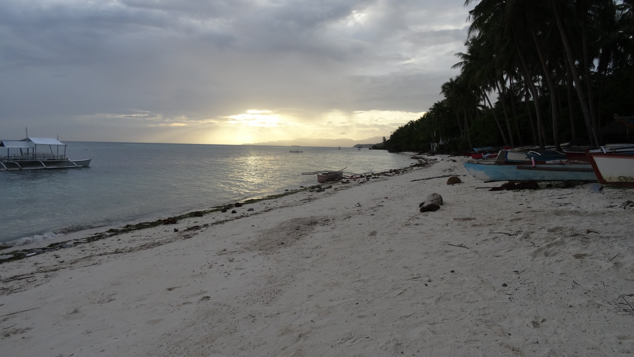
d64DSC02980.JPG

South Korea: Cycling Seomjingan River Trail and Yeongsangang River Trail (313km)

Louise George

Sunset at Seomjingan River Trail Head

Sunset at Seomjingan River Trail Head

South Korea in late autumn: November. We had completed the 4 Rivers Trail (you can read about that ride here) and had five nights in Busan. We are not the best at following signage and we have read other blogs about linking these two river trails by riding many kilometres on a motorway, (that we would prefer not to do) so we imported a file from RidewithGPS to both Nev’s Komoot App and my Garmin so we wouldn’t go wrong, at least with navigational errors. We were relaxed about leaving Busan and getting to the Eastern bus station because we had already ridden from the suburb where the station is located, and confident that we knew where it was, and then pleased that our return ride to Sansong was straight forward. Navigation though, was clearly not the only aspect of touring we could get wrong!  A bus to Gwangyang was already at the terminal. Nev went in to purchase a ticket for the 11:00 bus to give us time to unload the bags and get the bikes ready for stowage in the luggage compartment. Nev returned to where I was waiting, with tickets for the 11:19 bus. He commented that it seemed an unusual time and showed me that the time space on the ticket showed 10:10. We decided that must be the time of purchase. We prepared for travel and waited. Another bus parked in Bay 25, due to depart at 11:00. By this time Nev had wandered off to the toilet but he was taking such a long time I knew he was nosing around the outdoor clothing outlet stalls. While Nev was gone the driver of this second bus to Gwangyang asked to look at my ticket. He pointed to 10:10 and said “time!” “Change!” I realised that what Nev thought was the departure time was actually today’s date written in the format 11:19! We should have been on the 10:10 bus, although that would have been impossible, because it departed moments after we purchased the tickets. Nev had still not returned to me when that second bus departed. By now we had actually missed two buses! Nev easily got the ticket changed to 12:20 p.m. By the time that bus arrived we had been standing at the station, in the cool shade, for 2 hours, presiding over our pile of gear. 

The two hours of bus travel to Gwangyang was luxurious, with plenty of leg room and a seat that could recline with leg support for those that enjoy that level of comfort. Because we had up to now been following rivers I thought the road route might offer different scenery, however apart from the absence of rivers it was much the same. Broad cultivated valleys punctuated by hill mounds covered in foliage that had gone beyond the autumn tones and now brazen, appeared to just need a strong breeze to float the remaining leaves to the ground.

Seomjingan River Trail

On the bikes we had 9 km to the trail starting point at the Seomjingang River mouth. We arrived at 3:30 and, as there was a camping area next to the trail-head, we decided to pitch our tent under a pergola to let it dry out thoroughly. I can’t say I’ve been excited about camping in South Korea and that has disappointed Nev, but it’s been very cold the two nights we had previously camped, and the nights are very long with darkness from 6:00pm to 7:00am. Also with no electricity or data , many hours of reading becomes the only entertainment. I agreed to camp rather than ride in the direction of Hadong, 20 km away, probably the nearest town with a Motel. The cold began to settle as soon as the sun dropped. Tonight rather than sit around in the cold we headed off to a restaurant we had located through Maps.me, that was 2 km away on the other side of the river. There were a number of ‘fish’ restaurants and we chose the one with the brightest neon lights. It was only 6pm and we were the only patrons. We had no idea what to order and the only thing we could establish with any certainty was that the fish had to be purchased by the kilo, that at equivalent to $72AU, was way out of our budget! A soup on the menu was reasonably priced so we pointed to that picture. The bubbling hot dish was placed centre-table with the gas flame lit beneath it, keeping the broth at a fast boil. The spicy stock was full of delicate tiny eel, beef bones and many vegetables. On the table, surrounding the soup tureen, a bowl of hot rice each was placed, along with twelve small dishes of cold food, and one small whole fish. We sat awkwardly on the floor at the low table and tucked into the feast. One of the women working in the restaurant came over from time to time and watched, with a huge grin and sparkling eyes (clearly Westerner clients are a rare source of amusement),  to see how we were getting on. She wanted to chat but that was hopelessly funny, even using Google Translate. Later she kindly brought us a Persimmon, sliced for our dessert.

The night was as cold as I anticipated it would be. Our sleeping bags are summer weight and even with most of my clothes on, as well as my hat and scarf, the chill seemed to permeate my bones. At 7 am it was 2C.

Following our Meusli breakfast, the gear was packed quickly as the pergola overhead had kept everything dry. With the Seomjingan River as our guide, we set off. There wasn’t a breath of wind and as the day progressed we were able to strip off some layers of clothing. We’ve made a habit of stopping for coffee around the 20km point, but we were at 35km and still hadn’t come across a cafe or a shop selling food. We were beginning to wonder if we’d even get a lunch break when at 40km we came across a restaurant, about one kilometre before Nampo Bridge, with a few vans parked outside. We sat at the only table, along with some working men, and were served lunch. There was no menu; everyone was served the same: thick beef bone broth, rice and nine cold accompaniments, similar to last night’s meal. Men came and went as we ate the very hearty meal, with a lot of liquid for rehydration. 

It would be almost impossible to take a wrong direction on this trail as the course is marked with a solid blue line painted the entire length. Signage to checkpoints is also very good, so when we watched some cyclists turn onto our route, (the only ones we had seen today), with that distraction we overlooked that Namdo Bridge was our Certificate Registration spot. Two kilometres further there was a coffee van so we stopped for a cappuccino, and Nev realised the error. We’d discussed not double-backing for check-points when we’d missed some on the last river trail we rode, so continued on. One of our difficulties is that we are unable to interpret the many signs that show points of interest, and I assume also accommodation options along the route. The Korean, Naver Navigation App, would have been useful, as it shows the trail and also place names in Korean and English but data is needed to use it, and we do not have a Korean CIM card as we had not purchased a Tourist CIM in Seoul. The Maps.me App, with South Korea downloaded, had helped us identify a town that had a Motel and we were happy to finish our day at Ace Motel in Yongjeong, having covered 70 kms. 

We had a late start to the day as Nev had been vomiting in the night. At 10:00 o’clock the morning chill had not lifted however we set off in 4C and it remained at that temperature for much of the time we were riding. At least the air was calm and dry. Nev had little energy and we decided to make the day a shorter distance, slowly covering a very pretty, but cold 46.2km. Just after the Hyanga Park checkpoint Tunnel we diverted 5km away from the course to find a Motel in Sunchang where Nev went to bed for the rest of the day.

Next day dawned with weak sunshine and with Nev feeling better, we set off without panniers. We had identified that the return route, linking Seomjingan and Yeongsangang Rivers, came to within a few kilometres on the other side of Sunchang city.  It seemed sensible to have a shorter day’s ride, with light bikes, and have two nights at Goldeun Motel. 

The trail continued beside the river that flowed and snaked through deep valleys. With less flat fertile areas the fields of rice and onions were much smaller. Occasionally a bright crop of red chillies added colour. At Janggunmok there was an area of wooden  platforms for campers. Across the river were some cabins and later we passed glamping tents. This appeared to be an area popular for summer river activities, and hiking trails, but at this time nothing was open. At  Seomjinggangdam, the final Certificate Registration on this river trail, we were delighted to see a Coffee sign, the first in 40km. Coffee with cake, served in a tiny cafe, where the heating was so intense that I stripped down to my first layer, was our chosen celebration on finishing Seomjingan River Trail. Back on the bikes we doubled back 5 km then took a more direct road route to Sunchang. What a difference a little sunshine makes. We were wearing just as many clothes as yesterday but the sun-bright high of 8C reached us around midday and with a few climbs we were soon stripping off some layers. We had just clocked 60 km on arriving back at our accommodation. 

Yeosangang River Trail

Tyres crunched the frost as they crossed the bridge but the sun held promise of warmth. The route not far from Sunchang-eup led us to a flight of concrete steps. At this point I was thinking ‘oh, here we go, this is the motorway that I’ve read about, and the course has brought us to it at this stepped side entrance point so we can’t see any ‘bicycles not allowed’ signs’. The bikes were unloaded, gear lugged up to the highway and then the bikes carried up in turn. Actually for six kilometres we rode on a dual carriageway, that had light traffic and a wide shoulder, so there was no difficulty. We left the highway and took a secondary road up to Damyangdam, our starting point for Yeongsangang bicycle path.

The first section of trail was on a rubberised surface similar to the protection under children’s play equipment at parks. The surface felt like it was gripping the tyres and slowing us down. Fortunately a stop-bank with a gravel path on top, travelled in the same direction so for a while we took that option. 

We found Yeosangang River Trail very easy to follow. The solid blue painted line continued, but with the bonus of directional signage being in both Korean and English. There were also two different types of signs, marking each kilometre. The trail lead us through Gaeksa-ri, a pretty tourist orientated town with many coffee shops, restaurants and a bamboo park. Our travel continued in the same vein as other river trails. The route was usually along the stop-bank that gave us views of the river on one side and acres of greenhouses shining as their coating of taut plastic glistened in the sun on the other. Occasionally there was a rice field or garlic crop that was planted in neat rows with their tops poked up through circles punched in plastic. The river had many bridge crossings, but we stayed on the left bank with the trail usually dropping beneath a bridge, so the path was continuous, punctuated with 7% descents to get below a bridge and then a 7% ascent to rise back to the path.

The river had trickled from the dam, but flow increased as tributaries entered. Occasionally a weir would reduce the flow to pools surrounded by grasses, habitats for birds, then later the river would broaden again. 

By Gwangju the river was very wide with the banks linked by many bridges. The city extended about 12km each side, beyond the river, with high-rise apartments jostling for river views. We wanted to split the trail into two days riding, so continued to a motel on the outskirts of Haksan-ri. Our odometer recorded 70 km for the day. As there were no shops nearby, we heated our packets of noodle meals and ate in the room.

Gwangju River Side

Gwangju River Side

There was the occasional spit of rain as we put our panniers on the bikes but by the time we’d ridden the 3km to seek out breakfast it was raining heavily. We drank our coffee at a cafe, then from the 7/11 brought food: hard-boiled eggs, tuna rice cakes and sandwiches, that we ate at the first pergola we came across, beside the river path. Our course continued along the stop-banks with a couple of very steep, but fortunately short, climbs adding riding challenge but little in the way of interest as our view was totally obscured by the rain and fog.

sceneDSC02915.JPG

Fortunately the rain stopped later and we eventually dried out except for the pools in our shoes. I was hoping to knock-off the 67km today without a break but with only 20km to go, energy levels were low. We left the river path but continued riding parallel to our course, hoping to find a shop. We found ourselves riding through a rural setting of acres of rice paddies, that appeared to sprout green shoots before our eyes, as they soaked up the rainwater. Occasionally there was a cluster of implement sheds and houses, but no shops. Back at the river we stopped at a shelter and ate the last of our food supplies. Three slices of dry bread, that was three days old and had a slight coconut flavour, spread with crunchy peanut butter and topped with cherry tomatoes, one Persimmon, a handful of walnuts. Our ride into Makpo continued along the stop-bank of what was now a very broad river. We were joined by a cyclist from Newcastle, UK who had been working at Makpo for a few months in the shipping industry. He was delighted to have English speakers to converse with. Later when we stopped at the final Certification Registration kiosk, a Korean man, out walking with his family on the trail, stopped me for a chat. Later, when we stopped at a cafe, the man sitting at the table next to us happened to be a teacher of English and he struck up a conversation. We hadn’t spoken to anyone for over a week so this was a wonderful way to end our last day on mainland Korea. By the time we checked into a Motel near the port we had completed 80km. Tomorrow we take a ferry to Jeju Island. You can read about our circumnavigation of Jeju Island, following the Fantasy Bicycle Trail here.

South Korea: Cycling Four Rivers Trail from Seoul to Busan

Louise George

themeDSC02744.JPG

Our ride over this route took 10 days, covering 680 kilometres. We rode in late autumn; November. Rather than write a day by day blog, I decided to give an overall picture, both in the text content of this blog and in the grouping of pictures, rather than a chronological account, because anyone riding this route will be of varying abilities, have different amounts of gear and may choose to take a different amount of time. At the end of the blog I have listed our travel in days and distances.

We had five days of sightseeing in Seoul. The official starting point was Ara West Sea Lock and we didn’t want to ride there. We had established that bikes could be taken on the trains, only on the weekends and only in the first and last carriages that would be identified by a bicycle icon. It was Sunday and we envisaged the train and 40 km ride would only take the morning, leaving the afternoon for more sightseeing back in the city. I highly recommend you plan to enjoy just the cycling activity because in effect, that is all we achieved that day.

We decided to get the express train that goes to the airport from Seoul City Station as that train passes through, and also stops at Cheongna International City, the nearest station to the start of the trail. This journey was for us, by no means straightforward. We had difficulty finding elevators, at the stations, and when we did the space was sometimes small, so one bike (just as well without gear at this stage) would be taken at a time. The train we boarded stopped one station before Cheongna International City (not what we were expecting to happen) and wasn’t continuing. Maybe we’re a ‘bit thick’ as it took us ages to figure out how to get the next train in the direction we wanted; our efforts included riding with the bikes on an escalator (not recommended, and probably not allowed) and then being told by locals we couldn’t, with bikes, get on a train we were trying to board. Finally we went back to the platform we had initially arrived at, got the next train and disembarked at Cheongna International City.  A cycle path took us to Ara West Sea Lock, that was the trail head. Then we had difficulty finding where to purchase the Trail Passport. Coming from the trail head it’s from a reception area in the second large building beside the Ara waterway, the Ara Tower, Ground Floor. In Korea F1 is the Ground Floor. Look for the building, pictured in the next group of photos. From here you can get the Passport and also pick up a brochure about points of interest along the waterway.

We found Korea’s Cross Country Road Tour Passport useful as it gave us specific points to aim for, breaking the route into sections. Our first day we were having trouble finding the 3rd and 4th stamps (because we thought they were directly beside the trail, and these two weren’t) and started feeling like our ride was now becoming an Orienteering event; (a sporting activity we are not particularly good at), so we decided if we missed a stamp, it wasn’t so important that we would double back for it. The passport also came with a map of all the South Korean trails, and this became our only printed map. Only trouble was, the map was only in Hangul characters that Korean is written in.  We also hadn’t realised that some of the map trails were shown on different maps but some details overlapped, so at some points we were expected to have put two stamps in the passport, but on the different pages that applied to different trail sections. At one Passport kiosk (called Certification Centres) someone had taken the stamp. If that is the case, and a finishing medal is important to you, take a photo of yourself at the booth, as proof you were there. We found the person checking our passport at the end of the ride, took her job very seriously!

We found the ride back to Seoul, firstly on the Ara Waterway and then the first part of the Hagang Trail such a delight. We rode on the right bank and had a good view of the Ara Falls (Korea’s largest artificial waterfall) but were opposite the Ara Mary observatory (a circled glass floor, hanging 45m above the canal). Being a sunny autumn Sunday, there were hundreds of people out riding; family groups, wobbly new riders, many cyclists on ‘top-end’ titanium bikes. The path was dedicated for only cyclists and walkers, so three lanes with solid painted lines defining each lane. No one crossed out of their lane, no-one rode more than two abreast, most were single-file. The speed limit was 20kph and occasionally there was a pole beside the path with a fixed light that flashed red or blue to show your compliance, or not, with that regulation. We saw one policeman driving slowly on a motorscooter and two small electric trucks with workers equipped with broom and rubbish collecting items (not that we saw a single piece of litter). There were pop-up cafes, bicycle workshops, cycle retail outlets and occasionally a bike station featuring a pressurised air hose for blowing off dust, track pump, pergola and seats for relaxing, and water fountains to replenish water bottles. There were many toilet blocks, at a guess no more than 500 metres apart. There was always the river on one side and the other side of the path was sometimes wetlands, or nearer the city many parks for outdoor activities such as walking in nature, or fields for sports of many disciplines. Because everything about the trail culture was new to us, we took our time to enjoy this first day. We did wonder about the 20km speed limit but it appeared to be only a restriction on this waterway and through Seoul, and appeared again, only occasionally, where paths went through other large cities.
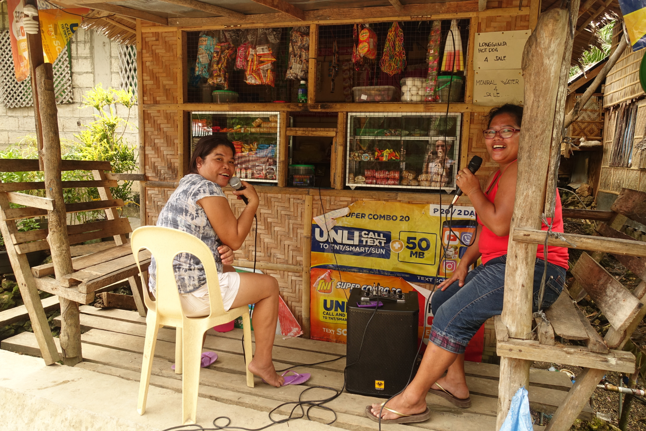
Main1DSC05437.JPG

It was Tuesday when we headed off towards Busan, many days riding away. There were still many other cyclists on the trail for about 25km, the distance it took us to reach the edge of Seoul’s metropolitan area, and then we saw very few people until the next weekend. 

We continued to enjoy the autumn foliage but found the days cooler and shorter than we had expected. It was dark from 6p.m. to 7a.m. The trail is well suited to camping. Occasionally there are dedicated campsites with full facilities that there is probably a charge for, but we were under the impression from other blogs that camping beside the trail was acceptable. We had our first 2 nights free-camping, the first beside a wetlands walking path, on the outskirts of a town. The second night was more emergency camping because it had got dark, and we were nowhere near a town. We had just passed a restaurant that was open, and it had a toilet block outside the building. We ate at the restaurant and then pitched the tent opposite, tucked behind roadside shrubbery. Both nights the temperature dropped to 2C so we decided in future to find accommodation indoors. 

Most of the signage along the trail was in Korean, so we had no idea what towns we were passing or what might be a point of interest. Google Translate wasn’t very good at identifying Hangul characters displayed in colour, on wooden boards. Google Maps didn’t show all of the towns. We learned that the Koreans use the Naver Navigation App, that has places in Korean and English. The bicycle trails are also marked on Naver. We did download the Naver App, but the problem for us was that Naver needs data. We hadn’t purchased a Tourist CIM Card when we were in Seoul, as it cost about $50, (we should have purchased this) and at that time we were planning to be in Korea for only two weeks, and we also knew that in cities, free Wifi was available at most cafes, restaurants and sometimes public spots. We managed to find accommodation by using the Maps.me App with South Korea (downloaded when we had free Wifi). Searching under the category Hotels would also display Motels, as a blue dot, and we would head in their direction. Often the trail bypassed towns so sometimes it meant just crossing the river to find accommodation and food. As a couple we found staying at ‘love motels’ very reasonably priced (and sometimes a bit quirky) but they were clean, and in addition to the bed were often furnished with a table and chairs, kettle provided so we could fix our own breakfast or heat noodles, and had an en-suite so they were very suitable. With underfloor heating a feature of the Korean lifestyle, staying overnight indoors was sometimes too warm for us, but really who’s complaining. An unexpected bonus was we could sometimes talk to other people, rather than just be the two of us camping in isolation. One day we were invited to join the motel manager as she attended morning prayers at a Buddhist Temple, high in the mountains, usually a two hour hike. This resulted in us taking tea, made from ginger flowers, with the resident Monk, and were each given a gift of a Korean face mask and bead bracelet. Another time we had an enthusiast manager invite a local member of the cycling association to meet us and he gave us some good tips. 

We found Koreans to be very generous as has already been mentioned, or occasionally we were given a piece of fruit by other cyclists or walkers. We also spent an evening as guests in a Korean home, in response to a generous invitation. Our knowledge of the Korean language is ziltch and outside large cities we often didn’t find English speakers, but we got by with hand gestures, Google Translate App downloaded, and pointing to pictures on the wall in restaurants. We were often asked ‘how old are you’ and found this to be in relation to Confucianism and respecting elders. While we found Korean people always respectful, additional respect was given to people older than themselves. This could be as simple as serving the eldest person first.

The trail surface was always sealed so easy riding in that respect. Most of the kilometres were flat, however many times each day there were the 7% ups and downs to access the top of a stop-bank or drop under a bridge. Korea certainly knows how to produce hills and threw a few into the mix. For us Day 3 had some road sections and with 234m ascent we gave our legs a bit more to do. Our first major climbing experience appeared on Day 5. There were two significant climbs that day, although the gradient and distance covered on the first section wasn’t too bad. The second climb was 5km of between 6-10%. We completed this ascent at the end of the day and night had fallen by the time we got to Ihwaryeong Rest Area checkpoint. We had a very cold, winding, downhill ride to Mungyeong in complete darkness. A good test for our lights. Day 6 gave us a couple of short sharp climbs and a memorable one with an unexpected 26% gradient (short and sharp) that was absolutely impossible to ride on loaded bikes. Climbs continued to feature, for us, between Daegu and Susan-Ri. After Daegu we were advised to check the trail map for when squiggles appeared, as this would identify a hilly section, and studying the map usually showed a section of road that offered an alternative, avoided the climbs and later linked to the trail. We didn’t heed this advice at the first squiggling we came across and ended up pushing 300 metres up a 15-20% incline. Where possible squiggling lines were avoided after that. There were a couple of big unavoidable climbs after Hajeong. The first included an 18% incline and the second appeared to go straight up for the short distance we could see, so we started pushing. The climb then eased to between 12-16% over 2 kilometres!

The trail infrastructure continued to amaze us. Toilet facilities were placed along the trail at regular intervals. Most were clean with toilet paper and hand washing facilities; some with music. A few toilets were squat over, porcelain pans over long-drops; usually in isolated places. Pagodas could usually be found at summits of hills or on a riverbend that had an outlook that was aesthetically pleasing; these offered shelter and lunch spots. Stainless steel fencing, extended for kilometres, even in isolated places whenever it was possible that someone might drop off the trail, if they weren’t paying attention. We were fascinated by the use of stainless steel in South Korea, for fencing, bollards, drink tumblers and even chopsticks (that I found to be very slippery) but the shiny steel gave a clean appearance.

Safety signs were prolific, in fact it was obvious the trail was treated the same as any highway with warnings as appropriate for such things as trail works, steep gradients, possibility of falling if leaving the trail (even though the boundary was usually fenced if there was any likelihood of a fall injury)! 

The theme of the trails was understandably bicycling. There were occasional art works, seats, even a toilet block, and many kilometres of stainless steel fencing that embraced cycling. At Dongam-dong there is the Sangju Bicycle Museum. 

We never tired of the scenery. It was autumn so some days were hazy all day, some were thick fog until late morning then clear in the afternoon, some were sunny with clear visibility and we had one day of stubborn rain so we called it off early. We were surprised that there was never anyone using the river. There are many weirs so there can be no through traffic such as Europe’s industrial waterways, but we never saw a small boat of any kind, nor fishermen on the riverside. 


The land beside the river had various uses, with walking tracks through wetlands, and sports fields being the most common near cities. Park Golf seemed popular, and it was at these up-sized putting greens that we saw large numbers of people. Adult outdoor gym equipment parks were plentiful, and occasionally we saw people making use of them. In rural areas there were kilometres of crops: turnips, onions and garlic, with daikon radishes and cabbages being harvested. Rice fields extended for kilometres; at this time the grain had been harvested and now the stalks were being cut and bailed in white plastic rolls. Greenhouses covered in taut plastic would stretch as far as the eye could see and change the view to one similar to glistening ripples of snow moguls. 

The mountains were often distant silhouettes, blurred by the weather, although we did get up close and personal with mountains, mid ride. There was always a cluster of high rise apartments in sight. We had no idea that South Korean urban populations would be so dense. Most people lived in an apartment in a high rise building that had a large number on the side. Groups of these buildings were called villages, and a number of villages formed a city. Closer to Busan we came across a few rural villages with clusters of small houses.
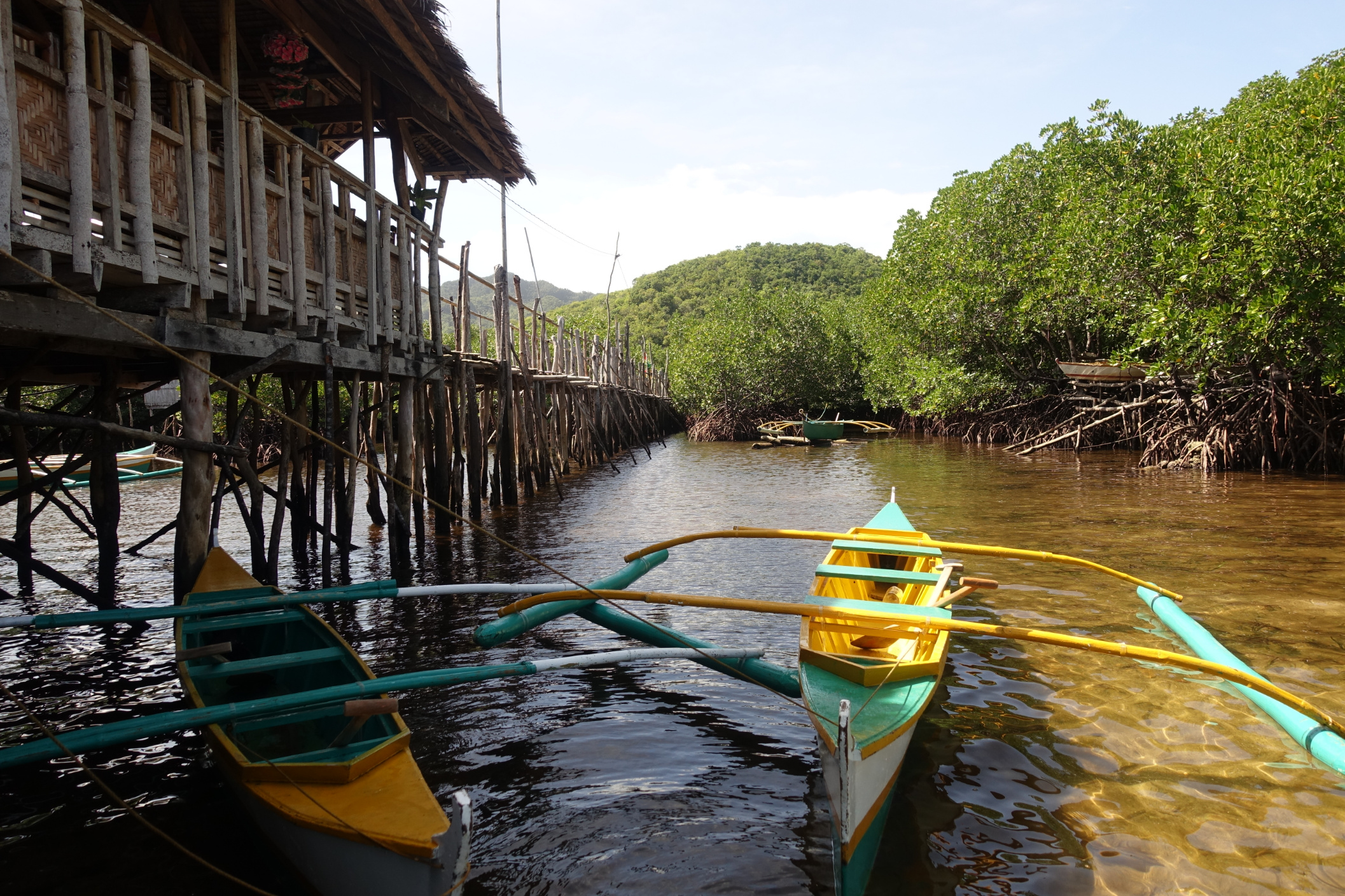
Mornings were sometimes very cold and we did make use of the face masks we were given. With the mask and a buff under our helmets we were pretty toasty but as the day warmed we removed these and other layers of clothing. We found it amusing that local cyclists, even when the temperature increased, would remain covered from head to toe in face mask, puffer jacket and long pants and imagined ourselves to be in a sweating lather if it was us riding in that attire. Sometimes we became aware of an approaching cyclist because we could hear music blasting from a speaker, surprisingly usually western songs. We also came across this sharing of music when we did some hikes, that we found annoying or not, depending on personal taste. 

This is possibly a generalisation, but it seemed that Korean cyclists did not have the knowledge, or the equipment to repair a puncture. On three occasions Nev stopped and fixed punctures, the person not having the means to repair, and many other cyclists would have also gone passed the person pushing their bike, and had not offered assistance. 

PunctureDSC05547.JPG

We very rarely rode on a street in South Korea, but when we did we rode defensively, as we would anywhere, but we didn’t feel confident that drivers would be looking out for riders, as so many cyclists ride on trails away from traffic. Apart from difficulty choosing food at some restaurants, language wasn’t an issue. We did find getting cash was a problem at times. A lot of ATMs wouldn’t accept a foreign card, and while 7/11 stores ATMs were okay they would only dispense a maximum 100,000 won, with high fees. 

Four Rivers Trail completed

Four Rivers Trail completed

Overall we enjoyed our 4 Rivers experience and decided to spend more time in South Korea, riding Seomjingan and Yeongsangang Rivers Trail (you can read about that ride here) and then riding the circumference of Jeju Island (you can read about that here).

end2DSC02791.JPG

RIDING ITINERARY

Day 1: 47km: Ara Waterway, Hangang River to Seoul, stayed at Kimchee Hostel

Day sightseeing in Seoul 

Day 2: 74km: Seoul to Yangpyeong-gun; Free camp

Day 3: 76km: Yangpyeong-gun to ; Jocheon-ri; Free camp

Day 4: 30km; Jocheon-ri, to Mokaeng-dong; Damien Motel (shorter day because of torrential rain)

Day 5: 76.km, 914m ascent; Mokaeng-dong to Mungyeong; Sky Motel

Day 6: 77km, 357m ascent; Mungyeong to Nakdong-ri; Phoenix Motel, 

Day 7: 87.8km, 246m ascent; Nakdong-ri to Daegu; Hosted at a Warmshowers home

Day 8: 70.5km, 374m ascent; Daegu to Hapjeon on outskirts of Angjin-ri

Day 9: 63.5km, 519m ascent; Susan-ri, Princess Hours Motel

Day 10: 75.4km; to final check-point at Nakdonggang Estuary Park, then to our accommodation in Busan

Morocco: To the desert and beyond

Louise George

Copy of DSC02230.jpg

“Where are you from? Welcome to Morocco!” These two statements we heard on a daily basis, said with genuine interest and cordiality; no strings attached! I would however highly recommend having an understanding of French language if travelling in Morocco. My schoolgirl French was very limited. We got by; but we would have liked to have communicated with locals more as that would likely have given us a richer experience.

Travelling on a bike seat can be difficult, but any time, in many of the countries we’ve travelled in, when we’ve chosen to travel by bus with the bikes and our many bags (we each have 4 panniers and a handlebar bag), there has usually been a lot of bike preparation, and difficulties transferring gear. We had already used CTM buses to travel from Agadir to Marrakesh with boxed bikes in the luggage compartment. Now we’ve established that, for a fee, we can freight items from Marrakech to Fez. So the smaller bike box was put inside the larger bike box along with the front panniers and various items we would not need as we rode south. Fingers crossed the very large package will be safely transported from Marrakesh, and will be in Fez when we arrive in a fortnight.

Next we walked up the road to a different bus station and booked a ticket for us to travel on a Supr@Tours bus the next day, from Marrakesh to Ouarzazate. We chose Supr@tours because their timetable was more suitable for us, but we were advised to arrive next day at least 30 minutes before departure to book the bikes as freight. Carrying the bikes would then still be at the discretion of the driver, and it would also be up to the driver to allow us to get off the bus at Tiz’n’Tichka Pass, as we actually want to ride some of the way to Ouarzazate. The bus would save us 106 km of cycling, and a significant amount of climbing.

Tiz’n’Tichka - Ouarzazate 89 kilometres, 355 m ascent

Fortunately, on the day, everything was as we wanted and after a three hour bus journey, the driver pulled over at Col du Tichka, and left us on the roadside with bikes and panniers. Nev quickly got the bikes ready for riding. We took a couple of photos at the highest pass in Morocco, and set off. At 2260m the air was thin, and the landscape bare red soil. We were quite out of breath as we climbed a little more to the highest section of road. I was hoping for a ride of only downhill (descent was 1336 metres) but the total ascent of 355 metres, kept the day honest.

With temperatures up to 35C, the heat from the sun and the warm wind, sucked the energy and the moisture from our bodies. There was no shade so we had one short break in the scorching sun to eat the croissants we had brought along with us for lunch. Later we took a longer break at a cafe to re-hydrate.

Many photo stops stretched out our travel time. We were enthralled by the constantly changing landscape and colour variations. With not being sure what the road surface would be like, we didn’t detour to the tourist attraction area of Ait Benhaddou. On the first day of this cycle tour we were not ready to make it an epic, as had been the case when we rode a three day loop from Agadir, (you can read the blog about that ride here). The modest accommodation we had booked in Ouarzazate, ‘Hotel Valley Rose’ was very comfortable. With a fridge in our room we looked forward to cold drinks at least for the start of tomorrow. Reception offered to store the bikes securely; no trouble, and pointed us in the direction of a shop that sold water and food so we purchased supplies for a back-up.

Ouarzazate - Ait Sedrate Sahi El Ghar, 87.31 kilometres, 750m ascent

It would have been great to start early but the restaurant opened at 7 a.m. and it was actually very dark until that time too. We were packed and ready to leave as soon as we’d eaten. We had watched the sun rise as we ate breakfast, and with the early temperature at a pleasant 17C, we set off to get a head start on temperatures that reached 35C before midday. With only a few photo stops we easily covered the 41km to Skoura, and settled at the first cafe we come across for coffee and Wifi. Later we went into the Skoura town centre, but because we didn’t find anywhere more appealing to eat at, ended up returning to the cafe we had sat at earlier. Nev was just recovering from a couple of days of diarrhoea that started in Marrakesh, and my appetite was dulled because of the heat and dehydration. Even though neither of us was hungry, we knew we needed to eat the meagre lunch we’d chosen of tomato salad and chips.

D2DSC02023.JPG

A soft pink hue kissed the landscape. Distant mountains melted into silhouettes in the heat haze. The arid terrain didn’t seem like it would support a large population so we were surprised to pass through many villages. At a high vantage point on the road, we could see six villages dotted over about a 15 km distance. From our bike seats these villages often appeared to be clusters of small mud brick houses hidden behind walls of the same material, (kasbahs) but we found that there is often quite a large population in the villages, with dwellings that actually extend well back from the road. To locate the typical Moroccan Auberge in the village of Ait Sedrate Sahi El Ghar where we stayed the night, we rode, as if negotiating a maze; along narrow dirt tracks between high walls, to the outskirts of town, about two kilometres from the main road.

Ait Sedrate Sahi El Ghar - near Dades Gorge, 43.31 kilometres, 385m ascent

We chose not to eat breakfast at the auberge for a few reasons; last night’s tagine had been very expensive so we assumed breakfast would probably also be pricey; I had been in hot and cold sweats all night, had hardly slept and didn’t feel like eating, and we wanted to make an early start. We rode out at 7:30, on a snack of Orange Juice and a Meusli Bar. At the main road we passed hundreds of children walking to school. From Kalaat M´Gouna to Boumaine Dades it seemed like Highway N10 was one long route where villages conjoined each other; with houses of the small mud brick variety or grand homes of many levels, all dressed in sandy pink.

We were riding the valley formed by the Dades River. As with any area in Morocco where there is a water source, populations are dense. The small town of Kalaat M’Gouna had an industry of rosewater and rose fragrances. Every second shop was selling rose products. Evidently there is a Rose Festival every May. We continued towards Boumaine but made a left turn just before the town in the direction of Dades Gorge. Only ten kilometres along the road into the gorge, we settled into Hotel Cascades Dades. Nev did bike maintenance, while I napped, then we spent a relaxing afternoon on the terrace perched high above the fields. We were looking down on a group of industrious women who cut the dried stalks off corn plants and stacked them on a donkey, then cleared the remaining stubble, readying the land for the next crop. We decided to stay out of the heat and leave the ride to the gorge until tomorrow.

Dades Gorge - Boumaine Dades, 50 kilometres, 626m ascent

My feeling unwell yesterday turned into Moroccan belly overnight. Breakfast was out of the question for me, however I wanted to see the gorge. We left our panniers and cycled at a gentle pace for the 22 kilometres.

We passed through many small villages along the way. The valley is fed by the Dades River and was densely populated. There were some new buildings under construction; some very grand. We shared the road with women coaxing donkeys loaded with corn plants, presumably to be used for winter stock feed. These swaying loads amused me, but it saddened me that sometimes only two legs were visible and on closer inspection it was an old woman carrying the burden. There were clusters of olive trees and fig, almond and walnut trees dotted the borders of many small fields of corn, from which the cobs had already been picked. Women were industriously chopping the plants at ground level, then drawing them into bundles to load onto the donkeys. The background was of rich red rock. We rode to the top of the gorge for the best views.

A magic descent

A magic descent

The road zigzagged up the rocky escarpment, upon which sat an eyesore of a building. Nev rode a few kilometres further to the head of the gorge then returned to where I had waited at the restaurant/hotel at the top. We had a nice coffee, then returned to last nights hotel for our panniers, before taking the final 10 km to Boumaine. Boumaine is one of the largest towns in the area. It hugs the hillside and blends with the ochre earth. Our accommodation had a view along the oasis of the Dades River, a swathe of deep green at the bottom of the red valley. We walked to a nearby cafe for pizza and an avocado juice. The pizza wasn’t much more than a bread base topped with cheese and herbs and the juice was very milky. I was drinking mine quickly, because I really wanted the experience of consuming it to be finished as soon as possible, as I was feeling a bit ‘grossed-out’. I had glanced across to see another avocado juice being made. The milk comes in plastic bags and the young man making the drink, tore the corner of the bag open with his teeth!

Boumaine Dades - Ait Oussalem and Gorges Todgha, 70.3 kilometres, 405m ascent

There were only a couple of climbs over the 43km to Tinghir. The road went along the centre of a broad arid valley that only supported hardy scrubby bushes. There wasn’t much visible in the way of life except a couple of goat herds and their herder, a flock of scraggly sheep and their shepherd, a group of donkeys. Occasionally a dirt road would branch from the tarmac into the dry hills that bordered the valley, and often a person would be waiting at these intersections, for a bus.

For about three kilometres before Tinghir, we passed through Nouvelle Tinghir. This area was new roading and vacant blocks that would take hundreds of new homes. There was a beautiful new Polytechnic educational complex. Clearly a lot of population growth expected! Tinghir Town was our lunch stop and what a mission it was to find food! My stomach was still delicate and I had a fruit juice drink in mind. Nev just wanted a sandwich or similar. We slowed at each cafe, trying to see what food they served. We went into a couple but I was put off by the poor quality fruit or diced chicken meat sitting out, unrefrigerated. Eventually we settled at a cafe for juice, coffee and icecream!

We rode almost to the head of Todgha Gorge and rested at our accommodation at Ait Oussalem. I had developed full on Moroccan Belly again. When the sun left the gorge we rode to the most spectacular section, the last 600 metres where the canyon narrowed to about 12 metres wide and sheer rock walls towered to 160 metres. The road we were cycling narrowed, and the river that had been flowing on our right, just disappeared. Many people had set up stalls selling scarves and rugs. They were beginning to pack up but we wondered if they might be staying in caves in the area as there were no vehicles parked.

D5DSC02041.jpg

Back at our accommodation we had been hearing a youngster crying on and off, and on entering the dining room noticed that a child was lying in a woman’s lap, with a doctor appearing to be doing sutures on the child´s stomach. We sat at a table at the far side of the room and discussed whether an appendectomy was being performed; and the doctor doesn’t have gloves on! When I was a child I would be unable to continue a meal if there was so much as a hair in the food. Now the dinner, that had been ordered before I was aware I had gastro issues, was placed in front of me, and I tried not to think of my illness, surgical procedures, and teeth tearing at milk containers. Nev had to eat most of the two tagines, salad, bread and fruit. We later discovered the child did have an appendectomy, two weeks ago, and we had witnessed the sutures being removed

Ait Oussalem - Ksar Touroug, 100.30 kilometres, 282 m ascent

A delicious looking Berber Eggs for two, kick started Nevs day. I was still unwell, so ate bread. The ride back out to the valley was grandly picturesque, but we soon left the gorge and were back in the same broad valley of yesterday, this time for 100 kilometres.

We had pinpointed a town, Ksar Touroug, to stop at that we could see on Google maps had three cafes. Surely there would be accommodation. But no; that was not the case. As we had no cooking gear we decided to eat at the Sahara Cafe, where the cook had told us there was no camping, nor accommodation that he knew of. We were on the outskirts of town so we decided we would leave the cafe to find a spot in the desert to camp. As we were about to leave the young man at the cafe asked if we’d like to stay at his house. “We’d love to!” He took us across an open area, then through a double gate, were he introduced us to a woman. She took us upstairs to a room with a mattress on the floor and we set up our camping bed. And so began my evening with Aisha, and later her mother, who joined us after attending to the two cows housed in a walled compound next to the kitchen. We sat on tiny stools on the floor of the kitchen. Aisha prepared the filling for Berber pancakes: Grated Onion, lard, carrot, chopped chilli, basil. We were later joined by Aisha’s father, and Nev, for the evening meal. A small low round table was brought in and, as it was a snack for us, we shared a small portion of their meal; bread torn from the large flat loaf, dipped in oil, with black olives. This was followed by mint tea. We tried to communicate in French, but were now in an Arabic speaking area. Google translate came up with some weird responses, but I did learn that Aisha was a widow with two school age children. She lived here with her parents and her income was from selling breakfast at the weekly Souk.

Ksar Touroug - Erfoud, 52 kilometres, 71m ascent

I agreed to get up at 5 a.m. and go to the Souk with Aisha. We walked in the dark to the cafe, where the cooking facilities were; just a bench and sink and one gas burner. We quietly stepped over someone who was sleeping on the concrete outside, beside the door. I watched Aisha make the Berber Pancakes. Firstly she prepared an enormous mix in a large plastic bowl: 000 grade flour and coarser wheat flour, yeast, and water, set aside to rise. About 6 a.m. the first trucks arrived to set up awnings, designating individual shops of the Souk. By daylight at 7 a.m. there were many stalls ready and the first customer arrived at the cafe for breakfast. I went to the house to get Nev who had packed both our bikes, ready for the day’s ride. We fare-welled Aisha’s dad and were given two enormous pomegranates. Back at the cafe we ate freshly prepared Berber pancake, that is the dough mix cooked neatly in two exact same size pancake-like circles. The filling, prepared last night was spread over the entire surface of one circle and then the two circles were sandwiched together for further cooking. It was a tasty start to the day. We set off with a heartfelt farewell of Aisha and Amin.

As soon as we left the protection of the town buildings we were into a head wind. We weren’t anticipating a long riding day but the force of the wind slowed our pace considerably. The wind intensified and our flat ride resembled an uphill battle. A haze of sand particles obscured the distant range of hills. Sand could not be seen on the road but must have settled between the stones pressed into the tarmac. The tyres of oncoming vehicles sucked out the sand and sprayed it over us, the same as water forms into sheets when wheels pass through puddles on a wet day. Fortunately the battle into the wind was only for a couple of hours, as a change in our direction brought a reprieve.

D6DSC05004.JPG

We passed by many kilometres of what appeared to be rows of holes, with the fill from the holes in surrounding mounds. A number of vehicles parked in one place piqued our interest and this was our cue to stop and take a look. We joined a couple of other English speakers for a guided tour. The area was of sophisticated underground canals called Khettaras, about four to eight kilometres long, used historically as a water source for irrigation. The canal contained the water but the shafts, spaced regularly, were access for maintenance and for aeration. We were shown how water was raised from the canals and also taken down into the canals to walk along a section. They hadn’t been in use since a Dam was built changing access to water, but prior to that the ground water source had been used for irrigation for 1000 of years. The separate rows were so that there were no fights over water rights between the Arabs and the Berber people.

While we rode, we’d often had children wave or run beside us as if we are in a race. To have two boys run either side of the bike was not unusual so I didn’t think anything of it. Seconds later I heard a noise behind and turned in time to see them darting up a sand hill with my locks in their hands. The locks were clipped under the pannier straps and the boys had simultaneously unclipped each side. We stopped and called to them but they just waved the locks, laughing at their cleverness. Nev waved a money note and they scarpered down the slope, threw the locks in Nev’s direction, snatched the money and raced back up and over the sandhill. I’d like to think that the boys were just being pranksters but it was a good warning for us; so the locks were then locked securely to my bike and remained that way for the rest of our trip. Later a young man rode beside Nev for a little while, then later dropped back to ride beside me. He repeatedly asked the same questions in English. I was now paranoid about our valuables and watched Nev’s phone and my Garmin, like a hawk. We slipped the devices into the handlebar bag when the lad wasn’t looking. Oddly enough a little later a man pulled in front of the young man and yelled at him, to which he slunk off. We continued to slip our valuables away whenever anyone rode beside us, or came over to talk; rather than have them on display.

The arid land slowly changed to fertile fields. It looked like some were prepared for planting. It is autumn now and I expect that Spring in Morocco is a very different scene.

Erfoud and Erg Chebbi

We arrived at Erfoud by mid afternoon and had booked a more superior hotel, because we wanted a couple of days break from riding and to celebrate our 43rd Wedding Anniversary. To be honest I’d been sucked in by the tourist hype that the ‘thing to do’ here was join the stream of other romantically inclined travellers and see the sunset over Erg Chebbi, from the back of a camel. I was exhausted from days of cycling while feeling unwell, plonked myself beside the pool and asked Nev to organise our excursion.

Late afternoon the following day, the 4WD arrived and took us to the Erg Chebbi sand dunes south of Erfoud. The track to Sandfisch followed a short section of the Paris to Dakar race. It certainly was fun to be moving faster than our bicycle pace. We arrived at Sandfisch, where we will stay the night and the vehicle was swapped for a camel each. We jostled and swayed as the animals plodded three kilometres towards the large sand dunes, and then they continued to climb with us on their backs for quite a height. Believe me, it was a pleasure to dismount. We’ve travelled almost 5000 kilometres by bicycle with no saddle sore issues, yet an hour on a camel and we both thought our butts were grazed! The camels were hobbled and we walked a little higher up the dune to rest on a blanket, that had been spread out for us by the camel driver. We watched as many other tourists arrived at the foot of the dunes by 4WD, and then mounted camels for a ride of about ten minutes. Lucky them! We were on an enormous dune, not at the top, and the summit didn’t look more than 30 metres away so we set off to conquer it. The distance was deceptive and it took a while to get to the top, but the view was well worth it.

Happy Anniversary!

Happy Anniversary!

After many sunset photos, we joined the camels and they carried us off the dune. For fear that we would be too stiff legged to ride our bikes the next day, we chose to dismount at the sandy trail, and walked the 3 km back to the auberge. Dinner was being served when we arrived and we joined another tourist group in the dining room, for a delicious tagine dinner. The evening finished with an open fire outside, and traditional music played by locals. We wanted to shower before bed as we had been romping around in the sand. Evidently a shower is not usually included in the tourist package we had chosen, but we were happy that they changed their minds and let us shower in someone else’s room. We were taken in the dark to our tent accommodation. Sure it was a Berber tent but in reality just a tent. We had been sleeping in our own tent many nights in the past five months.

We rose before sunrise so we could witness the glory of an expanse of sky throwing spotlights that changed the colourful golden tones of the desert.

Our driver returned us to Erfoud where we collected the gear we had left stored at the hotel and were on the bikes by 9:30 a.m.

Erfoud - Er-Erichidia, 83.65 kilometres, 464m ascent

We rode through a broad desert valley with a rift of rock either side. Contrasting with the barren landscape was an oasis of date palms for many kilometres. We stopped at a market. I stayed with the bikes while Nev went to look for bananas and salad vegetables. While waiting I was watching men rummage through boxes of dates, looking for good quality, and thinking to myself, ‘no wonder we get sick, where have their hands been’, then a man walked over to me and kindly gave me some dates that I put in my handle-bar bag.

As usual temperatures were hot and it was hard to find shade for our lunch break. We left the road on a single track towards date palms, and an area that seemed tucked away out sight. Within moments of laying out lunch a boy rode passed on a donkey. Not long after, a man walked by. The man later returned with a handful of dates for us.

We had passed the 5000 kilometres milestone of cycle touring without mishaps, and had hardly finished congratulating ourselves when my tyre went flat. Our first puncture! Nev found a thorn in the tyre, presumably picked up at lunchtime. Within moments we were surrounded by five boys full of business, who took the tube from Nev and found the hole. Another boy carefully checked the interior of the tyre and found two more thorns. Nev couldn’t locate the puncture repair kit and assumed he must have left it behind at Dades Gorge when he had his tool kit out for bike maintenance. We also found that the spare tube Nev had been carrying so carefully, was actually a skinny tube and not for our broad tyre. Nevertheless he inserted that tube and one of the boys helped with inflating it. Then the boy asked if he could have our Lezyne Cycle Pump. No way!

Later in the afternoon we passed through Er-Erichidia; a large town. Keen to get the punctured tube repaired we stopped at a vehicle tyre shop. Success! Later we found the items needed for puncture repair at a bike maintenance shop. Two rounds of bread restocked our emergency provisions and we headed to a family run auberge at a small village not far from town. We were shown to our room and the strains of guitar music filled the house. At dinner we met our host Youssif, the talented young musician, who spoke English. We had hardly spoken to another person in English for weeks and we found it very refreshing to be able to share Australian music with Yousif through YouTube and to learn from him what life was like for his family. His brother who was working in Saudi, telephoned home while we were there. Youssif was a qualified accountant but not happy in that profession, who had decided to open the family home to guests, and manage the Hostel, with Mum as the cook. Dad helped out as well as working on the farm.

Er-Erichidia - Er Rich, 60.45 kilometres, 689m ascent

Breakfast was Berber pancakes, Berber bread, eggs, oil, olives, jam and honey. When we left we were given the Berber Pancakes we had not eaten, for our mid morning snack. The ride of 40 kilometres took us at first high above the Barrage, an enormous lake of water storage. Long climbs led us through the red rocky terrain of the Middle Atlas Mountains. On one gruelling climb we were passed by a car that pulled over a little ahead of us. I must admit I was thinking ‘is this going to be a problem situation for us?’ When a man, very enthusiastic about our effort, came towards us taking photos. We stopped and he offered us water. Turned out he was Karim Mosta, Moroccan Desert Runner, former World Champion and his companion. We felt invigorated as they took delight in what we were doing!

The mountains ended, swapped by a spectacular ride through Gorges de Ziz, following the Ziz River and exiting through Legionnaires Tunnel built by French colonial troops in the 1930s to create a route through to the Ziz Valley that we had just ridden.

D12DSC05013.JPG

Many Peugeot vehicles came towards us and with numbers displayed, it was clear we were on a rally route. We stopped at one car that was parked beside the road, that had people standing around it, and the bonnet slightly ajar. We asked if they had broken down, but no, having the bonnet slightly open made a level surface on which to place the wine and cheeses that was their lunch!

Our ride finished at Er Rich, 3 kilometres from the main road. We had no accommodation booked but found Hotel Tisslite had a room with ensuite. We wandered around the market, and I soon became aware that there were few women in public and that we were the only Westerners. This was an observation rather than a discomfort for me. I must admit though that in Morocco I did feel more comfortable wearing shorts and T-shirt when I was on or pushing my bike. L'sportif was sometimes said as I walked by. We had difficulty finding somewhere to eat. Eventually we asked a female chemist if she could draw a map to a restaurant. We never did find that restaurant but, while searching, came across a snack bar, walked in and ordered the same meal as the only other customer was eating. Our meal of Harissa soup, chips, cold chicken sandwich, was tasty, and fingers crossed okay for our gut. Back at the room, I showered and found the plumbing broken so had a quick cold wash. We eyed the single beds with suspicion and decided to sleep in our own sleeping bags. Er Rich was not on the tourist route, prices were low, indicative of the quality and service but we left feeling like Er Rich was the most honest little town we had stayed in.

Leaving Er Rich for the bus station

Leaving Er Rich for the bus station

Er Rich - Azrou by bus

Early morning we were at the bus station to take a local bus to Azrou. I’m not sure what is worse; cycling up a mountain pass or sitting on a bus amongst people spewing into plastic bags. The bus was however a good choice as most of the journey was a gentle climb through scenery similar to what we had ridden through previously. Because we went all the way to Azrou, we missed out on riding a very long ascent. Once we crossed the Ante Atlas Mountains, the presence of higher precipitation was evident. Fresh meadows were grazed by many sheep herds. The clusters of trees turned into swathes of forest. It was mid afternoon when we got off the bus and we responded to being ushered into a street side cafe, because the waitress spoke English. We were quickly seated and served, but lunch was marred by the smell of caged sheep. Yesterday many trucks and small vans with sheep in cages on the roofs, had come towards us, presumably going to market. Today while we ate, sheep looked down at us from the roof of a small van that was parked next to us at the kerb.

We checked into Riad Azrou, our home for two nights. The accommodation was furnished in traditional Moroccan style, with earthy tones and drapery giving a Bedouin atmosphere. We had a large room with ensuite on the ground floor adjacent to the lounge area, where we parked our bikes. Breakfast was served each morning on the roof.

Azrou - Ain Leuh - Azrou, 51.36 kilometres, 809m ascent

Looking down to Azrou

Looking down to Azrou

Azrou is nestled in the Middle Atlas Mountains, with a backdrop of lush forest and a fertile valley stretching out below. We took the opportunity to ride unloaded on a loop from Azrou, at first climbing up to the forest behind the town and for many kilometres along the hillside in the shadow of the trees. Eventually we were rewarded with many kilometres of downhill passing acres of stone fruit trees. There were new fields being prepared for planting. It looked like machinery had recently moved the enormous boulders that would have been scattered over the area, into piles, or to create a boundary, freeing the fertile soil for production. Our destination was Ain Leuh, a small town that had a waterfall. We knew, as it was the end of summer, that there would likely be no water, and we were right, but were surprised to see that for many kilometres we followed an aqueduct of fast flowing water that delivered water to homes and fields. We rode down the steep main road of Ain Leuh, dodging people and shop-front wares that intruded into the narrow street. We continued a small distance beyond the town to where the weekly Souk was spread under canvas shelters.

Many times we have seen vans with all sorts of goods stacked on the roof and covered in netting. These are mobile shops, going from one village Souk to the next. The stalls are set up and dismantled each day. What an effort, and as an observer, it seemed for little reward! Our loop route returned to Azrou, following the valley. Now and again we were passed by taxis dropping off passengers or pick-up trucks with many people standing in the back tray, getting a ride home.

Azrou - Ifrane, 29.5 kilometres, 766m ascent

Our destination was Ifrane but we took the 'scenic' route. Over eight kilometres we climb 500 metres to get to the Cedar Forest of Ifrane National Park. The ancient trees stood proudly on the hilltops. We saw the occasional monkey. Back on the main road we continued to climb to within ten kilometres of Ifrane before we got a breather. Ifrane in the distance was an unexpected sight. The buildings are all white with pointed red-tile roofs; certainly nothing like the kasbah style of town we have seen throughout Morocco.

Ifrane to Fes, 66.39 kilometres, 115m ascent, 1301m descent

Our last day of cycle touring in Morocco, was the most delightful of rides. We rode our fully loaded bikes for 66 kilometres at an average speed of 25.4 kilometres an hour. Not because we had become super strong by rotating those pedals on loaded bikes, but because apart from the first couple of kilometres, it was all down hill! We stopped in Ouled Tayet for breakfast and coffee at a cafe that was sparkling clean. Such a contrast to the dirt and dust that we had previously experienced. We didn´t stop for any photos.

We retrieved our bike boxes from Fes bus station and packed the bikes ready for their next unridden journey; by bus to Casablanca, followed by a long flight to South Korea. You can read about our ride of the South Korean River Trails here.

Copy of DSC05403.JPG

Morocco: Cycling a Loop from Agadir To Imouzzer and return

Louise George

DSC02084.JPG

We’d been in Agadir for four days, hardly venturing out of our hotel. That was intentional. Nev needed a couple of days to prepare our tax for the accountant and I wanted to catch up with our blogs and sort out photos. Poor wifi, even when using our phone data, was a source of frustration, stretching out the hours we spent indoors. We’d been on the go since April and even though we had a few periods of 2 or 3 nights in one place, that was always to take in the sites, and we had walked many kilometres each day. I particularly was keen for a proper rest, so apart from a couple of walks around the block to get food, a walk to the Souk, and two visits to Agadir beach, we had been very laid back. It seems that Agadir may not have more much than that as far as tourist sightseeing goes. The city was totally destroyed in an earthquake in 1960, and up to 15,000 people killed; 1/3 of the cities population at that time.

I’d be fooling myself if I didn’t acknowledge that I was anxious about riding in Morocco. So to get a feel for the country, we decided to do a three day loop on the bikes.

Day 1, Agadir to top of Paradise Valley

40 km Ascent 1130m Descent 538m 

We easily rode to Agadir’s outer suburbs and admired the grand real estate we passed. Some of the very large homes had green lawns, something we hadn’t seen until now, as the green spaces representing parks on the map had been browned off dust bowls. We were advised later that this suburb was the home to expats and corporations. Then we turned a corner and faced brown hills, scrubby bushes and cactus. Nev commented sarcastically “I’ll be interested to see what ‘real’ desert is like!” Our route planner had taken us on a little road, with a patchy tarmac surface, and virtually no traffic; which is a good thing. We had been climbing through the outer suburbs but the climbing now began with a vengeance. We climbed 536m in 14 kilometres at 4kph, not much greater than walking pace! Then we plunged into a valley, loosing all the height we had gained, and joined a well formed (main) road, climbing at a gentle gradient into Paradise Valley. The oasis of many date palms was a stunning contrast to the arid countryside, festooned with scrub and cactus that we had been riding through. On our approach to the valley, there was a shop with items that would appeal to tourists. The shop keeper ushered us to the rooftop “for the best photo” and invited us to enter other display rooms on the way down, of many colourful bowls and plates, some jewellery and Ammonites, as well as rocks broken to reveal coloured crystals. All very beautiful but we are not adding to our load, “no, not even a necklace”. Around the corner we stopped at a small shop, hoping for lunch but came out with an ice-cream and bananas. Up to now we’d seen two shepherds watching their small flocks of a half dozen sheep, and a female goat herder so we found it interesting to sit under the shop’s canvas porch, in the shade, watching the comings and goings of a number of people. A couple of motor scooters for a petrol fill from a plastic soft drink bottle, a delivery of bread, carried in a cane basket on the back of a motorcycle. We snacked on the supply of food we’d brought with us; dates, apricots, walnuts and almonds before getting back on the bikes and facing the heat.

Onward and upwards, there was a lot of dusty road works; it appeared that they are trying to make the road edges more secure so that when heavy rains come, the road will stay intake. We passed a couple of places where huge chunks of concrete had dropped away. At the moment the river is flowing at such a slow rate, some restaurants (that appeared to be not open) have put plastic chairs and tables in the stream of water, so that potential customers can cool their feet while eating. A heavy rock on the seat kept the furniture from floating away. We continued climbing gradually in intense heat as, in the afternoon, there was virtually no shade in the gorge. We came across a parking area, and vehicles parked along both side of the road. With thirty vehicles in one place, we applied our usual thought of ‘this many people can’t be wrong’ so we pulled into the parking area and walked down to another palm shaded Paradise Valley, and stopped for a soft drink at a restaurant. One group of tourists was eating lunch of tagine. Tagines (clay pots with burning hot coals underneath) were lined up along the bench waiting for customers. They looked delicious but we weren’t hungry. Back at the bikes, the carpark attendant came over for a chat. As we were about to ride off he said “there’s one other matter; the car park fee”. Fair enough!

Paradise Valley

Paradise Valley

The afternoon continued with climbing and more climbing. For me the best approach was to put the bike into ‘walking mode’, that is gear one, and try to ride at a cadence of about 60, one pedal stroke after another, while focusing on the view of the stunning gorge cliffs to the side, rather than looking up to see how much more climbing there was because I knew it was going to be never-ending. The heat was intense! Nev thinks my Garmin is incorrect when it displayed 40C, but even drop it by five degrees and it’s too hot for my riding comfort. We’ve come from 6 weeks of flat riding in cool temperatures to the opposite extreme and my body is struggling. The best thing Nev did was pre-book a room at Hotel Tifrit, with a pool, (that actually contained water) 17 kilometres before Imouzzer (which we know is at the top of the climb). We take a refreshing swim before dinner of grilled chicken, couscous, vegetables, and chips. We are offered wine, and are so surprised (we had been lead to believe that alcohol was generally unavailable) that we said “yes a glass with dinner would be nice” didn’t ask the price (advice we had read about). We are given a bottle of Gris, made in Morocco! After dinner we established that breakfast would be served at 8:30. That is late for us as we still have 17 kilometres to Imouzzer and would like to ‘beat the heat’ but apart from dried fruit and nuts we have no supplies, so we have no option but to wait.


Day 2 Paradise Valley to somewhere in the middle of nowhere!

75 km, Ascent 1544m, Descent 1774m, Riding time 7 hours and 4 minutes!

We had the bikes packed before 8:30 but hadn’t noticed any signs of other life at the hotel. We went to the restaurant and waited. Eventually we were served a fried egg each, and given some flat bread buns, honey, almond butter and jam. 

On the bikes we rode the 17km to Imouzzer in 2 hours 6 minutes! The scenery continued to be stunning as we climbed to the full height of the gorge and then had a small reprieve when we turned into a high broad valley with some crops, or fields ready for planting. At Imouzzer we found a cafe open and when we asked about food we were offered lunch of fried eggs, garnished with olives and tomatoes, served with flat breads and bowls of oil and honey. Quite tasty but at this age do we need to watch our cholesterol levels? 

The next 17 km was covered in 50 minutes as we dropped into another valley. With a bit of a head wind holding us back we dropped at a comfortable rate, not needing to brake too intensely. Stretched before us was ‘wow factor’ scenery. The valleys we viewed were oases of green palms; quite a contrast to the reds or golds of the cliffs, that changed from valley to valley.

DSC02083.JPG

We knew we had three major climbs and had completed two of them; each at least six kilometres long, with gradients of 7-12%, we rode no faster than walking pace and stopped for many photos along the way. At the top of the second climb, we came to a road junction and I found that Nev, who had been navigating, hadn’t bothered checking because his phone was flat! We should have turned off “a few k’s back”. Ten kilometres! Actually 9.8 to be precise. I was furious! We had already ridden 50 kilometres, I was feeling exhausted and was hanging out to get the last major climb over with. Now our options were to continue 49 km to the coast from this point, and end up many kilometres further north of Agadir, probably necessitating an extra night out, or turn around and back-track. It was my decision, so I chose the latter, and fumed under my breath as we road down the climb we had just completed and then climbed for six kilometres. I tried to focus on the second opportunity to enjoy the amazing scenery but my head was filled with negativity. We found the turn off, and it was on to a very steep single lane concrete track.

DSC02081.JPG

No wonder neither of us had noticed a turn-off; and probably had we done so, we would have reviewed our options, and considered alternatives, that would have likely meant we would have ridden in the direction we had just turned back from. We didn’t want to cover the same road three times so with no option now, we started climbing. We came across a group of African men who were building more concrete road in a different direction. They indicated to Nev that the road we were about to ride was good! Not long after, the concrete ran out and we were riding a rocky four wheel drive track. We followed this! And surprisingly passed a few people. At one point a 4WD vehicle came towards us, full of local people. I told myself that in other circumstances (overnight trip with friends, and good provisions), I would be finding this ride an adventure, but neither of us had drunken any water for ages and we were each down to about one cup left. I must admit I was beginning to feel very afraid. Occasionally the surface was loose rock and I was afraid I might have an accident. I was afraid we were going to have to camp out with only our snacks to eat, and virtually no water; although I told myself this was unlikely to kill me. I was afraid we would be lost in here forever! My Garmin, that did have a good map, was almost flat. Nev’s phone was charged but for some reason he couldn’t see the course. Our power pack was flat. No-one knew where we were. We passed some women who had been collecting Argon nuts and from their flask, they filled one of our drink bottles.

Later we passed a women, with two boys who were loading donkeys with boxes, but she didn’t understand that we were asking for water, I’m using the Duolingo App to do a crash course in French, but not learning fast enough! We continued riding until almost dark and fortunately came across some women walking towards a mosque. We followed the direction they went and noticed some lads playing soccer. We hoped they would speak English so headed over to them. Their English was as limited as my French but we eventually got the help we needed; a flat place to pitch the tent, and some water. Then they offered for us to go to their Souk. I picked up the words ‘to eat’ so we accepted, wondering if we were being asked to join them for dinner. We were taken to three little shops. From one we purchased apples, tomatoes and the flat breads eaten here. The next store we purchased a can of Sardines, and the third store a bottle of soft drink for us, for our new friend, and for a small boy who had tagged along. We were guided back to our tent where we made peanut butter and tomato sandwiches (thank you Russell Brown for introducing us to this weird combination when we visited New Zealand in February) to eat, followed by apples for dessert. Neither of us could face the sardines. As soon as we finished eating I lay down, and promptly fell into a deep sleep. A couple of hours later I woke to a cacophony of dogs barking and donkeys braying. The animals alternated the chorus throughout the night. I’d turned my phone off to save battery, expecting I’d wake early as usual. The call to prayer disturbed me at around 5:15 a.m. but my next conscious moment was when light infused the tent at 8:30. 

Flat and not so stony ground outside the community of Ait Oussa

Flat and not so stony ground outside the community of Ait Oussa


Day 3 Somewhere in the middle of nowhere (AIT OUSSA) to Agadir

51.2km Garmin closed but Ascent approximately 450m Descent 766m

The young man who had helped us last night had explained, a number of times, the direction we needed to take this morning. While we broke camp we saw many men arriving at the Souk, on donkeys. We also saw two vehicles on the road in the distance, so that was encouraging; we shouldn’t be entirely alone. Having breakfasted on a handful of our nuts and dates washed down with water, we set off. 

We had 11 kilometres of mostly climbing on the rocky track, at first towards the mountain, and then left, left, left, as we had been told. We passed a group of men, some in a vehicle and three walking beside it, who were carrying guns. I asked what they were hunting and they produced a couple of dead hares that they will eat. We saw a few children who waved enthusiastically, and two vehicles came towards us, that we made room for. We were almost at what appeared to be the highest point, when we stopped for Nev to deflate the tyres a little so that we didn’t bounce around so much. Five hundred metres later, we were on firm tarmac.

And so began our descent, initially along a ridge through an area bordered by areas of scrubby Juniper, and then for five kilometres downhill, along the lip of an arid gorge. Eventually through the coastal haze, the Atlantic Ocean came into view. The road passed by the village of Aghroud, then dropped to meet the main coastal road at a cluster of what appeared to be old holiday shacks. The cafe was closed, but the owner of a little shop offered to prepare us a four-egg omelette, served with bread and mint tea. He advised he was a waiter at a large hotel complex nearby and took a photo of us and the meal, so he could show his boss how versatile he was. Three kilometres down the road we passed a number of resort style accommodations, and some rather lovely restaurants!

Our final thirty kilometres was an easy ride along the coast, taking the main road, with a broad shoulder through the surfer town of Taghazout and then along the newly made promenade that made up the foreshore of many kilometres of building construction of holiday apartment complexes in varying stages of completion; some looking like the project had been abandoned. There are many old cars in Morocco and the final few kilometres on the four lane main road into Agadir was rather fumy, and that was later replaced with a very fishy odour as we rode through the industrial and port areas. Finally two weary travellers arrived back to the comfort of a hotel room and a much needed shower.

Lessons we have learned; again! (maybe dementia is setting in!)

  • Take more water than just our 2 bottles each

  • Take a meal; just in case (at a minimum: bread, bananas, peanut butter)

  • Check the course before setting off, for both gradient and distance ´off road´

  • One of us is to have the course visible at all times

  • Communicate better!

  • Try to find cafes that serve meals other than eggs.

To see if we learned our lesson you can read about our other ride in Morocco (Marrakesh to Fez) here

Eastern Europe: Lithuania

Louise George

Sculpture park in Kaunas

Sculpture park in Kaunas

Coming from Latvia, (you can read my Latvia blog here) right on the border is a small Bar. We are excited to see it, as we are both out of water. We stop for a soft-drink and a reprieve from battling the wind. Back on the bikes, the road appears to have narrowed a little, but we are now hemmed in by tall forests either side, and the wind doesn’t seem so bad for the remaining distance we have to Palanga.

Latvia / Lithuania border

Latvia / Lithuania border

At Palanga we stock up on groceries, and cook in the shared kitchen at our accommodation. Rain falls throughout the night.

It´s still raining when we wake, but at least it’s dry when we leave our room. We both agree there is nothing worse than starting in rain. If it comes later you just ‘get on with it’. Palanga is a thriving summer holiday destination for Lithuanians, but it’s now cool autumn, and very noticeable that the holiday season is over with the number of deserted restaurants along the pedestrian precinct, that leads up and over a sand hill to the beach where it’s howling wind.

From Palanga we have only 30 kilometres to get us to Klaipeda and it’s a pretty ride, mostly sheltered, through forests on a bike trail. We stop to look at a small lake set up for bird watching and later at a blustery view-point looking out to Dutchmen Cap, where the wind is so strong it’s hard to stand up. Rain hits us at this point and stays with us to Klaipeda where we stay for two nights.

We’ve come to Klaipeda so that we can ride on the Curonian Spit, a 98 kilometre sand dune that separates the Curonian Lagoon from the Baltic Sea. The lagoon is a resting place for many migrating birds and the sand dune is a protected area. We catch the bus down to Nida, only four kilometres from the border of the Russian land of Kaliningrad. Nida is hit with a hail storm not long after we get off the bus.

Fortunately we are indoors having lunch at the time but the afternoon is cold and we keep our raincoats on for extra warmth. The spit has dedicated cycle trails, mostly through wooded areas. We take our time and include a walk out to the moving dunes, and later to the dead dunes. Time gets away on us and we realise we’ve still got about 28km of Trail to ride and the signpost beside us, shows that for vehicles it is about 8km shorter. We take the road option, only to find later that there are signs that bikes are not allowed on the road and there is no shoulder. There’s not much traffic so we chose to ignore the signs and race to the ferry. We arrive back at Klaipeda in darkness.

A few days ago we had spoken with a local cyclist who told us that most cycle tourers in the Baltic State ride from Germany on the EuroVelo Route and in the opposite direction to us. This would give them the advantage of tail winds. but we had chosen the most interesting route south by coming south-west. He said that there was nothing much between Klaipeda and Kaunas. We had the option of taking a train, but a transfer was involved, or a bus. We found that the bus had bike racks and was the quickest option so we loaded up and sat back and enjoyed a bus ride from Klaipeda to Kaunas.

Kaunas is a town that had a large river and a couple of hills and we were staying for two nights in the suburbs at the top of one of them. We had one day exploring on foot. The bike lane through the walking precinct was very impressive! The weather had turned cold and while our raincoats protected us from a couple of heavy rain showers, we were not warm. We walked for many kilometres that day and late afternoon went to a movie, (English with Lithuanian sub-titles) to sit somewhere warm and dry. 

We are back on the bikes Kaunas, heading towards Vilnius, the capital of Lithuania. The morning was heavily overcast, but dry. We have booked accommodation about 50km away so with not too far to ride, this should be easy. As soon as we left the outer suburbs of Kaunas we were riding firm packed sandy forest roads. It was nice to be away from traffic and to just focus on dodging the occasional pot-hole. The scenery was typical of what we had seen throughout Lithuania. Occasionally we came across people foraging for forest mushrooms, and we had seen many different varieties available at the markets and on menus. Occasionally we came across ´Cross-Craft´; that is a centuries old artistic tradition, expressing the Christian faith, through remembering the dead, expressing gratitude, or repentance; and styles were unique to different areas. We continued to pass by thousands of homes of the same style pictured here, in both towns and in the country-side; some were made of wood but many were made of whitish-grey brick. Towns we passed through were only a cluster of farm houses with no services, so it was just as well I’d dropped into a supermarket for a couple of ‘marmalades’ (jam doughnuts) before leaving the Kaunas behind. These doughnuts were eaten roadside, washed down with water rather than the hot coffee we would have preferred. Lunch was pre-packaged sandwiches and vendor-machine coffee that was eaten at the kerb, outside the petrol station we purchased them from. 

For the final 12 km of the day’s ride we went through the Regionalpark Kaunasser Meer, on tarmac to Ziezmariai. Often with a tail wind we moved along quickly. It was threatening rain on our approach to Ziezmariai and we were keen to get to our accommodation without a drenching. Alas it was not meant to be. Google had taken us to a street of the name Parko g. in Kaisiadorys but this was rows of apartment blocks and nothing like the picture of our accommodation, nor was there a lake that the building was supposed to face! We dropped into a shopping centre to escape the rain and get our bearings, only to find we should be at Parko g. in Stasiunai, 6 km away. We knew we wouldn’t have kitchen facilities but had decided to get supplies that we could cook outside, on our stove; with the hope that there’d be enough gas for one lastcook up! Finally we made it to Dalyios Sodyba, wet and cold. A man turned up and showed us to our room then kindly opened a nearby lodge for us to use the commercial kitchen facilities.

Our last day cycling in Europe! The day dawned dry, at least only the ground was wet from a recent shower. Knowing we only had about 60 kilometres to ride, followed by a number of days off the bikes was a positive. Another boost occurred as we rode through the countryside. A young man out walking, called “marvellous” and “beautiful” accompanied by applause, and that brought a grin to our faces. Today the entire ride was a pleasure; there was farmland, forest and marshlands with many lakes that are sanctuaries for migratory birds, but none present at the moment. There were many hills that added exertion, as well as interest. What goes up, must come down and instead of free-wheeling we wound the gears up to the top of 18 and tried to see what we could get for maximum speed. Nev got 52kph and I got just under 51kph. Goes to show how much we trust these loaded idworx bikes; good speeds and not even a shimmer!

DSC02007.JPG

We stopped at Trakai that has a 14th Century castle fortress on an island in Lake Galve. We found the day’s temperature very cold and having already been inside of, and climbed many castle towers over our travels, decided it was more important to warm up by having a solid lunch of hot soup and Lithuanian potato dumplings; potato similar to a mash texture, filled with something similar to a meat patty, deep fried and covered in a sauce such as mushroom.

DSC05238.JPG

Warmed from within we had a brisk walk around the castle and then rode the lake shore track to the railway station. To avoid entering a city on busy roads, we caught the train, the final 30 kilometres, to Vilnius, capital of Lithuania. 

Vilnius would be our final European city. Our Schengen Visa is about to expire and we fly out in two days. We struck the jackpot with the apartment we booked. It was reasonably central and was the first one we’ve had with a separate bedroom. The little kitchen had everything we needed. We soon cluttered the lounge  with cardboard bike boxes and drying laundry. 

Vilnius has some hills, great for view-points, and every time we raised our eyes there was a new spire in sight. Vilnius is a city of churches and the different denominations, and different time periods have all produced beautiful architecture. The impressive St Anne’s Church remains much the same as when it was built 500 years ago. There is a beautiful Old Town to explore. A quaint area that was the Jewish Ghetto. Until World War 2, Vilnius had a Jewish population of 100,000 making up 45% of the population. There were over 110 Synagogues; now there is one remaining. Most of the communities were decimated and 90% of the Jewish population exterminated. There is a KGB museum here and other historic buildings that have been witness to years, recent, and in the ancient past, of turmoil and war. There is also a quirky ‘Republic Uzupio’ an artistic community by the river, as well as cosmopolitan suburbs and malls as you would expect in any modern city. We found Vilnius to be a delightful city in which to finish our Eastern Europe cycling tour. 

Eastern Europe: Latvia

Louise George

DSC05147.JPG

We crossed from Estonia (you can read our Estonia blog here) into Latvia. Of course, the road and scenery hadn’t changed; flat, forest, occasionally farmland, with no view of the ocean, and I was beginning to think that our ride in Latvia was going to be uneventful. I started to question why we were here. We wanted to experience the Baltic States, as these countries were closed to travellers in the mid 70’s when we travelled extensively in Europe, by VW Combi van. We hadn’t found much information about riding here, and the relative unknown had an appeal, but the ride was starting to feel monotonous, and unspectacular. There were two points of interest, published in tourist brochures so we headed inland to see Cesis and Sigula.

At Salacgriva, a bill-board map showed we could follow cycle route 7, then later switch to 111, to get to Cesis. The route went through Limbazi and there was a lake that had a trail along the shoreline. We felt certain we’d find a suitable camp spot there, but scrubby bush grew almost to the spongy lake edge so we continued into the countryside. Near the start of the minor road we would take the next day, we found a secluded area beside a small lake near an abandoned cottage. 

The night was our coldest yet, it was only 6 degrees when we broke camp. On the minor road the surface was sandy-gravel and it sucked our energy but warmed us up quickly. We rode about twenty kilometres on forest roads, although still gravel, fortunately the surface firmed up. It was good to get back onto tarmac near Stalbes and buy some more water that was ‘normal’. Last night’s supply, purchased as a back up, had been mineral water. Not so good for making coffee. We rode through Gaujas National Park, a heavily wooded area, popular for hiking, and with small lakes for boating. 

Cesis, a small town of cobbled streets and wooden houses that seemed to have mostly been converted to coffee shops, is known for its medieval castle built in the 13th Century, and rebuilt many times since. There is also a ‘new castle’ that was a palace. We visited both, walked all of the streets and around the castle lake and had an early dinner at a restaurant serving Latvian traditional food, before making our way to the station and catching a train to Sigulda, saving ourselves a 40km cold, wet, ride. We had read that Latvian trains are awkward to get bikes onto and that was certainly the case. We had unloaded the bags but had to hoist them up a number of steep steps to get them onto the carriage. Fortunately we got offers of help to get them onto, and later off, the train. We had trouble finding our accommodation. It was near town and the location easy enough to find, but we’d booked an apartment and found ourselves standing outside a concrete apartment block, that with an exterior of peeling paint, looked rather dismal. Eventually a young man stopped and asked if he could help. He rang the phone number on the booking. We were at the right place. A man came to let us in to a very nice apartment on the third floor. I guess here people who rent apartments in huge blocks have no control over the condition of the exterior. With no secure parking, Nev, as usual, had to lug each bike up the stairs.

A tourist brochure had a couple of cycle routes to explore. “Sigulda ‘Thrills’ Bike Ride” guided us to Walking Stick Park, that acknowledges the 200 year old history of walking stick making, that began to assist people walking in the woods. On the outskirts of town we had extensive views of forest of the National Park that surrounds the town. Sigulda is proud of the two adventure parks and a Bobsled and Luge track, used for training by locals who have won medals at Olympics. There is also a Serpentine Road, the only one in the Baltics, and a castle, but our hearts were no longer in sightseeing mode, so we headed back to the station and caught a midday train to Riga.

Riga is the capital of Latvia, and we enjoyed one and a half days exploring, on foot and by bike. Riga is a pretty city with a canal and parklands running through the centre. There is also the very wide Daugava River that has a port. The Old town, had many interesting buildings and many streets on the more modern area of the city had buildings of ‘art nouveau’ style; painted in pretty pastels with white decorations as elaborate as wedding cakes.

To depart from Riga, we took a train to Slokas Station, Jurmala, 24 kilometres away. This gave us an easy exit from the city and allowed us to start our ride from the coast. We had deliberately chosen a, not so direct, route to Liepaja, because there were a couple of attractions on the way. While our ride began by following the Riga Gulf coast, we couldn’t actually see it. Later, at the place where we detoured to go to look at the ocean, it happened to be a war memorial, remembrance to the Finnish Jaegers who fought along this coast in World War 1. Indentations of the trenches were still visible. We continued our ride rather sombrely as we passed a number of cemeteries in the area, and reflected again on our good fortune to be born in a ‘lucky” country. Even though we’d started our day by train, and the ride had been only 60 kilometres, with only occasional waves of hills that added interest to the landscape, it had seemed like a long day. We pitched our tent amongst some trees and settled for the night.

The following days became a blur of a view that hardly ever changed. A long stretch of road, that eventually led into a corner, farmland either side and in the distance some forest. Apart from breaks at a couple of towns, this view continued for 300km, getting ever more drawn out as we battled into headwinds, all the way to Klaipeda in Lithuania. Over the next few days we covered around 80km each day, taking turns in the lead for 2 km at a time. We were mostly riding main roads, watching the white line, pulling into the lay-by every second bus stop, and changing lead position. At least traffic was light, and continued to overtake us courteously. 

We’ve come this way to see Latvia’s highest waterfall, Ventas Rumba but we won’t get there until later in the day. We’re attracted by a bill-board that boasts to be Latvia’s second highest waterfall so pay the €1.50 each to take a look. We ride to a pretty river that has not much more than a small rapid on a bend. It’s a tranquil spot with a camping or picnic area beside it. I note the sentence on the bill-board as we leave to the effect that; ¨people from overseas may not be impressed by the size of the waterfall, but people form opinions based on their world view and other experiences¨. I am reminded again of my privileged lifestyle. We’ve been given opportunities and made some good choices in life that have lead to our current retirement travel by bicycle. People here have only had 30 years of freedom, and still many would not have the opportunity to travel beyond their own country. 

Ventas Rumba

Ventas Rumba

Our next stop was at Ventas Rumba, the widest waterfall in Europe – 249 metres (817 ft) and up to 270 metres (886 ft) during spring floods. At certain times of the year, fish jump it to go to their spawning grounds. The waterfall was a solid obstruction on the Venta River, and at times between the 17th and 19th centuries, efforts were made to dig a channel around the falls to achieve a waterway between the Baltic and the Black Sea. These efforts were later abandoned. We crossed the brick bridge built in 1874 into the ancient town of Kuldiga, first mentioned in 1242, and wandered around the cobbled streets, admiring the wooden buildings.

DSC01956.JPG
Riding into Kuldiga

Riding into Kuldiga

From Kuldiga we ride another 10 kilometres, as we’d noticed a small lake on the map just off our route, and decided to head there to camp. We passed open pasture, and some farm houses to get to the lake but after some exploring, found the lake to be surrounded by reeds and bog with many mosquitoes. By the time we got back to the main road it was almost dark. Fortunately we found a good place to pitch the tent on a grassy unused track, just to the left of, and on a rise, higher than the road. 

Another long day of riding into headwinds delivers us to a nice ‘granny flat’ in Leipaja that is situated in the backyard of the owner. Having had 2 nights of free-camping we are ready for a shower and catching up on laundry. We walk into the town centre for dinner and the next morning ride around the key points of interest in the town, along the river promenade and through a park that borders the beach, before battling another long day of 80km into headwinds. We stop for lunch at Nica, and are each served an enormous meal. Potato fritters and salad for me, and for Nev, pork and mash. From here it’s a long ride to Palanga, but we cross the border into Lithuania before we get there. You can read our Lithuania blog here

Eastern Europe: Estonia

Louise George

DSC01872.JPG

The cruise ship we had travelled on, overnight from Stockholm, the Baltic Queen, berthed mid morning, and with the paper map and occasionally using Google maps to pinpoint our exact position, we easily skirted the old town and headed towards north-east Tallinn to the suburb of Pohja, where our accommodation was. We noticed that the style of housing in Tallinn was apartment living. The apartments closest to the city were wooden, either a natural brown or painted in pastel colours. Further out the apartments were concrete structures and we found we were staying in a residential housing block similar to the hundreds we had already ridden past. We had an almost new shopping mall one hundred metres away and although it wasn’t beach weather, there was a beach three minutes walk away.

The bikes were locked in the lower level, at the base of the stairs along with an assortment of other bikes and kick-scooters. The panniers were dumped in the room and we went to the supermarket for lunch supplies. What a surprise this supermarket was! Stacks of fresh fruit and vegetables, cold meats and fish, herrings mostly; presented in every way imaginable (smoked, marinated, pickled), a bakery with whole-grain, seed breads and black breads, and many cakes. Bowls of every type of salad. Cooked potato’s, even mashed! We couldn’t find any ready-made packet food (for a standby meal to carry on the ride) but there was certainly no need to cook here as there were so many other meals that could be microwaved. To sum it up, this was one of the best supermarkets we had ever seen!

DSC01806.JPG

We’ve seen many ‘old towns’ on our travels and each has been interesting to wander around. We found Tallinn both interesting and quirky! Quirky as in the entrance to the Farm Restaurant that was a display of stuffed animals having some ales! Some quirky handcrafts. Marzipan was manufactured here from the 19th Century, first sold in pharmacies because it was thought to have healing properties and later as a confectionery. I’m very fond of Marzipan so pigged out on Dark chocolate with Marzipan centres.

The entrance to the old town of stone wall and Viru gates was very impressive and we paid to climb the wall. The stone stair was narrow and steep ending in a large circular ‘war room’ that had an enormous fireplace along one wall. We got some good views of the city at rooftop height. Later on our walk we found other sections of wall (there is almost 2km of the wall still standing) and in all, 26 towers, that were more intact and photogenic. Unfortunately each section charges a separate entrance fee.

There are many museums in Tallinn. We chose to visit two. The KGB cells are housed in the basement of what is now an apartment block, but was formerly the headquarters of the KGB. The basement has a few small cells and each tell the sobering story of some of those interred here, before their deportation or execution under Soviet rule. 

The Estonian History museum exhibit ‘Spirit of Survival, 11,000 years of Estonian History, is housed in The Great Guild Hall, a gothic-style building completed in 1410 as the home of Tallinn’s union of wealthy merchants. The exhibit gives an overview of the history of the Estonian people and the occupation of the country by whom and when. The details are staggering, but essentially Estonia has been occupied by the Swedes, Germans or Russians since the 1500’s until freedom from Russian occupation in 1991. In the last 800 years, Estonians have ruled their own country for only 40 years!

Freedom and Perseverance were words that featured in both these museums. I was reminded then, and many times during our travel in Eastern Europe, how fortunate we are, to be born in a country that our forebears chose to emigrate to, and that for us, has only ever known freedom.

Estonia has some interesting statistics: 

  • Population: 1,354,989 (2018) of which about half live in five cities. 68% are ethnic Estonians. 

  • The largest minority group is Russian, roughly 26%. 

  • 60% of the country is forest. 

  • Population density 29/2km. 

  • Estonia is not a religious country. There is no state religion and only 29% of the population claims any religious affiliation (Lutheran or Russian Orthodox). 

  • 60% of babies born, (2009) were out of wedlock. 

  • Estonian’s are considered some of the unhappiest people! Possibly due to the Nordic winter and the hardship of the centuries of foreign rule. 

I’m not sure how ‘unhappy’ pairs with their love of music and singing. There are regular song festivals in Tallinn attended by about 100,000 people. Imagine the joy of that number of people singing in one place! Evidently Estonia had a massive musical demonstration that in 1988 demonstrated against Soviet rule and was a catalyst towards independence.

We had two days in Tallinn, a city dating back to the 13th century, and explored on foot and by bike. There is a network of roads that skirts the old town, and out through the suburbs. Near the city centre, roads are narrow with many traffic lanes and these broaden as they extend into the suburbs; there are motorways that lead to other cities. Every road we went on in the city, (apart from the motorway, that we did not ride) had a cycle lane, either marked on the road, sharing a broad footpath, or sometimes a dedicated pathway. We rode out to the Kadriorg Palace and then through the enormous arena of the Tallinn Song Festival grounds, and then continued for a few kilometres towards the TV tower. The tower was still a long way off and we decided not to continue but should have done, because then we could say we had been to the second highest point in Estonia. The highest is Suur Munamagi, only 318m, and not in the direction we will be riding.

Returning to town we rode around the small Pae Lake. Our intention was then to have a look at Ulemiste Lake, that took up a large part of the city map. From the approach we took, the lake was beyond a network of roads, a motorway and a railway line. There didn’t appear to be an easy direct road to the lake and after riding single track along a wooded area that popped us into a cemetery, and nowhere near the lake, we had another look at the map and decided that if the lake had motorway along the shoreline, then it probably wouldn´t be an area worth looking at, and gave up. We will never know if we were wrong!

With the statistics mentioned earlier we envisaged our travel would be through flat, wooded, sparsely populated countryside; and we were right! There was about 1500 kilometres between Tallinn and Vilnius, in Lithuania, where our flight left from, and not much elevation over that distance. We had 21 days to cover Estonia, Latvia and Lithuania. 

For our first night we’d booked a cabin at Kuijoe, about 12km away from the section of the rail trail route we’d planned for the day. That would make our first day back on the bikes to 98km, a distance we hadn’t covered, all in one day, for weeks. We decided to make the day easier by taking a train, only an hour’s journey to Risipere. From Risipere we started the Laanemaa Tervisetee (64km long Health Trail) built along a disused railway that “gives locals the opportunity to exercise (walk, jog, cycle or ski) enjoying movement, joy, fresh air and wonderful nature such as rural settlements, bogs and woodlands”.

The first 12km was a fast, flat, straight, lightly gravelled path through woodlands of birch, oak, pine and juniper. We left the trail to see Turba, a small rural town that boasts a Post Office in an old wooden building and a motor sport museum housed in a former power supply building; we didn’t enter either. There were a couple of high-rise apartment blocks and little else. Back on course, the route continued as before, all the way to Risti. We had a little excitement that day! At one point we saw lights ahead and eventually came across a double trailer logging truck. We squeezed passed, and then watched the driver negotiate a narrow bridge, with tyres hanging over the edge! We saw a snake in the middle of the track, and a squirrel darted away quickly at one point. We found the blue berries (Logan berries) we had read about that grow wild, and sampled a few. Similar to a blackberry, except blue; even though plump and juicy looking, they were a little tart. 

Risti had a memorial to the 3000 people of the region who would have passed through the Risti Station on their deportation to Siberia. Nationally the Soviets organised two major deportations, in 1941 and 1949. At least 30,000 people were deported on account of their nationality or financial status. In addition it is estimated that between 1940 and 1988, 60-80,000 we’re arrested and sent to Russian labour camps. That equates to about every tenth Estonia resident, deported during the period of the Soviet occupation. 

A large scenic place of natural interest is Marimetsa bog and we went to seek it out. Evidently there is an 8km nature trail of which 5km is boardwalk and there are 3 watch towers for bird watching. The bog is a migration stop for cranes and there are Golden Eagles and wading birds. We rode for about 5 km and then came across signage showing we had another 11km to get there. We were heading in the opposite direction of our cabin, so turned around and headed back to Risti. Bog visit wasn’t really on our ‘must do’ list. On the way to Kuijoe I realised we’d forgotten to go and look at the 250 year old pine tree!

Just as well we’d purchased Instant Noodles and cheese at Risti Coop. We found that Rehe Turismitalu (our accommodation) only provided dinner with advanced notice, so our dinner was going to be meagre. We bought from our host, some eggs and bread, and a couple of bottles of his craft beer. We didn’t go hungry and we had a cosy little cabin to sleep in.

Yesterday the rail trail hadn’t been visually stimulating so we decided rather than ride 12 km to return there, we would take a road that ran on a diagonal to Haapsalu. We noticed that the road we travelled on was signed EuroVelo Route 10; the route was flat, and the scenery almost identical to that along the rail trail; forest each side of the road, the occasional small house tucked among the trees, and then towards the coast some larger farms, cattle, and rolled hay bales. Only seven vehicles overtook us in the first hour! We didn’t really stop the 35km to Haapsalu, apart from, on the outskirts, where we stopped at a supermarket in a new shopping mall (as was our experience in Tallinn, there were no people in the shops, except the supermarket).

Haapsalu is a historic seaside spa town, famous for the healing powers of its mud. In times passed it was often frequented by the Tsars of Russia and other Russian aristocracy. At one time Tchaikovsky also visited, and worked on a piece while he was staying here, incorporating a local tune into the music score. There is a bench on the promenade in memory of this. Today tourists walk the Promenade, and see the sites already mentioned, take a spa, poke around souvenir shops and eat at restaurants. A visit to the Episcopal Castle in the centre of town is also of interest. The castle, established in mid 1200 was built over the next 3 centuries, as a diocese for the bishop. Within the castle walls there is a cathedral with a window, haunted by the ‘white lady’. 

The ferry to Huuimaa Island leaves from Rohukula. On the way we passed the impressive ruins of Ungru Castle and taking time over getting the best photo meant we had to fly to catch the boat. Just made it!

Huuimaa Island was not in our initial plan but Nev doesn’t like to backtrack and riding through the island would mean we wouldn’t have to do so. From Huuimaa we intend crossing by ferry to Saaremaa Island and back to the mainland via Muhu Island. On Huuimaa Island we only stopped to look at the exterior of a church and a windmill. By the time we got to Saaretirp, we’d covered in total today, 82km. Saaretirp is a spit that, legend has it, started to be built as a bridge, from this point to Saaremaa Island, by a giant of a man named Leiger, however it was never finished. We experienced our first free-camping that Estonia boasts about.  Our tent was pitched in a huge mown area beside a cluster of trees. There were long-drop toilets and an enormous wooden swing that would seat a number of people on benches at either end of a wooden platform. Evidently swinging in Estonian is a cultural ‘thing’. People come together at times of celebrations to swing and sing together. 500 metres, in the direction we’d come from was the Lest & Lamas Restaurant that we returned to for dinner. Then we dashed to the seashore to catch a stunningly rich sunset. 

DSC05113.JPG

Breakfast was camp pan-cooked wild mushrooms, black bread, and a few red currants found growing near our tent.

An easy 31 kilometres got us to Soru to catch the ferry, but we weren’t sure what the ferry timetable was. Apart from a couple of photo breaks and an ATM stop there was no reason to delay. We saw a ferry at the dock and rushed to board it; only to be told that the boat doesn’t sail until 17:30! It was now only 11:00, there was no cafe, or Internet. The museum was closed. Only a shop with a coffee vending machine and a few provisions was open, so at least we could buy snacks. It was frustrating to see the ferry berthed, but not going anywhere, and that the island of Saaremaa was in sight, a distance of what appeared to be only one kilometre away, and we had 6&1/2 hours to wait. With our tight schedule we might get behind in our riding time! Yet if we wanted a perfect day to be stranded this would be it. The temperature was 23C, the sun shone and there wasn’t a breath of wind. The sea was as calm as a millpond. There was a swing that made an ideal spot to hang washing to dry and update the blog.

Later in the afternoon three other cycle tourists came to catch the ferry. They were three men from Finland, who go on an excursion together for a week every year; two of them were on e-bikes. We enjoyed a discussion about bikes and cycling in Finland. By the time we’d docked at Saaremaa it was 6:30 p.m. While on the ferry we had used the free Wifi frantically, and we knew the restaurant at Leisi, a few kilometres away, would close at 7. We arrived with 10 minutes to spare and the lady was happy to serve us. The air was cool as we left Leisi so we put on an extra layer and hit the road. While riding on Huuimaa Island, we’d thought the bus stops, small shelters with a door and window, would be good for a late stop, and decided we’d stay in one here, as soon as it started getting dark. Only problem was the bus stops on Saaremaa we’re only three sides with a bench at the rear and the road facing aspect was open. We set up camp in an area beyond the road and went to bed.

Waking to the patter of rain didn’t inspire us to start the day, but we had a long one planned. This was the first morning ever on our cycle tour that we ate breakfast inside the tent. The rain had stopped by the time we were ready to ride, but it caught us later and we stood in a wooded area waiting for it to ease. We’d taken a small detour to see the Kaali meteor crater, and got caught in another downpour. The crater had been publicised as, “first in Europe and second in the world, which has proven meteor heritage” so internationally unique. This was the largest of nine craters in a one square kilometre area. While impressive that a meteor should find its way to land on the island of Saaremaa, I think one of the comments we got on Instagram summed it up; ¨that it looked like a New Zealand pond¨! Fortunately the rain eased to light drizzle and by the time we arrived in the town of Kuressaare it had stopped and we remained dry the rest of the day. Kuressaare is another spa town catering to tourists, but the tourist season is over and there were only a few people about. The entire town centre was rather unattractive as it was undergoing major road works and was dug up from building to building each side. It will look great for next year’s summer season, but we dodged working machinery, rain puddles and open ditches. We walked along the castle bastions, and got a view of the beach, but the castle and museum were closed. Another area promoted as interesting was the Panga Cliff. In a country that is largely vertical, a horizontal cliff of 21.2 metres is probably stunning, but the photos publicising the feature were taken from a drone over the ocean, looking towards land, and we were never going to get that view! 

With 58km to Orissaare we needed to get moving. We rode the EuroVelo 10 route, along a quiet secondary road, through farmland. With only an occasional stop to take a photo or sample free-fall apples, we pretty much just kept moving. We’d made a note of a couple of accommodation options at Orissaare but didn’t want to book anything. I thought we would pass them both on the way into town, but no luck. Evidently I didn’t have the map oriented on my phone, so they were both the other side of town. Fortunately we found a hostel with a spare room, but no food, right in the middle of town. At the end of that riding day my Garmin showed my fastest 40km in 2 hours. I thought that was pretty good for a loaded bike! Nev thought it was a cheat when I told him the time pauses when I stop. 

From Orissaare we rode across the land bridge, to Muhu and then across the small island. A short ferry ride then took us back to the mainland. We chose to leave EuroVelo 10 as it followed the coast to Parnu. We cut through on the diagonal and shaved off 44km. I’m sure the two routes would have been much the same; quiet country roads, farmland and forest. With the rain gone, the wind had come up, and mostly from behind it was in our favour as we covered 96 km.  Parnu is a town on a peninsula and as we crossed the bridge we noticed a Mexican Restaurant and unanimously decided that was going to be our dinner destination. When we returned later, we were the only customers! Tourist season is finished! Our room in Parnu was one bedroom of three, with shared kitchen and bathroom, in a residential block. All of the rooms were very small but the bathroom included a washing machine (a rare treat) so our room became rather cramped with gear, bikes, and drying rack! 

We stopped at Parnu’s wind-swept beach just long enough to be sand-blasted while taking a photo. The beach looked like it would be a lovely place to be on a summer’s day. A self-guided walking tour of Parnu didn’t take long so we were soon on the bikes for the day’s ride. There was only one direct route south, following the coast. We were back on EuroVelo 10 that, wherever possible, would take us onto small roads that ran parallel. The main road had a wide sealed shoulder, edged with compacted gravel. While there were a lot of trucks and buses, in reality the traffic was quite light. With long spaces between vehicles, both on our side and on-coming, the drivers were all very considerate, giving us at least half a lane as they overtook. We got into slip-steam mode and moved along easily. Generally the wind had been in our favour and the rain showers light enough to only be a nuisance. After 57km, near Kabli, we came across a camp. Although a number of children were on school camp there, they were happy for us to pitch our tent, sheltered behind reeds on the sea-shore that the wind had made dirty brown and frothy.

The coastal route continued; flat, forest, occasionally farmland, with no view of the ocean. There were only a couple of small towns and only some had a COOP store that had little in the way of fresh provisions.  The coastal forested area is popular for people hiking, there are many trails marked through the woods; there are also wild animals such as Linx and Beaver and snakes. Free camping is allowed at designated areas that have long-drop toilets and a supply of firewood available and steel fires to burn the wood in. We were disappointed not to have found one of these camp sites at a distance that matched a time we would want to be stopping for the night. Then we crossed into Latvia (you can read our Latvia blog here).


Ciro Bike Trail: Croatia - Bosnia-Herzegoniva

Louise George

DSC04346 (1).JPG

Day 1

Our campsite was packed up early because we want to beat the heat. By the time I’d located an official website, downloaded the trail brochure and gpx file for the map, stocked up on supplies at the supermarket (we will be self-sufficient for 3 breakfasts, 2 lunches, and 2 evening meals), it was already 8:30. We’d both read a couple of ‘blogs’ with contradictory points of view so we didn’t know what to expect. Although we’ve now got access to the brochure, we haven’t read it. If you are intending to do the trail, the following link may help you. http://www.ciro.herzegovinabike.ba/gb/

From Mlini on the Croatian coast, just out of Dubrovnik, it’s a climb of 12 km, up to the border. It’s 10:30 by the time we join the queue to leave Croatia, and then a second queue to enter Bosnia-Herzegovina, and already the temperature is 36 C. Nev looks at the steep rocky mountain to the right of the road. He points high up to where there is a stone wall, of zig-zag formation. He reckons, from a blog he read, that will be the route. I’m confused because I’d had a quick glance at the contour graph, and felt good about the first 40km being mainly flat. Nev asks what direction the route notes started from, and I didn’t know, so he reckons it was from Mostar, our destination; and he was correct.  Looks like I’ll have to mentally prepare myself for at least one kilometre of torture! We’re not sure if we can queue hop, as we have been able to do at other borders, but there is no shade, the line of vehicles is moving tooooi slowly, so we take the risk. No-one tells us off, and we are quickly through with another stamp in the passports.

About 20 metres from the border, there is a sign on our right, Ciro Cycling Trail is over the road; a narrow asphalt track. First we have coffee at Ivanika, and realise we have no local currency. Fortunately they accept any of Euro, Croatian Kuna, or Bosnia-Herzegovina Mark. We are not sure if there will be water tanks on route, so fill our four water bottles and an extra two litre container. 

The trail follows what was formerly a narrow gauge railway, that was operational from 1901 until 1976, linking Dubrovnik and Trebinje in Croatia, with Mostar, Herzegovina. The first train that used the line was named ‘Ciro.’ There is possibly another trail starting point at Trebinje in Croatia, but we are starting from the Dubrovnik end, in the village of Ivanika.

In the far distance there are the remnants of a village. Stone houses with walls collapsed and roofs missing. Immediately we have a surreal feeling, in response to the desolation, and that we know we are entering what we think is an isolated area, and will need to remain on the trail as the area was land-mined during the war in the 1990’s. We believe we will have no traffic for 130km, and after recently riding 100’s of kilometres of busy main roads, this will be bliss. 

We don’t have a tortuous start, and the gradient is gentle, between -2 and +2%, and continues in this manner for much of the day. The narrow sliver of road is bordered by green shrubbery. After only a few kilometres we come to the first Station, now a ruin, and surrounding buildings in the same state. We are surprised to be overtaken by a vehicle but we later come across the occasional occupied home. At the larger village of Hum, a few houses appear to be occupied but many are partially destroyed and have ‘OK’ painted near the doorway; we expect that means that they had been searched and cleared of weapons and mines. 

Our ride continued in this manner; stopping to read the notice boards at each station, stopping to wander around a church, or for photos of the amazing views; all at a relaxed pace. We were following the contour line along the edge of Popovo Polji, looking out to a large flat basin formed in the past by the Trebišnjica river. Occasionally the canal, that was built on the riverbed of the  Trebišnjica  River, and through which it now flows,(at 68km is the longest slab of concrete in the world), snakes through our view. 

We encountered little in the way of danger or difficulty. One dead snake, a good reminder not to venture off the asphalt, one sign warning about land mines, one hornet that took a dislike to me when I spent too long observing them going into a hole in some concrete, three vehicles. The heat reached 40 C by the middle of the afternoon, but as long as we were moving, we created our own airflow. Just as well we had an adequate water supply, as, (apart from knocking on someone’s door if we’d got desperate) there had been no places to refill. At one time we waved to two cyclists coming toward us. They had no gear so appeared to be on a day trip. Other than the cyclists we had seen no more than ten other people.

Just before Zavala, the track widened and some cars were parked. A group of people on our left were wearing blue jackets and had yellow helmets on their heads. We’d arrived at the Cave Vjetrenica, and this was a tour group. At the cave entrance, with a grill to prevent unguided people entering, it was the best natural air-conditioning you could wish for. We sat with our drink, waiting to take the 4p.m. tour, in the blast from the ‘wind cave’ and with the air that was blowing out, at just over 11C, we soon forgot that it was actually extremely hot elsewhere. Our cave tour, of 6 people and guide, was following a path 600 metres through the cave, with key points explained. The cave was limestone and key features were the ponds, with water so calm and clear, it was invisible. We saw one Salamander with almost translucent white skin. Evidently the Salamander has the slowest metabolism of any creature on earth, only needing to eat once every ten years. Now that would be handy for a cyclist!

Zavala has a well presented, renovated station, hotel, with a row of green bikes parked at the kerb, free for people to use. We ordered coffee and noted that a room was €60 and they had a nice menu. Nev has his heart set on wild camping, so we fill our water containers and then move on to visit the Cave Museum that explains some of the geology of the cave system and history of the cave exploration. 

The lady working at the museum recommended we now take the road option to Radvo. We would avoid a dangerous bridge and a tunnel full of bats, and it’s only a 6 kilometre climb!  The last point clinches our decision to go via the trail, as we had always intended, even though the asphalt is replaced by the macadam surface; whatever that is! We find ourselves on a flat, easily ridden gravel section and not far from Zavala we round a bend to find a grassy verge beside the trail, tucked against a bank. An ideal spot for our camp. It’s almost 6 o’clock; a long day to have been out in the heat.

Today’s distance: 49 km from Mlini

Day 2

I must admit I was worried about the tunnel. Another lady we spoke with at Zavala yesterday had said she rode there with her son, had twice entered the tunnel and each time turned back because of the bats. Nev leads and all goes well until I suggest we stop for a photo. Trouble is, when we stop our dynamo lights go out. So we’re in complete darkness with bats squeaking above us. I take a photo and then hot foot it out of there. For the next tunnel I’ll wear my headlamp as a back-up light source! The viaduct was immediately after the tunnel. It was a steel bridge with solid wooden decking, wide enough to ride over.

Ravno had a kafe open so we took the opportunity to have coffee. There is another nice station hotel here. 

Our morning continues to be 30km of delightful riding, with views of the Popovo Polje and later across to the artificial lake Vrutak that is filled with water of the Trebišnjica River flowing into it. We had assumed the river was flowing to the sea! 

We come to another macadam section. This section becomes quite challenging as, in patches, the surface is large chunks of rock that roll under the wheels. The line had been built high on the karst stone field, and with steep drop-offs either side I choose to walk a couple of the sections that I find more difficult. Fortunately this rough section is only 2.5 km long. Nev of course, rides it all. By the time we get to Donji Zelenikovac it’s 36C at 1100 a.m.  We meet a guy from Finland cycling in the same direction as us. He has based himself at Ravno, and is doing a day trip loop. We chat for a while about the trail and the area we have ridden through. He tells us that at one point he stopped to take a photo, glanced down and noticed a hand grenade in a hole in the ground! He rides on, but we are on the main road, at a house where there are a couple of tables and chairs set up and cold drinks for sale. We take a refreshment break in the shade of a tree. 

The next section is 22km of macadam surface. Nev has let some of the air out of our tyres, and we find this section is not as rocky as the last one, so we move along at a steady pace. The changed surface adds interest to the ride, as does negotiating ten tunnels over the distance. I swear Bats squeak in all of them. Some tunnels are quite long and even with the bike light it feels like the walls are closing in. Sometimes I find it difficult to keep my line on the firm part of the track, and end up in the rocky mound in the middle. I take the tunnels cautiously because I don’t want to fall off. 

We caught up with the Finnish guy at end of tunnel 10. There was an almighty ‘bang’ and his front tyre had blown! Back on road tarmac, just before Hutovo, we cross the Neretva river and stop for a couple of hours, enjoying a meal in the shade of a pergola riverside. At 36C in the shade, the heat has not dissipated. 

At 3p.m. we decide to move on, but only a couple of kilometres later, we saw people enjoying themselves by a pretty river. We take a left turn, follow signs to Canoe Tours, and take up a small portion of the pebble riverside, swim in the cold, translucent, green water, and watching the children enjoying the Saturday afternoon, are reminded of similar summer activities of our childhood in New Zealand.

Hutovo is the largest town we’ve come across. It has an ATM, so we finally get some Bosnian Marks, and a few more grocery items. About 4 km out of town we find a secluded spot, and camp beside the river.

Today’s distance: 62.5 km

Day 3

DSC04425.JPG

Our last day is only 30 km to Mostar. We follow the river for a while. There are very impressive waterfalls, with a bridge crossing the river. We made an excursion the next day, but if you have time, make a diversion here and cross the river and go to Blagaj where you will find the source of the Buna River, and it is very beautiful to see as it comes from a cave within an enormous stone cliff. Our entry into Mostar is from the industrial side of town. It’s Sunday and the roads in the early morning are quiet. It’s a flat ride.

 I reflect on our time riding the trail. We chose the off-road option when it was available, and that made the route more interesting. We had no hills! I can only assume that the climbs we saw on the contour map related to the road section. The railway history was interesting and well documented on bill-boards. It was impossible not to feel saddened when thinking about the war that had torn this region; lives had been lost, families and property destroyed. Camping was no issue but there was accommodation available at the distances we wanted to stop. For us, it was good to be self sufficient with food and to take extra water, as it meant we could take our time. 

DSC01138.JPG

Albania: Shkoder - Berat by bicycle

Louise George

DSC04158.JPG

Our ride into Albania is at the end of a brutal day. (Post about Montenegro coming soon).  We´ve just completed a long descent, stopped at a service station cafe for a cool drink and about 5 km later, crossed the border. In fact that means we have been ´checked-out´ of Montenegro but there has been no official entry into Albania; we´re just there! We have 20 km more to ride and it is flat all the way to Shkoder. We stop for a phone card, and a city map, and easily make our way to Green Garden Hostel, where Warmshowers guests are welcome, and offered the first night camping for free.  (Warmshowers is an international group of cyclists who host, or are hosted by, other Warmshowers members). We are told there are still rooms available, and because we will be in Shkoder for two nights, and we like comfort; we skip the free back-yard camping and choose a room.

Statistics for a brutal day: 71km, 5:42hrs, 1154m ascent, 1161m descent.

A day off the bikes! We don´t want to do too much as we´re both tired. We take a walk into Shkoder centre; passing vendors who have set up temporary stalls on the edge of the wide footpath, beside the road.  Typical wares for sale include fruit and vegetables, knick knacks, plastic wares, piles of tobacco, filters and paper, second hand clothes, and shoes.  We also pass two streets of market stalls piled deep with second-hand clothing. It appears that all of Australia´s Goodwill bins have been sent to Albania!

We have another three days off the bikes, as we take a minibus to Theth and hike from Theth to Valbone and then a ferry on Lake Komani. See photo below. You can read about that trip here.

DSC04116.JPG

After much discussion about temporarily lightening our loads by storing our camping gear and warm clothing, having studied maps, terrain and altitude, we have decided to head south tomorrow; with everything! Nev had suggested we consider returning to Montenegro and we did so briefly, but I know I´ve been influenced by talking with other people about their experiences, and am keen to see more of Albania and what will unfold. I am very conscious that there will be hills, but will worry about that later. We’ve had a few days off the bikes, one in Shkoder recovering from the previous three days of riding, one day travelling to, and one day travelling from the mountains, with a tough day of hiking in between. I’m thinking I’d like another day in Shkoder to get organised for the days ahead, but in reality I’m just delaying because, in spite of what I said earlier, I feel like I’ve lost the confidence to be a nomadic cyclist! Difficulties will be the climbing and the heat, now forecast at over 30C that is typical for this time of year. In reality, what is there to organise when your home is in the panniers, there are shops along the way, and the washing can be dry in two hours?

Checking navigation, overlooked by Shkroder Castle

Checking navigation, overlooked by Shkroder Castle

We’re on the bikes at 8 a.m. looking forward to a comfortable, yet long day. Around 85 km of mostly flat riding. The easiest route south is the main highway. While we had travelled in the minibus, I’d felt like I would not want to be riding these roads. In reality it’s like canoeing a fast moving river; everything’s flowing in the same direction and you’re only aware of what is immediately beside you. As we moved through the rural landscape of cornfields, and small farms, the traffic was mostly courteous; giving plenty of room as they passed and many trucks and buses gave a gentle warning toot. It was helpful to have the mirrors and keep an eye on what vehicles were coming from behind.

We’re coming up to a motorway section and turn off just before it, because we want to access a minor road. Somehow we’ve missed the road we have been looking for, and find ourselves on a secondary road flyover, with the narrow road below us. We can’t be bothered returning 5 km to the turn off we missed. There is a very steep gravel path (something the locals would have made for a shortcut) from the flyover we are on, down to the road we want. The bikes are unloaded. Slipping and sliding we make numerous trips to transfer everything from one road to the other.

This minor road is more to our liking. There were many “hello” calls from children and adults on the roadside, there are few vehicles and many give the occasional honk of greeting with the peace sign offered out the window. We pass through a couple of villages that have acres of buildings and brick chimney stacks, in various stages of ruin. Evidently when the country was under the Communist regime, there was a lot of industry; steel, woollen, and cotton mills. Now it is long gone, and some urban areas are looking quite forlorn. There is a lot of unemployment in Albania. There was also a boom in high rise accommodation that was built for the people who came from the countryside to work in the factories. These unattractive buildings on the outer suburbs of most cities are still used as housing.

We had regular breaks and by lunchtime we’d covered 50 km and still feeling good. Nev went to Booking.com and found that the room that appealed to him last night was still available at Krujë. Even though I know this will mean our ride will finish with a climb, I’m sucked in by the romantic notion of a room directly overlooking the castle, and so the booking is made.

The afternoon heat continues to intensify. I’m deliberately not checking the temperature on my Garmin hoping that by not knowing, I’ll not be affected by it. I don’t need to see a number to know that it is very hot; it’s hot enough that after lunch I pull into a car wash (hand-done here) and am given the hose and am able to give myself a thorough wetting. Later a very loud “hello” hailed from the shade of trees at a Bar/Kafe is a good excuse to stop for a cool drink, and chat (via charades and google translate) with a couple of men who are interested in where we have come from, how did we get here, and the bikes, particularly the gear-box, (most people think they are e-bikes, which is a bit disappointing)!

The road surface fluctuates between new seal and potholes, then to newly laid, firm, pressed rock, and later deteriorates further, to many kilometres of potholes and road works. Finally we’re at the turn-off to Krujë and the beginning of the climb. There is a car wash ahead, so I go in for another drenching. There´s a sign showing 8 km to Hotel Panorama. With a name like that, it must be high. We’re not staying there, but we know our accommodation is at the top of the hill, so it will be at least that far. The climb is almost immediately horrendous, waivering between 5 and 9%. It isn’t long before we’re stopping after each kilometre, to give my heartrate the opportunity to drop, to snatch some water, and get the fortitude to continue. It takes us 1 & 1/2 hours to cover nine kilometres. We’re finally in the town but still have two kilometres to go, and the road narrows, continuing up. I’ve been telling myself how amazing my body is to get thrashed like this and keep going, when I round a switchback corner to where Nev is waiting, and see the gradient increases. Wracking sobs overwhelm me! While wiping my eyes, I realise I don’t have any glasses on. I always wear glasses! Because we’re experiencing intense sunny days, today I wore my prescription sunglasses. They had often annoyed me as I rode, slipping down my nose, and I’ve got no idea if I’ve been so stressed I didn’t notice them slip off. Also I reckon Nev must have looked at me, at least each time we stopped; surely he noticed my glasses missing, There’s no way I’m going back to look for them.

To get to our accommodation, Nev suggests that he’ll continue upward, and then come back for me. Nev rides on, and I begin pushing my bike. Suddenly it’s rolling easier and a man has grabbed the carrier and continues to assist me for about 500 metres of the steepest section. I am so thankful for his kindness! I’ve regained the strength to ride, and find that the top of the immediate hill is followed by a short descent. Nev has parked his bike at the bottom, on the castle cobblestones, and is trying to decide which of the three directions is the correct way. A car pulls up and a young man asks if he can help. It happens he is from Emiliano where we are staying. He phones his brother, who comes to guide us. My bike is taken from me and I have no way of keeping up with the young man’s pace as he pushes my bike and I walk freely, to cover the final 150 metres to our accommodation. We are shown to the shady garden, given a ‘welcome’ beer, and just go “wow!” Behind, across a valley, is the rocky face of a mountain with some homes clinging to the surface and situated higher than the hill we are perched upon. The other three directions are uninterupted views of at least 30 kilometres, out to the ocean, and south to beyond Tirane. We are at the top of a hill, within the perimeter of an old castle, staying in a family home that is 300 years old, and being served by the fifth generation of inhabitants.

Today we will not be riding. We both feel weary after yesterday’s effort, so relax by exploring Krujë Castle, built in the 5th or 6th Century. The National Skanderbeg museum there, gives a good perspective of Albanian history. Albania has been inhabited by people, the Illyrians (Indo-European tribes) from antiquity. More recent history shows Albania has been ruled at various times over the centuries (1200´s to late 1800´s) by the Venetians, Sicilians. Serbians, Ottomans, Italians, and Greeks. In 1922 Albania was admitted to the League of Nations as a sovereign independent state. Even up to the 2nd world war Albania was being carved up and dished out to neighboring countries.

We learn of Albania’s National Hero, Skanderbeg, who served the Ottomans but deserted in 1944, along with hundreds of Albanians under his leadership, and became the ruler of Krujë. He reconverted to Christianity and for 25 years he lead many rebellions against the Ottomans, that continued even after his death. He has been recognised as a hero in many Western European countries as a model of Christian resistance against Muslims!

The drop from Krujë should have been a ripper of a ride, but we take it easy, checking each corner where we had stopped while climbing a couple of days ago, to see if my sunglasses have fallen to the roadside. They don´t show up so at the bottom, I pull into the Lavazh where I’d given myself a cool drenching. A man immediately waves, and with his fingers circled before his eyes, demonstrates he has my glasses. He indicates for me to wait, goes up the road beside the car wash, and returns with them. I am so grateful, and he will not accept any thanks other than the words, and the kiss that I blow in his direction as we ride away.

The route to Tirana (the capital) is quite straight-forward. Through the city centre there is a designated cycle path, although navigating some of the roundabouts is challenging. Soon we are out the other side. We are not stopping as we will be coming back this way. We stop at a bar/kafe just before the countryside and have a Coca-Cola and a cheese pie that we purchased from the bakery downstairs. Not very satisfying food but we appear to have passed all shops, other than bakeries. We have a climb out of Tirana and onto a secondary road through Rolling Hills. This is a new suburb with grand houses and an International school nearby. The suburb´s name is not true!  The climbs are really steep! Nev doesn't seem to know where we are. We end up following the course that he created using the Komoot APP, and end up bouncing our way down a trail that would be suitable for tractors,  eventually dropping into Mullet. It is still not clear what road we should be on, but we can both see a motorway on our right; and that is where we are heading. 

Our navigation shows we’ve got a couple of climbs before Elbasan (we are not actually going to Elbasan, but in that direction) so we’ll decide later how far to ride today. We’re on SH3, and there is a lot of traffic. For much of the morning, my view has been of the bitumen immediately before me, making sure I keep as close as possible to Nev in front, to minimise overtaking time for vehicles, and also as close as possible to the white line delineating the road edge. There are constant quick glances at the rear-view mirror to check what is coming from behind. Decisions then need to be made. Can the vehicle overtake us easily. If there is on-coming traffic, will we need to move into the gravel for those coming from behind to overtake, or will we need to stop completely. Nev pulls into a lay-by for a drink from his water bottle. I’m surprised to see that he too, is not game to take his hands off the handle-bars, for fear of losing his line.

We are almost at the top of the climbing for today. There is only a little blip left on Nev´s graph. We pull into a bar/kafe just beyond Ibe. I´ve already had Coca-Cola today and a bottle of sweet electrolyte drink, I feel like something not sweet, so I order a beer, and Nev does likewise. I´m going to celebrate the end of the climbing and enjoy the refreshment.  We are also each given a huge glass of iced water, that dilutes the alcohol significantly. Sitting in the shade and high in the hills we´re able to feel a light breeze; bliss!

Back on the bikes we´ve decided to stop and find accommodation at Mushqeta, at the bottom of the hill, only another five kilometres. As we begin to drop into the valley there is a sign about a tunnel. Tractors and bicycles must not enter, but are to take the road towards Gracen.  The road to Gracen completely bypasses Mushqeta and begins with a climb, and then continues climbing for 12 km.  We pass a few grand residences, that appear to have been abandoned. Finally we get to the restaurant, that, when we turned onto this road, a bill-board had displayed as being 3 km!  We take the opportunity to fill up all of our water bottles from the fountain in front of the restaurant. Evidently we still have 23km to go to Elbasen! It was only 22km to Elbasan from the tunnel! The road continues undulating along the ridge, with stunning views and then at last we begin descending.

The long 12 km descent follows a ridge only as wide as the road, so we have views on both sides, when we dare to cast a peripheral glance. We ride with some care, as we share the road with goats watched by their herders, donkeys rolling in the dust, the occasional horse grazing, chickens flapping roadside, and the pair of cows that each rural family appears to own, being moved for milking. There are also a few switchback corners that keep us from having a blast, and the occasional pothole that has been repaired to overflowing, so large bumps of concrete are bounced over. Nevertheless it’s a great way to finish a very long day and we roll into Landis Bar Camping at Bradashesh, and pitch the tent in the company of the kennelled family dog, a rooster and batch of very shrill chickens calling to the hens. Our host at Landis offers us a very large beer and his wife makes us a simple meal. We are happy to make our way early to the tent and leave our host with his family who are celebrating a birthday, in the bar. In Albania there are many bar/kafe businesses that sell only alcohol, soft drinks and coffee. Bar Landis is unique as it has camping on the side as well as offering locals the opportunity to have a drink while their car is being washed (by hand). Albania is the home of many bar/kafes, many car washes, and many very shiny, black Mercedes!

We left Landis Bar Camping at 6:05 because we want to beat the heat but it´s 26 degrees already. We take the main road out of Bradashesh, and it´s an easy 15km to the next reasonable sized village, where we decide to stop for sustenance; we haven´t eaten yet today. Breakfast of Pilaf and Fried Eggs hits the spot and we are off again for a couple of kilometres in the wrong direction before Nev realises we should have turned off. I haven’t got a navigation system and find it exceedingly annoying when Nev gets it wrong. This will be rectified before we ride another day!  With our course corrected we continue on main roads. There is little traffic, the road is wide and there is also a wide shoulder. The climbs are long and steady, the surface is usually good, in fact some of the bitumen is so new, there are no road markings, and I feel like I might be the first person to travel on it. One of the descents is memorable because it was so long, with few corners, and at a gradient where we could roll at quite a good speed without ever braking. It brought a smile to my face on a day that fascilated between negativity and positivity, probably in accordance with whether I was climbing or descending hills

Our travel is through a few small villages. There is a noticeable number of abandoned houses. In some places there are many new, partly built houses. Some of these are quite grand. We are later told that many Albanians live and work in other countries, and send back money to family, so building progress is likely, subject to these contributions. We pass many homes with the cut bushes of what smells like thyme (possibly mountain tea), drying in the sun on tarpaulins spread on the roadside, sometimes taking the space to the centre line! Occasionally a car doesn’t pass widely enough and sweet scent wafts around us as we ride by.

Our progress is good, traffic is light, surroundings are interesting, all the while the day gets increasingly hotter until by 11:30 it is 36 degrees. We stop briefly for photos of nodding donkeys. Some are very old, looking neglected and appear to not be operating. Some have muddy oil around the structure. In one village we rode through, one is nodding away in the centre of the car-park area. Evidently Albania is rich in petroleum and gas resources. 

At Kucove, Nev’s route has us turning from the town, continuing along the base of the hills with what appear to be a number of little climbs. We’re facing a small road that climbs at a gradient I’m not interested in riding right now, and then repeating for the next little while, so I opt that we go back to the main road, and fortunately that gives a perfectly flat ride for the next ten kilometres. We’ve hardly stopped today apart from breakfast, a few photos and purchasing a couple of bananas at a market. The heat is intense so just 5 km from Berat we take a long break to sit in the shade and buy cold water that we drink in copious amounts.

We arrive in Berat around 1 pm. Nev suggests lunch but I’m too hot to eat so we have a snow freeze. We think our accommodation is in the old town. Sure enough it is but not down near the river, the road looks to be quite near the top of the hill on our left. We check Google maps for directions and choose what appears to be the most direct route. It certainly is! Immediately it is slippery shiny uneven flagstones, so we dismount and walk. Pushing the bikes is relatively easy at first but then the gradient becomes so steep that we park one bike and both push the other. Park that one, return for the first and repeat, and repeat and repeat, all the while thinking ´we must be almost there´.  Eventually we get to tarmac and Nev reckons he can ride, so he sets off with the intention of finding the guesthouse and then returning to help me. When he gets back, much later, he has still not found the guesthouse, but he has phoned them. Evidently our accommodation is within the castle, not the old town as we had thought. Nev has parked his bike at the castle gate and returned about 700 metres to me. Nev takes my bike and rides, with me pushing for as long as I can keep up. We pay the castle entry fee and are directed to take the middle road. Guesthouse Vasili is at the top!

Nev’s shirt is sodden with sweat. It could be rung out. I’m in awe that he rode the gradient on both his own, and then my bike. What was supposed to be a moderately easy day of cycling; turned to custard at the end. We are shown to our room and the adjoining shaded balcony offers a place for recovery with a small breeze. The two night stay we have booked at Guesthouse Vasili is a highlight of our time in Albania. Freddie and his wife Nina are very welcoming and their neighbour and life-time friend, Mickel joins us for each breakfast and evening meal and is our personal translator. We pass two evenings sitting outdoors, eating Nina´s delicious home-cooked food, to the point of bursting, and hearing of what life is like living within a castle in heritage listed houses, as well as life in general in Albania.

Freddie drives us down to Berat city via a route much easier than the one we took (evidently our route was the second steepest way), and we visit the ethnological museum and walk the main streets. There is no noticeable tourist population and it is refreshing to note that shops appear to be more to meet the needs of the locals. Later we catch the local ´mini-bus´ back up to the castle. The castle dates back 2,500 years and is unique in that there is a well inhabited village within the walls; homes such as the one we are staying at. We have an interesting explore of the fortress perimeter walls, wander around the exterior of a mosque and byzantine church, check out the water cistern and visit inside one of the Orthodox churches that is home to 16th Century iconic paintings by Master Onufri. 

Berat down-town with view of ´old town´ and castle

Berat down-town with view of ´old town´ and castle

We have decided to head north and hopefully find cooler riding. With that decision made we decide not to stop in Tirane on our way to Shkodra, even though we change buses there. The large bus from Berat station is very suitable because it has a large luggage compartment underneath. Even so, Nev has to remove the pedals, turn the handle-bars and bag the bikes, in the idworx bags he has been carrying for such an occasion.  At Tirane he puts the bikes back together so that we can ride the seven kilometres to the Shkodra bus station. Google maps, pops up a photo ‘welcome to the Shkodra Bus Station’ but it has lead us astray. We find ourselves in an empty gravel space. There is a small shed and a man there calls someone over who speaks English. Soon we are back on the bikes returning half the distance we have already ridden to a parking area where there are only mini-buses. Making the connection work for us from Tirane to Shkoder is very challenging as Nev and the driver complete the puzzle of stowing our bikes and gear along with that of other passengers in the very full mini-bus. 

The day passes quickly with a very easy journey from Berat to Shkoder, where we return to Green Garden Hostel for the third time. Tomorrow we will leave early and ride to Montenegro.


In conclusion we had a wonderful time in Albania. In July, the heat combined with the hills made the cycling too challenging for me. We would like to return, maybe in April/May. We chose accommodation at the lower end of the market and it was always well presented and our hosts were very friendly. Some Albanians have never left Albania, and they are as interested in our home (Australia) and lifestyle, as much as we are in theirs. We loved the fresh fruit and vegetables. Food is presented as is in season. We found it unusual but not distasteful to have cucumbers, tomatoes and white cheese at every meal, including breakfast. On leaving we were surprised that it was near impossible to change Albanian currency, so it’s best to spend all cash, or change money at an Albanian bank before leaving.

Albania: Theth to Valbone and Lake Komani

Louise George

DSC04129.JPG

We are picked up by a Mercedes mini van, organised by Green Garden Hostel, and driven to Theth. We felt like we’d been teleported to Nepal. Initially the road was narrow and although sealed, dodging or moving over for other traffic made the journey slow.  We drive past fields of lavender and what appear to be chamomile flowers blooming. Soon we were on a mountain road. The mountains were steep and rocky, some with pockets of dirty snow. Clouds hung low in the drizzle. The road was very narrow with steep drop offs. Later the surface deteriorated to rough gravel and embedded raised rocks. There was no room to pass on-coming vehicles, so some backing-up to wider verges was required. It took almost 3 hours to travel 70 kms.  

We arrived in drizzle at accommodation Alpbes Theth, a guesthouse that is associated with Green Garden Hostel. Meals are included and we are almost immediately sat down to lunch of bread, spinach pie, sheep milk cheese, salad of tomatoes, cucumbers, onion, and yellow capsicum, coated in olive oil, sheep milk yoghurt, washed down with a shot of Rakija. The soft rain turned the air cold. In fact I found it hard to generate any warmth in spite of donning all of the clothes I’d brought for the hike. While packing for the trip the last thing Nev said to me was he had his bathers, because there was a blue spring, and you could swim there. I didn’t even open my bag of warm gear that I had brought for the possibility of cycling getting cool, and now I am berating myself for my stupidity, entering a mountain region unprepared. For most of the afternoon we rested in the room, I was wrapped in the quilt.

Later we were bored, and still had to wait until 8 pm for dinner, so we walked out in the soft drizzle.

DSC04107.JPG

When we were called for dinner, I was reluctant to go to the dining room and leave the quilt behind, but soon warmed up after a dinner of soup, chips, BBQ lamb leg, cheese, salad, bread, and vegetable slice.

We requested breakfast for 7:30 and hoped that the weather would be fine so that tomorrow we can undertake the hike we intended. Breakfast is: mountain tea, bread, omelette, homemade butter, white cheese, ricotta, honey, fig jam. Feeling very full of food, and with a pile of additional food hastily prepared for a picnic, (our hosts hadn´t realised our intention to complete the hike) we departed just after 9. The 4WD track lead us about 3 km downhill to the trail head. The sign indicates that it´s 6km to Valbone Col, so that means 6km uphill! We continue on a rocky 4wd trail, that soon turned to zigzag up the steep shingle hill. Later it was muddy underfoot through beech forest. Still we continue upwards with occasional pauses for photos. The mountain views were stunning. About 40 minutes from the top, on the edge of the forest there was a cafe! We supported the local economy by purchasing cans of Nescafé Latte, and a slice of pancake-layer-stack, glued with honey.

At the Col, nimble Nev detoured out to the highest point to get some 360 degree views. We crossed through to the other side and then began descending, crossing many shingle avalanches.  Sometimes the track was quite narrow. This is the type of surface I don’t like walking on. I’ve never slipped, but the consequences of doing so, would be treacherous. Eventually, after much descending, we arrived at a meadow that was a good place to stop for lunch. Our packed lunch was bread, white cheese, tomatoes and cucumbers. Up to now we had seen only one other couple, but at this point we passed many people going up from the Valbone side. 

The descent continued following a stark white, rocky riverbed, and we are completely surrounded by mountains. The sun was shining and it was a pleasant walk all the way to Valbone where we stepped onto tarmac opposite a luxury hotel, where we celebrated by sharing a bottle of beer.

The trail finishes near the hotel tucked in the forest

The trail finishes near the hotel tucked in the forest

DSC04121.JPG

The walk wasn’t over for us; we didn’t have anywhere to stay, so we continued, looking for a guesthouse with a spare room.  We met 2 French couples on bikes. They were travelling separately, and had met a month ago, and now, by chance, had met up again. It was interesting to get their perspecive of cycling in Albania. By the time we had found suitable accommodation we had walked 22.2km. I was extremely cold, and again I’d been tucked under a quilt trying to be warm, but dinner was served outside, sitting in armchairs at a small table, surrounded by peaks kissed by the last of the sun.  Tepid Moussaka with some rice mixed in, bread, pasta shells that had been cooked in a broth, (but with no sauce) salad of tomatoes and cucumbers, ricotta with chopped green pickled tomatoes stirred in. We watched as goats on the road were herded to safety for the night, and a lone horse wandered home. We declined the offer to watch the World Cup Soccer, and headed for bed.

DSC04123.JPG

An early start; breakfast is to be at 6:30. I used Nev´s phone to set the time not realising that the 6:00 alarm was only for Saturday, for the rides he used to go on in Australia, with his mates! Just as well I wake early. By the time I thought to check the time it was 6:15. We managed to pack ready to leave, and be at the outdoor table in time for breakfast of deep fried omelette, bread, another type of white cheese, and fig jam, washed down with mountain tea. Mountain Tea is an Albanian breakfast accompaniment. It is made by steeping the plant, stem and leaves, in hot water. It is served hot or room temperature, and has a very pleasant flavour with a hint of perfume similar to lavender. Evidently it is an endangered plant, Sideritis Raeseri, a medicinal herb, rich in antioxidants.

A minibus took us to Busan, where we needed to catch another minibus to Fierze. While we waited on the footpath what appeared to be a minibus pulled up in front of us. Yes he was going to Fierze and we had difficulty understanding the fare. Nev gave him 1500 Lek and then he snatched the remaining 600 Nev was still holding. We took off at a crazy rate. Nev and I simultaneously reaching around for seat belts, and exchanging the same thought as we looked into each other´s eyes; ¨what have we got into!¨ Nev checked Google maps and the exchange rate. It was now obvious that this vehicle, in spite of it´s disheveled state, was a taxi, and we were in the hands of a crazy Albanian driver! At a village he pulled over and he told us to get out, and pointing and waving, indicated we were to go with another man who was at the side of the road standing beside a small car. We clarified that we didn’t need to pay the man any money, then the minibus did a u-turn and disappeared. The driver of the small car lit a cigarette, and we were off, enveloped in smoke, to Fierze, only a few kilometres away. The driver stopped outside a restaurant and told us, quite sternly, to get out. So we did! On asking at the restaurant, we found it was still 3 km to the ferry and it departed in 45 minutes. We set off at a brisk walk and then decided to hitchhike. Thumbs out to the first car and it pulled over. Two young men quickly moved stuff to one side of the back seat and we squeezed in. We were offered, and ate their biscuits, and soon dropped at the ferry.

The three hour ferry ride on Lake Komani was beautiful, even though the peace was disturbed by accompanying local music, played just a little too loudly! Lake Komani is a man-made reservoir as a result of damming the Drin River. Large hills rise from the water and occasionally there is a view of mountains behind. The scenes are very picturesque but not dramatic like the country we had walked through yesterday.

As soon as we disembark the ferry we are approached by a man who asks if we need a ride to Shkoder. He has a taxi with two passengers and is happy for two more fares. We are happy to accept his offer that is cheaper than the minibus we were expecting to catch. Today, in terms of transport; you lose some; you win some! 

Sri Lanka: Ella to Colombo - including Udawalawa National Park, Talalla, Uluwatuna

Louise George

DSC03483.JPG

Our calf muscles are a bit stiff but we’ve planned a day of walking. It’s May Day Public Holiday; usually held 1st May but deferred this year because last Monday was a Poya Public Holiday. 

The walking route to Ella from the height of our accommodation is down a long section of concrete steps and then along the railway.  There is a narrow track beside the line but with puddles and sometimes overhanging long grasses to brush against us at face height, we do what the locals do, and take no notice of the signs pointing out the danger of walking on the line, and make our walk easier by stepping from sleeper to sleeper, first a section on solid concrete ones and later, old wooden sleepers, that squelch in the moist mud. We walked a number of kilometres, along the railway line, through the short tunnel, to Nine Arch Bridge, a span of 91 metres at a height of 24 metres. The bridge was commissioned by the British in 1941. We took our place in the queue for a photo, along with many locals who were also out walking. I took my hat off for the photo and put it on the ground with the bag. We were about to walk on, when I said to Nev that it seemed odd, but my ear felt like it was sweating. On removing my hat he told me there was a leech attached to the top of my ear. Those around me panicked and one person, (Tasmanian)who fortunately has a leech phobia, had a bag of salt to sprinkle on it. It soon curled up and dropped to the ground but not before Nev took a photo of it. The Tasmanian took great delight in stomping the leech flat. From that time, I am constantly checking myself when we walk through long grasses.

We climbed a dirt track from the railway, and on joining a road came across a juice bar, that had a view directly down to the bridge. Sipping on passionfruit juice, we’d timed it right to see the crowds on the bridge scuttle, and the morning train crossed. More climbing and steps took us to the top of Little Adam’s Peak, but by the time we arrived, cloud had obscured the view. On heading towards town, raindrops fell just as we were passing a restaurant. The impending rain and attraction of a sign of Espresso, cappuccino, latte, seemed like a great time to stop. The restaurant had no coffee and we were too late for small meals. Nev ordered and I ate a small portion of his meal. By now it was 3 p.m. and we’d booked to attend a cooking class at 5, so I didn’t want to spoil my appetite. Rain bucketed down for the next 2 hours. We shared our table with an English couple, Cherry, Keith and daughter Kate. Kate and Keith, 70, had just completed Lanka Tuk Tuk challenge, and we loved hearing of their adventure. If anyone is crazy enough, here is a link to the organisation that runs that challenge; https://www.largeminority.travel/lanka-challenge/  (A few days later, in a car park in Unawatuna we saw two Tuk Tuks emblazoned with New Zealand stickers and flags that appear to have also participated in the event).

There were four of us at the Ella Rocks Cooking class. The Sri Lanka curries are mild and flavoursome. We cooked rice, yellow dhall, bean curry, pumpkin curry and coconut roti, all from scratch, even made the coconut milk; all very delicious, with a side of avocado salad. Dessert was a sweet, nutty, cinnamon, sago pudding, a National dish called Sauw.

Here is one very simple cooking tip you may like to use: when cooking rice, add a few cloves of Garlic (in their skins) to the water. They come out creamy, just like baked garlic. You can also do this when cooking yellow lentils for dhall.

Our calf muscles are tight! We’re going to have a ‘taking it easy’ day but as Ella Hide View is perched at the top of a hill, our outing starts with a stiff walk down the steps and along the railway to Ella. It’s easy to locate the bus stop and catch a blue one, that takes over the road as it speeds downhill around tight corners, towards Wellawaya. We get off after 6 km at the Rawana Ella falls, that drop an impressive 19 metres down to the roadside. There are large boulders and warnings not to climb them, as to date 36 people have died at this waterfall. The road each side was bordered by stalls selling peeled and sliced Mango, temptingly displayed as fruit strips protruding from small plastic bags. We’d had the most amazing breakfast at Ella Hide View that had included a fruit starter of slices each of mango, papaya, watermelon, orange, pineapple, small banana and half a passion fruit; so couldn’t be tempted. There is a bus stop nearby and we enjoy the wait for a return bus, as there are monkey’s antics to be entertained by. 

Back in Ella, we’re tempted by a coffee sign, only to find there is no power to restaurants in town, so again coffee is elusive. There is stormy cloud filling the space between the steep hills that border the valley of Ella Gap, so we returned to Ella Hide View to sit out what becomes torrential rain, that fell for a few hours.  We holed up for an admin afternoon. Our view was towards little Ella Falls and they had grown from two riverlets of silver to a solid burnished brown curtain, that was held apart by a ridge of green shrubbery. We wondered if Rawana Ella was cascading over the road!

Ella Hide View do not do lunch, and after such a large breakfast we thought that wouldn’t matter, but after the accumulated walking over the past few days, by 3 p.m. I’m feeling light headed.  The easiest way to town is another railway line walk, but this time we decided to follow a sign pointing down a road to Ella City, and found ourselves walking down a steep slippery narrow road with tourist accommodation built into the slopes. No wonder the locals prefer the flat railway. From a small store we buy peanuts and cashews. These are going in my bag so we’re never caught without food again, and then we eat a hearty meal at a local restaurant.

Were winding our way to Uva Halpewaththa tea plantation when the Tuk Tuk we are passengers in, stops. It’s broken down. At the rear of the vehicle, the flap is lifted and this gives Nev the opportunity to question the driver about the engine. It’s a four stroke, one cylinder, of only 125cc, that defies the massive ‘grunt’ they have, hauling three people (including the driver) up the steep hills in this region. The problem is a fuel blockage that the driver seems unable to fix, so a replacement vehicle and driver is called for and we continue on, leaving him to sort out his problem. 

The tea factory visit is very interesting. It starts with a lecture of the history and process, followed by a tour. The high country climate grows the best quality tea but it’s still graded into white or golden (being the delicate centre leaf), and three other grades, of which the third is used for tea bags. Later I read more about the tea industry and find that the British bought the plant from China, but the Sinhalese didn’t want to work in the plantations so southern Indians (Tamils) were bought here to pick. Pickers often live in community housing on the plantations, but the wage was a low $5 (2016) per 8 hour day, and living conditions often poor. Some plantations offer medical and educational services (such as Pedro’s we visited in Nuwara Eliya that advertise as ‘ethical’ tea), but I haven’t researched to confirm the extent of these claims. We´ve seen hundreds of acres of tea being grown and wonder at the enormity of the market for the leaf, considering our own capacity of a couple of tea bags each day!

The Tuk Tuk driver detours passed Ella Hide View so we can pick up our bag, and drops us at Ella where we sit at a restaurant eating Pizza Margherita, that we save half of for the bus journey.  The bus stops at Matalla and we need to change. The next bus isn’t leaving for 30 minutes and the driver and conductor are going to lunch. We sit outside the library and eat our pizza. By the time we get back to the bus it’s full of giggling school girls (school is from 7-1). By 3 we’re at Embilipitiya, and easily make our way to Pavana resort (Google maps, one of our most used Apps).  The welcome board displays Nev’s name and one other! The very welcoming manager plonks us in the foyer, delivers a juice drink, and insists we watch a BBC elephant documentary about Udawalawa Park, that will take 50 minutes! He fiddles for about 5 minutes trying to get the video to play, and then Nev puts him out of his misery, asks for the remote and easily loads it. (From this, Shirlee deduces that Nev must work in IT!) At 4 the screen dies, and we’re told that a transformer has blown; there is no power to the town! We are now taken to our room, that is very dark. Shirlee shows us the pool outside and explains the resort has been closed for 18 months. He is the very proud new proprietor, retired from an occupation in geology, and has been in his new role for only 2 weeks; we are his first guests. Well that explains his awkward exuberance!

Later we walk the short distance to town and see three men working up the pole to fix the power outage. We sit in a dark restaurant, barely lit by one torch lantern. Fried rice, cooked on gas, is an adequate meal. Power is restored early evening but we’re going to bed as we have an early start tomorrow.

We’re waiting for our Jeep at 5:15. Shirlee has prepared a large pink plastic basket with our picnic breakfast. Pick up time is 5:30 but at 6:15 after numerous attempts to contact by phone, both the driver and the company we booked through, we are still waiting. We go out to the main road and flag down a Tuk Tuk driver. We’ve covered half the 20 kms, when the driver pulls to a stop. The left rear tyre is flat. We get out of the little vehicle and watch as the spare is brought out from behind the back flap. The nuts on the wheel that is flat are undone. Nev and I both gasp as the driver lifts the vehicle to tilt it on one side and then balances it on his knee while he replaces the wheel! Nev offers to help but none is needed! Repairs completed and we continue, almost to Udawalawa National Park, to where the hire jeeps are waiting for customers.

Udawalawa National Park is known to be a great park to see elephants, and we have a delightful three hours, stopping at times to observe groups of them, many with young. The females and babies graze oblivious of us, but one male comes right up to the front passenger window and doesn’t appear to want to move. He nudges the vehicle and the driver squirts the elephant’s trunk from his water bottle! I saw those horror movies on the bus a few days ago, and I know that if the elephant decides to be aggressive, we will be the losers. Whenever one gets too close, I scarper to the opposite side of the Jeep. To be honest I got just as much pleasure looking at the beautiful birds (eagles, kingfishers, toucan, spotted crane, Weaver birds, that build nests that hang) as I did looking at elephants.

We return to Embilipitiya just to shower, check-out and catch a bus. As usual we both nod off. It’s a much longer ride than we expected and we find we’ve caught a bus that takes the very long coastal route. It’s a hot sticky ride but eventually we get to Talalla. This is a very pretty, crescent-shaped, golden-sand beach, edged with palms. Talalla Freedom Resort at the northern end (at the top of the hill) has a spare room (in fact no-one is staying here). The beach is deserted and the turquoise ocean breaks close to the shore. A picturesque scene spoiled by the zing of mosquitoes. The only restaurant we find open is at a Talalla Retreat and the fixed price meal is very expensive, but we’re hungry. The courses of soup, salad, main and dessert are delivered in such quick succession, that we’ve eaten an enormous amount in under an hour! We drag ourselves along the beach and back up the hill to pass out in food coma!

Talalla Beach

Talalla Beach

We’ve caught two buses but it hasn’t been difficult to transition at Matara, as a chap guided us (for a fee) through the station to seats on the bus to Unawatuna. We don’t have far to travel on this section. Soon there are a few people standing in the narrow aisle. Nev’s backpack is at the front of the bus and I have mine on my lap. We’ve been following our dot on Google Maps and know we’re almost at the peninsula where our accommodation is situated. There are more people to squeeze past to move forward, so I tell Nev I’ll go to the rear door while he goes to the front. The conductor is at the back by the door, and at the stop he indicates for me to get off. I move along the roadside towards the front door, but when I’m at only half the bus length, the bus moves off. Nev has not alighted! Oh shit! I’ve got no money and didn’t take any notice of the name of the place we’re going to stay. I set off in the direction of the bus at a fast paced walk. After about a kilometre I see Nev a long way in the distance, and run to catch up. Nev continues to walk quickly, away from me. I’m afraid he will think I’m still on the bus and grab a Tuk Tuk to chase it, so I break into a sprint. Finally I catch him but I’m exhausted and dripping sweat as if I’ve just stepped out of a shower. We flag a Tuk Tuk and don’t even haggle the price. We’ve spluttered up a hill and been dropped at the beginning of a steep driveway. How have we chosen accommodation on top of the only hill on the peninsula between Unawatuna Beach and Jungle Beach?

This begins a couple of days of relaxation, at Lanka Eco Village, getting laundry done (the humidity has been so high we’ve been unable to dry the clothes we washed ourselves in Ella, and they’re a bit musty), and preparing for our next travel. We’ve enjoyed lazying by the pool, and eating more food than we need. What would relaxation be without many walks, checking out the beaches, looking for restaurants (many are closed, because there are few tourists), and returning to our accommodation dripping wet from either perspiration, or from getting caught in torrential monsoon rains.

Yesterday dawned fresh and just a smidgen cooler as the thunderstorm that had raged all night had moved on. Everything dripped under the clear sky and on our hillside the road surfaces ran like rivers and the ocean had lost its turquoise hue. Nadee our accommodation manager, when we’d commented about very few women working in the service industries, had arranged for a female Tuk Tuk driver to take us to Galle Fort.  There has been a fort here since 1589 built initially by the Portuguese that was destroyed when the Dutch took Galle in 1640. The Dutch built the edifice that stands today. Galle was the main port for 200 years. There are many historic buildings, some still used as administrative offices or museums and churches, and we wander along the ramparts for a bird’s eye view.  

Apart from the historic attraction of the Fort, we’re intrigued by the number of couples we have seen getting formal photographs taken. Some are wearing very elaborate costumes and these are always colour coordinated. Poses are conjectured against a matching backdrop.

Unlike yesterday when breakfast was a buffet, today, Monday we’re the only two at breakfast that is included in our accommodation rate, and it’s taken at Villa Thawthisa Hotel next door. It is probably the only time in our lives that we will have a waiter attending only to us, and three cooks preparing our breakfast. We have juice, coffee, toast, grilled tomatoes, mushrooms, potatoes lyonnaise, and the world’s best cheese omelette. Mind you; eggs have been part of every breakfast in Sri Lanka, and I don’t want to eat another one for a very long time!

Our last train is half an hour late. Not at all unusual, but eventually the engine and shabby carriages pull in front of the platform. We get a 2nd class seat by a wide open window and appreciate any air that comes in.  Even though we’re following the coast, there is no coolness in the breeze. Apart from long stretches alongside beaches and the Indian Ocean we have rivers and swampy mangrove areas to cross. There is the occasional resort or tidy home but as living adjacent to a railway line is not usually desirable, many of the homes are small makeshift dwellings, close to dirty ditches that are full from recent rains. I’m reminded of the Smart Traveller warning of dengue fever in Sri Lanka and hope the occasional mosquito bite I’ve had is clean.

Last sunset in Sri Lanka, from the train on the way to Colombo

Last sunset in Sri Lanka, from the train on the way to Colombo

Our final dinner is in Colombo at a local restaurant. The tasty meal is washed down with Avocado juice, that we’ve seen as available throughout the trip, but never tried. Avocados here are enormous, and of the green smooth skinned variety. We did buy two (35c each) at one point to make our breakfast eggs into smashed avocado and eggs. The juice was very tasty, with a little sugar added. If you love avocados as much as I do you might like these nifty icons by Adelaide creative, Lisa Vertudaches. There is a link from Lisa’s Instagram

IMG_1703.PNG

The Grand Oriental Hotel has a top floor restaurant with a bird’s eye view of the Port. We try the local liquor called Arrack. Essentially it is like a brandy but made out of the fermented sap of coconut flowers. Sitting out on the balcony we watch the comings and goings of trucks out to the docked ships. For us, alcohol hasn’t featured while we´ve been traveling in Sri Lanka. Liquor is not allowed for a week either side of Vesak Poya, and the local restaurants we have eaten at do not usually sell alcohol. We did eventually go out to seek beers in Ullawatuna, and found a liquor shop that had bars covering the windows, and the bottles and staff were behind a metal grill; very high security! Later we are told that alcohol, brought to Sri Lanka by the British, is a real issue here; especially in the communities we’re poor grade Arrack is made and consumed in large quantities. Supported by the majority Buddhist nation, law forbids women to purchase alcohol.

In all the mornings here, we’ve not had a true Sri Lankan breakfast, so have to remedy that on our last morning. There are some local restaurants near the Grand Oriental so we go to look for one. We’ve only walked 100 metres and are joined by a young man who says he has seen us at the hotel; he works there the night shift and is on his way home. Can he help? He explains that the restaurants in the area will be closed as this is a Muslin area and today is the first day of Ramadan.  (Ramadan is a period of fasting, held this year from 15 May. Ramadan is observed by people of Muslim faith to commemorate the first revelation of the Quran to Muhammad). This chatty young man can show us to the best Sri Lankan restaurant at a food plaza, he is walking to his car and it’s in the same direction. When we get to the roads that converge at a roundabout with board fences securing building sites, he suggests it is difficult to walk (we’ve actually walked around this traffic island three times before without difficulty) and we should get a Tuk Tuk. Always take a government one he says, they have a meter; here is one now, and he flags the Tuk Tuk to the kerb. He tells the driver to take us to the restaurant but first he will stop at a gem shop that is on the way. Today being first day of Ramadan there is a sale from 6 a.m to 10 a.m., a once a year opportunity to get 50-60% off gem stones. It is a long ride in the Tuk Tuk in early morning traffic, and we’re both thinking this is a long way for breakfast! The vehicle pulls in front of the gem shop and we try to explain we’re not interested. It’s easier to ‘go with the flow’ so we go in to the shop, and are sat down to look at drawers of sparkling gems and jewellery. We humour the chap for five minutes and then insist we must go as we definitely do not want to buy, even with a 50% discount. The ‘government’ Tuk Tuk driver takes us to Lotus Food Court. He glances down at a dark screen I cannot read, and says the fee is R800, and would we like him to wait? We know this is a ludicrously expensive fee for the distance; pay, and say we will make our own way back. He isn’t very impressed!

Lotus Food Court has String Hoppers and Curry so we eat the same meal as the locals with the same utensils; our fingers! A very tasty breakfast, that we immediately ‘burn off’ as we power-walk the 3.3km back to the Grand Oriental, with only enough time spare for a quick shower and to get to the lobby to meet our driver. The driver of the car to the airport confirms we have been scammed! We laugh about dropping our guard, and being ‘caught out’ in the last moments of this trip. We parted with only a few dollars more for the orchestrated ride, and weren’t held at knifepoint and forced to part with large amounts of money, as he describes has happened to some tourists!


Sri Lanka: Kandy to Ella - including Nuwara Eliya and Adam’s Peak (Sri Pada)

Louise George

DSC03329.JPG

A Tuk Tuk driver was called for by our hostess and he delivered us to the bus station and pointed out the bus to Nuwara Eliya. It’s a blue one! I nodded into a heat induced stupor, even before leaving the bus station, and missed the first hour of travel. By then we were in tea country. The journey continues for another 2 hours of constant climbing and twisting around corners at a speed that sometimes throws the bus into a lean, as if it were a motorcycle. On one corner the jamming of brakes brought us to a complete halt, with the acrid smell of burning rubber, but we did not connect with the bus coming towards us! 

We have a stunning vista of tea plantations and vegetable garden beds. Eventually we started descending, winding past plantings of beautiful bright flowers. On the outside edge of each switchback there was a broader verge, and each of these was taken up with a vegetable stall.

We check-in to Blue Moon Hotel. The room is clean, it has an ensuite and the bonus of using shared kitchen facilities downstairs; breakfast is provided. For the three nights we stayed here, there are no other guests!

Because Nuwara Eliya is elevated, (1,868m) the air is cooler, so we set off for a late afternoon walk. It was harrowing walking on the narrow road shoulder during peak traffic. The detail on our map was scanty; in reality we had no idea where we were; so we made a decision to abandon the walk to Lovers Leap Waterfall until tomorrow.

A Tuk Tuk dropped us at Pedro Tea Estate. The factory here only operates at night when it is cooler, to ensure the tea is lighter and of a higher quality. Even though only one machine was operating, the tour was interesting. The estate was a better place to start the walk to Lovers Leap. The track took us through the tea plantation where we passed women picking, (they work an eight hour day, picking 18 kilograms) and men weeding or spraying. From the waterfall, the walk back to town is descending via narrow roads that gave us a good view of industrious local people going about their work; digging in compost, weeding and planting seedlings, and as always, someone is sweeping (the swish, swish of brush brooms is as common a sound as bird chirps).  From the main road we caught a Tuk Tuk that dropped us back to town in time for lunch. At the local restaurant a noodle meal cost R200 but the green tea was R350 each! 

Thunder and rain caught us as we wandered around Victoria Park (named to commemorate the 60th jubilee coronation of Queen Victoria), so we sat under the rotunda, for almost an hour, waiting for it to ease. Nuwara Eliya is a delightful little town. The city was founded in 1846 and the British used it to escape summer heat and found the climate was good for growing English plants, both floral and vegetable. Many large colonial houses still stand, with large lawns and brightly coloured gardens of plant varieties that are very familiar to us from our colder climate New Zealand gardens. The Grand Hotel is of Tudor design, and the local Post Office looks like it has been teleported from an English village.

DSC03348.JPG

Trip Advisor reviews pointed us to dinner at Sri Ambaal. We point to a variety of photos on the menu to order what are called ‘short eats’. The waiter indicates we should also have what everyone else is eating.  A plate of samosas and curry roll is delivered to the table. Then the meal of the evening is added to our stainless steel platter. It looked like a pancake, crispy around the edge, but tastes like cottage cheese fried in ghee and this is used to mop up yellow dhall and pumpkin curry, that is poured onto the platter from a stainless steel jug, then taken to the next table. What a great idea; the same meal for every diner. All very delicious, but so much food!

Finally we’re getting lucky. Were seated on the bus to Hatton. It’s a red short-length bus, with 2 seats on the right side, and 1 seat on the left. The seats are cloth, so maybe we won’t slide as much as usual, and Nev sitting near the aisle, has an arm rest. The full bus leaves the station. We’re surprised to find that the arm rest soon turns into a dickey seat, and the bus becomes very full!

At Hatton we walk to the railway station to catch a direct bus to Nallathanniya, but we’re told it’s not the season, and the direct bus is not now operating. Our choice is to either walk back to the bus station, and get two buses, or take a Tuk Tuk the 33km. Even though the ride was the usual, bumpy, noisy, fume smelling ride, we thought our choice of a Tuk Tuk was a good one.  We had a considerate driver, who was not in a desperate hurry, and was able to explain some points of interest along the way, with stops for photos of Castlereigh Reservoir. He will pick us up again at 9:30 and drop us back at Hatton station. In the meantime we have a Peak to climb.

I’m awake to other people leaving before the alarm, set for 2:45 a.m. The hotel host had encouraged us to leave at 2 a.m. (there was an opportunity here; something they could have told us!) but we figure that leaving at 3 will get us to the top of Adams Peak (Sri Pada 2243m) for sunrise. The route starts at a gentle grade on concrete or dirt trail.  Plastic sheeting encloses former tea stalls that until Vesak Poya Day (last Sunday and Monday) would have offered refreshments and souvenirs to pilgrims. The monastery is open and we are funnelled through the doorway so we can be blessed by the monk as he ties a white string around our right wrist. We then need to sign the book to record our Pilgrimage and to make the non-compulsory donation of exactly R1000 as has been recorded beside every other name. 

The climb up is tough! It’s just on 5 kilometres and around 5200 steps, of which the tread gets shorter and narrower as the gradient steepens.  We have a headlamp and small torch that are enough to guide each footfall, but even so it’s quite disconcerting with only blackness on the periphery. Fortunately the last few hundred that are extremely steep we have the assistance of a handrail. We walk for a long while with a local who appeared to be climbing at my pace, and kept encouraging me to move with “Come on, come on” but I found he really just needed my light and was slower than me.  I gave him my torch and proceeded with Nev. Many tourists were outside the temple, waiting for sunrise. We were disappointed to find many people waiting at the entrance to the temple and then more disappointed to find that it had closed a few days ago at the end of Poya, so we would not be able to see Buddha’s foot print or the place that God placed Adam when he was banished from Paradise. The sunrise was less than dramatic, but the view that unfolded before us as the sunlight drew back night’s curtain, was very impressive. Now we had to walk back down, stopping occasionally and taking our eyes from the steps, to enjoy the vista.

The 33km Tuk Tuk ride completed the morning’s exercise. Although we had the same gentle driver as yesterday it is the type of travel where I often have to tightly grip the underside of the bench seat to avoid sliding off the shiny surface, onto the road, and use my core muscles to stay balanced. A new kind of work-out!

We had booked this train, Hatton to Ella, while back in Colombo. At that time we were given 3rd class seats, being the only available. The Dutch woman waiting with us had just bought her 2nd Class ticket this morning. Nev went looking for an upgrade and only 1st Class was available. A few days ago an English couple told us they were disappointed with first class because the windows didn’t open for taking photographs, so we decided not to change. Third class was actually very suitable, with everyone seated and windows wide open. The vendors made their way to us so we snacked on samosas and other spicy ‘small eats’. The scenery was stunningly beautiful. Tea plantations, waterfalls, pine forest, eucalyptus forest, the occasional shea oak or rhododendron, and other colourful tropical trees. Small vegetable farms were replaced by jungle. Grand homes in towns indicated a degree of wealth whereas some small homes in the countryside with cladding of recycled materials, and people washing outdoors under water spouts, gave a sense of poverty. The railway was high on the ridges and the view in every direction was amazing. This was by far the most picturesque 100 kilometres we have ever covered by train.

Rain drops fell on our arrival at Ella. By the time we reached our accommodation, Ella Hide View was living up to the name. We were on the top of a hill, a couple of kilometres from town, and with the rain shower the view was now white out!