Ciro Bike Trail: Croatia - Bosnia-Herzegoniva
Louise George
Day 1
Our campsite was packed up early because we want to beat the heat. By the time I’d located an official website, downloaded the trail brochure and gpx file for the map, stocked up on supplies at the supermarket (we will be self-sufficient for 3 breakfasts, 2 lunches, and 2 evening meals), it was already 8:30. We’d both read a couple of ‘blogs’ with contradictory points of view so we didn’t know what to expect. Although we’ve now got access to the brochure, we haven’t read it. If you are intending to do the trail, the following link may help you. http://www.ciro.herzegovinabike.ba/gb/
From Mlini on the Croatian coast, just out of Dubrovnik, it’s a climb of 12 km, up to the border. It’s 10:30 by the time we join the queue to leave Croatia, and then a second queue to enter Bosnia-Herzegovina, and already the temperature is 36 C. Nev looks at the steep rocky mountain to the right of the road. He points high up to where there is a stone wall, of zig-zag formation. He reckons, from a blog he read, that will be the route. I’m confused because I’d had a quick glance at the contour graph, and felt good about the first 40km being mainly flat. Nev asks what direction the route notes started from, and I didn’t know, so he reckons it was from Mostar, our destination; and he was correct. Looks like I’ll have to mentally prepare myself for at least one kilometre of torture! We’re not sure if we can queue hop, as we have been able to do at other borders, but there is no shade, the line of vehicles is moving tooooi slowly, so we take the risk. No-one tells us off, and we are quickly through with another stamp in the passports.
About 20 metres from the border, there is a sign on our right, Ciro Cycling Trail is over the road; a narrow asphalt track. First we have coffee at Ivanika, and realise we have no local currency. Fortunately they accept any of Euro, Croatian Kuna, or Bosnia-Herzegovina Mark. We are not sure if there will be water tanks on route, so fill our four water bottles and an extra two litre container.
The trail follows what was formerly a narrow gauge railway, that was operational from 1901 until 1976, linking Dubrovnik and Trebinje in Croatia, with Mostar, Herzegovina. The first train that used the line was named ‘Ciro.’ There is possibly another trail starting point at Trebinje in Croatia, but we are starting from the Dubrovnik end, in the village of Ivanika.
In the far distance there are the remnants of a village. Stone houses with walls collapsed and roofs missing. Immediately we have a surreal feeling, in response to the desolation, and that we know we are entering what we think is an isolated area, and will need to remain on the trail as the area was land-mined during the war in the 1990’s. We believe we will have no traffic for 130km, and after recently riding 100’s of kilometres of busy main roads, this will be bliss.
We don’t have a tortuous start, and the gradient is gentle, between -2 and +2%, and continues in this manner for much of the day. The narrow sliver of road is bordered by green shrubbery. After only a few kilometres we come to the first Station, now a ruin, and surrounding buildings in the same state. We are surprised to be overtaken by a vehicle but we later come across the occasional occupied home. At the larger village of Hum, a few houses appear to be occupied but many are partially destroyed and have ‘OK’ painted near the doorway; we expect that means that they had been searched and cleared of weapons and mines.
Our ride continued in this manner; stopping to read the notice boards at each station, stopping to wander around a church, or for photos of the amazing views; all at a relaxed pace. We were following the contour line along the edge of Popovo Polji, looking out to a large flat basin formed in the past by the Trebišnjica river. Occasionally the canal, that was built on the riverbed of the Trebišnjica River, and through which it now flows,(at 68km is the longest slab of concrete in the world), snakes through our view.
We encountered little in the way of danger or difficulty. One dead snake, a good reminder not to venture off the asphalt, one sign warning about land mines, one hornet that took a dislike to me when I spent too long observing them going into a hole in some concrete, three vehicles. The heat reached 40 C by the middle of the afternoon, but as long as we were moving, we created our own airflow. Just as well we had an adequate water supply, as, (apart from knocking on someone’s door if we’d got desperate) there had been no places to refill. At one time we waved to two cyclists coming toward us. They had no gear so appeared to be on a day trip. Other than the cyclists we had seen no more than ten other people.
Just before Zavala, the track widened and some cars were parked. A group of people on our left were wearing blue jackets and had yellow helmets on their heads. We’d arrived at the Cave Vjetrenica, and this was a tour group. At the cave entrance, with a grill to prevent unguided people entering, it was the best natural air-conditioning you could wish for. We sat with our drink, waiting to take the 4p.m. tour, in the blast from the ‘wind cave’ and with the air that was blowing out, at just over 11C, we soon forgot that it was actually extremely hot elsewhere. Our cave tour, of 6 people and guide, was following a path 600 metres through the cave, with key points explained. The cave was limestone and key features were the ponds, with water so calm and clear, it was invisible. We saw one Salamander with almost translucent white skin. Evidently the Salamander has the slowest metabolism of any creature on earth, only needing to eat once every ten years. Now that would be handy for a cyclist!
Zavala has a well presented, renovated station, hotel, with a row of green bikes parked at the kerb, free for people to use. We ordered coffee and noted that a room was €60 and they had a nice menu. Nev has his heart set on wild camping, so we fill our water containers and then move on to visit the Cave Museum that explains some of the geology of the cave system and history of the cave exploration.
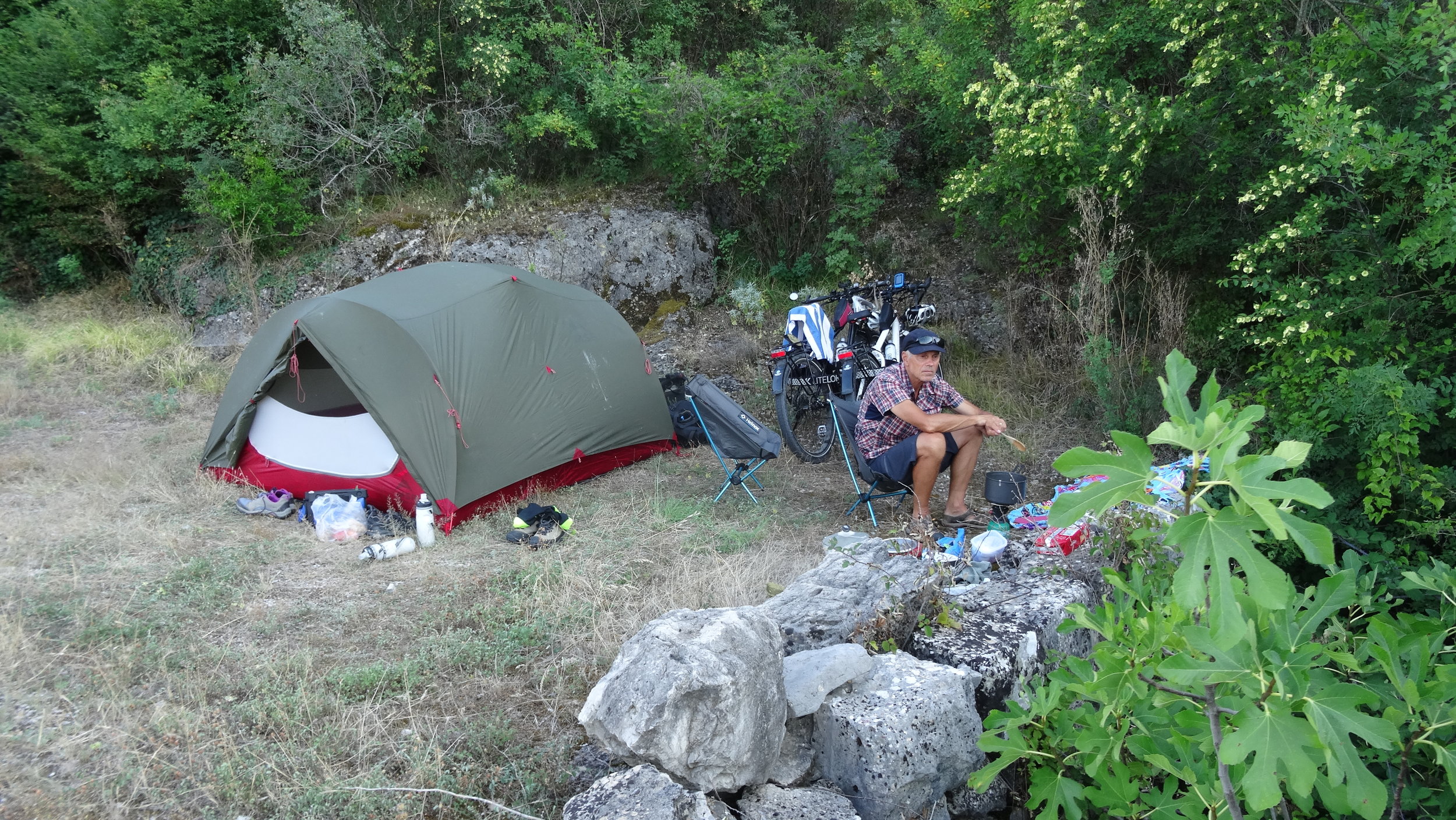
The lady working at the museum recommended we now take the road option to Radvo. We would avoid a dangerous bridge and a tunnel full of bats, and it’s only a 6 kilometre climb! The last point clinches our decision to go via the trail, as we had always intended, even though the asphalt is replaced by the macadam surface; whatever that is! We find ourselves on a flat, easily ridden gravel section and not far from Zavala we round a bend to find a grassy verge beside the trail, tucked against a bank. An ideal spot for our camp. It’s almost 6 o’clock; a long day to have been out in the heat.
Today’s distance: 49 km from Mlini
Day 2
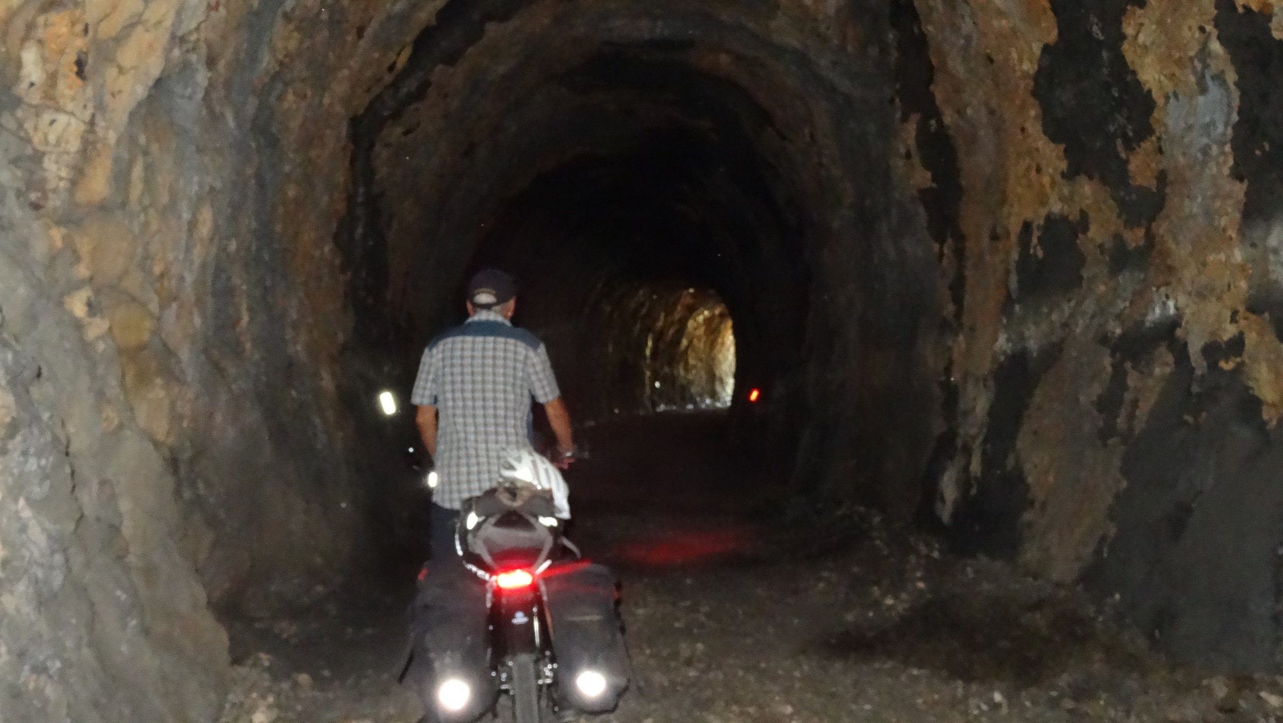
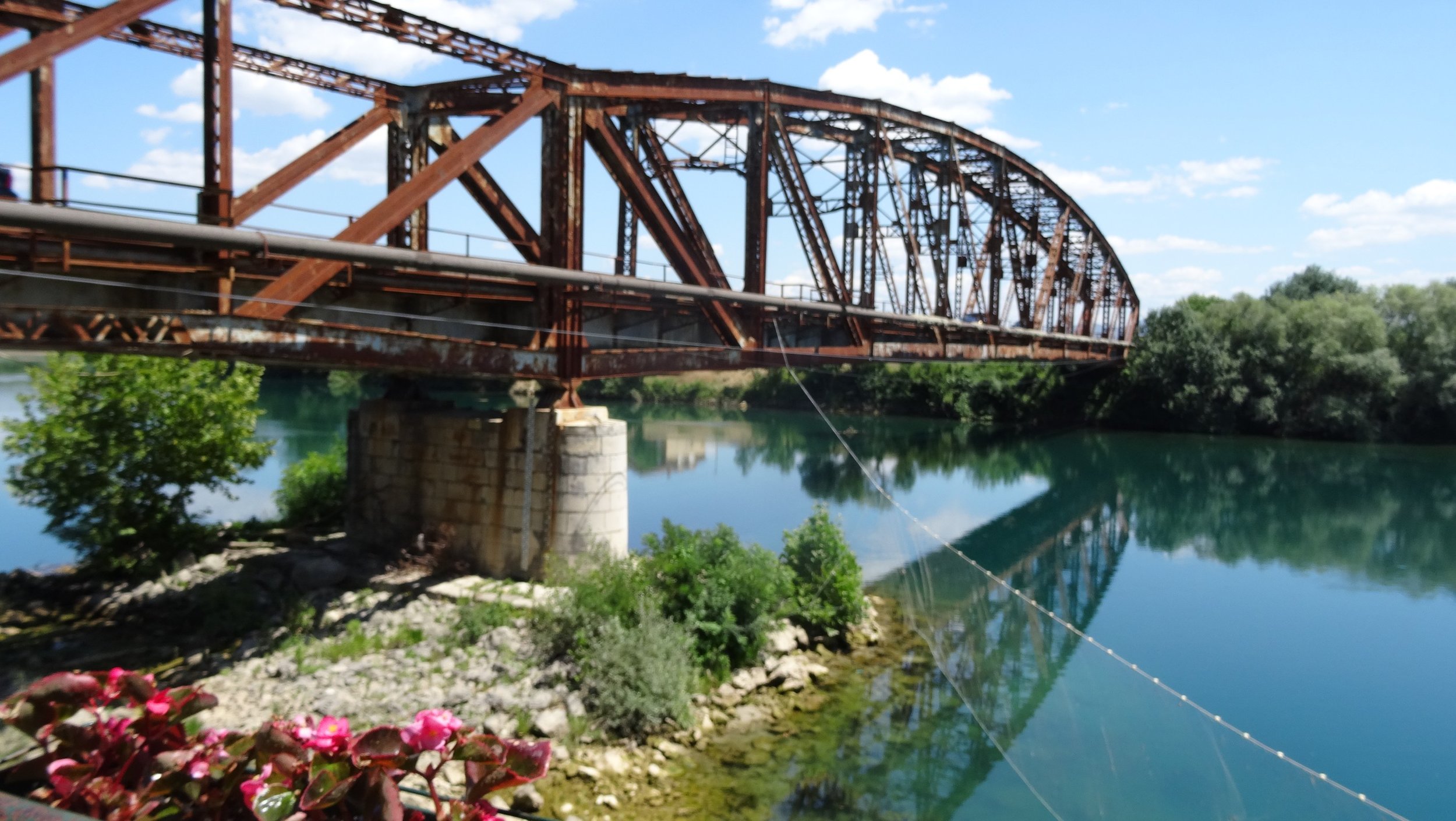
I must admit I was worried about the tunnel. Another lady we spoke with at Zavala yesterday had said she rode there with her son, had twice entered the tunnel and each time turned back because of the bats. Nev leads and all goes well until I suggest we stop for a photo. Trouble is, when we stop our dynamo lights go out. So we’re in complete darkness with bats squeaking above us. I take a photo and then hot foot it out of there. For the next tunnel I’ll wear my headlamp as a back-up light source! The viaduct was immediately after the tunnel. It was a steel bridge with solid wooden decking, wide enough to ride over.
Ravno had a kafe open so we took the opportunity to have coffee. There is another nice station hotel here.
Our morning continues to be 30km of delightful riding, with views of the Popovo Polje and later across to the artificial lake Vrutak that is filled with water of the Trebišnjica River flowing into it. We had assumed the river was flowing to the sea!
We come to another macadam section. This section becomes quite challenging as, in patches, the surface is large chunks of rock that roll under the wheels. The line had been built high on the karst stone field, and with steep drop-offs either side I choose to walk a couple of the sections that I find more difficult. Fortunately this rough section is only 2.5 km long. Nev of course, rides it all. By the time we get to Donji Zelenikovac it’s 36C at 1100 a.m. We meet a guy from Finland cycling in the same direction as us. He has based himself at Ravno, and is doing a day trip loop. We chat for a while about the trail and the area we have ridden through. He tells us that at one point he stopped to take a photo, glanced down and noticed a hand grenade in a hole in the ground! He rides on, but we are on the main road, at a house where there are a couple of tables and chairs set up and cold drinks for sale. We take a refreshment break in the shade of a tree.
The next section is 22km of macadam surface. Nev has let some of the air out of our tyres, and we find this section is not as rocky as the last one, so we move along at a steady pace. The changed surface adds interest to the ride, as does negotiating ten tunnels over the distance. I swear Bats squeak in all of them. Some tunnels are quite long and even with the bike light it feels like the walls are closing in. Sometimes I find it difficult to keep my line on the firm part of the track, and end up in the rocky mound in the middle. I take the tunnels cautiously because I don’t want to fall off.
We caught up with the Finnish guy at end of tunnel 10. There was an almighty ‘bang’ and his front tyre had blown! Back on road tarmac, just before Hutovo, we cross the Neretva river and stop for a couple of hours, enjoying a meal in the shade of a pergola riverside. At 36C in the shade, the heat has not dissipated.
At 3p.m. we decide to move on, but only a couple of kilometres later, we saw people enjoying themselves by a pretty river. We take a left turn, follow signs to Canoe Tours, and take up a small portion of the pebble riverside, swim in the cold, translucent, green water, and watching the children enjoying the Saturday afternoon, are reminded of similar summer activities of our childhood in New Zealand.
Hutovo is the largest town we’ve come across. It has an ATM, so we finally get some Bosnian Marks, and a few more grocery items. About 4 km out of town we find a secluded spot, and camp beside the river.
Today’s distance: 62.5 km
Day 3
Our last day is only 30 km to Mostar. We follow the river for a while. There are very impressive waterfalls, with a bridge crossing the river. We made an excursion the next day, but if you have time, make a diversion here and cross the river and go to Blagaj where you will find the source of the Buna River, and it is very beautiful to see as it comes from a cave within an enormous stone cliff. Our entry into Mostar is from the industrial side of town. It’s Sunday and the roads in the early morning are quiet. It’s a flat ride.
I reflect on our time riding the trail. We chose the off-road option when it was available, and that made the route more interesting. We had no hills! I can only assume that the climbs we saw on the contour map related to the road section. The railway history was interesting and well documented on bill-boards. It was impossible not to feel saddened when thinking about the war that had torn this region; lives had been lost, families and property destroyed. Camping was no issue but there was accommodation available at the distances we wanted to stop. For us, it was good to be self sufficient with food and to take extra water, as it meant we could take our time.


